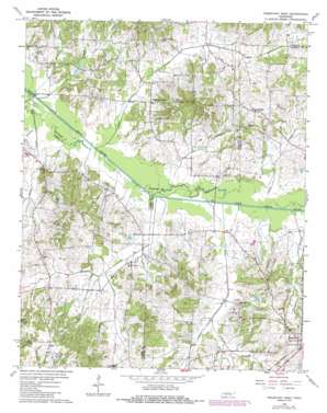
Trezevant West Topo Map Tennessee
To zoom in, hover over the map of Trezevant West
USGS Topo Quad 36088a6 - 1:24,000 scale
| Topo Map Name: | Trezevant West |
| USGS Topo Quad ID: | 36088a6 |
| Print Size: | ca. 21 1/4" wide x 27" high |
| Southeast Coordinates: | 36° N latitude / 88.625° W longitude |
| Map Center Coordinates: | 36.0625° N latitude / 88.6875° W longitude |
| U.S. State: | TN |
| Filename: | o36088a6.jpg |
| Download Map JPG Image: | Trezevant West topo map 1:24,000 scale |
| Map Type: | Topographic |
| Topo Series: | 7.5´ |
| Map Scale: | 1:24,000 |
| Source of Map Images: | United States Geological Survey (USGS) |
| Alternate Map Versions: |
Trezevant West TN 1966, updated 1968 Download PDF Buy paper map Trezevant West TN 1966, updated 1985 Download PDF Buy paper map Trezevant West TN 2010 Download PDF Buy paper map Trezevant West TN 2013 Download PDF Buy paper map Trezevant West TN 2016 Download PDF Buy paper map |
1:24,000 Topo Quads surrounding Trezevant West
> Back to 36088a1 at 1:100,000 scale
> Back to 36088a1 at 1:250,000 scale
> Back to U.S. Topo Maps home
Trezevant West topo map: Gazetteer
Trezevant West: Dams
Austin Hank Lake Dam elevation 121m 396′Trezevant West: Populated Places
Christmasville elevation 131m 429′Gann elevation 141m 462′
Holly Leaf elevation 105m 344′
Staffords Store elevation 112m 367′
Trezevant West: Reservoirs
Austin Hank Lake elevation 121m 396′Trezevant West: Streams
Bear Creek elevation 98m 321′Cane Branch elevation 97m 318′
DeMoss Branch elevation 106m 347′
DeMoss Creek elevation 100m 328′
Dolan Creek elevation 97m 318′
Pittman Branch elevation 97m 318′
Plum Creek elevation 101m 331′
Short Branch elevation 102m 334′
Thompson Branch elevation 103m 337′
Thompson Creek elevation 99m 324′
Trezevant West digital topo map on disk
Buy this Trezevant West topo map showing relief, roads, GPS coordinates and other geographical features, as a high-resolution digital map file on DVD:


