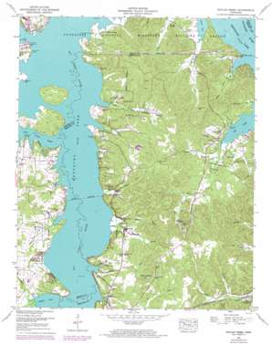
Poplar Creek Topo Map Tennessee
To zoom in, hover over the map of Poplar Creek
USGS Topo Quad 36088c1 - 1:24,000 scale
| Topo Map Name: | Poplar Creek |
| USGS Topo Quad ID: | 36088c1 |
| Print Size: | ca. 21 1/4" wide x 27" high |
| Southeast Coordinates: | 36.25° N latitude / 88° W longitude |
| Map Center Coordinates: | 36.3125° N latitude / 88.0625° W longitude |
| U.S. State: | TN |
| Filename: | o36088c1.jpg |
| Download Map JPG Image: | Poplar Creek topo map 1:24,000 scale |
| Map Type: | Topographic |
| Topo Series: | 7.5´ |
| Map Scale: | 1:24,000 |
| Source of Map Images: | United States Geological Survey (USGS) |
| Alternate Map Versions: |
Poplar Creek TN 1936 Download PDF Buy paper map Poplar Creek TN 1949, updated 1953 Download PDF Buy paper map Poplar Creek TN 1949, updated 1953 Download PDF Buy paper map Poplar Creek TN 1949, updated 1974 Download PDF Buy paper map Poplar Creek TN 2010 Download PDF Buy paper map Poplar Creek TN 2013 Download PDF Buy paper map Poplar Creek TN 2016 Download PDF Buy paper map |
1:24,000 Topo Quads surrounding Poplar Creek
> Back to 36088a1 at 1:100,000 scale
> Back to 36088a1 at 1:250,000 scale
> Back to U.S. Topo Maps home
Poplar Creek topo map: Gazetteer
Poplar Creek: Canals
Bg Sandy River Drainage Ditch (historical) elevation 109m 357′Poplar Creek: Crossings
Wynes Ferry (historical) elevation 109m 357′Poplar Creek: Dams
Dyer Lake Dam elevation 133m 436′Poplar Creek: Islands
Leatherwood Island (historical) elevation 109m 357′Poplar Creek: Populated Places
Faxon elevation 123m 403′Lakeview Manor elevation 120m 393′
Lick Creek elevation 125m 410′
Moons elevation 124m 406′
Poplar Creek: Reservoirs
Dyer Lake elevation 133m 436′Poplar Creek: Springs
Lashlee Spring elevation 115m 377′Poplar Creek: Streams
Cane Creek elevation 109m 357′Clendenin Creek elevation 109m 357′
Daniel Creek elevation 110m 360′
Granny Branch elevation 109m 357′
Hope Creek elevation 110m 360′
Hurricane Branch elevation 110m 360′
Jones Creek elevation 110m 360′
Matheny Branch elevation 110m 360′
Poplar Creek elevation 110m 360′
Redwater Creek elevation 125m 410′
Spring Branch elevation 109m 357′
Trace Creek elevation 109m 357′
Valentine Branch elevation 111m 364′
West Sandy Creek elevation 109m 357′
Poplar Creek: Valleys
McSwain Hollow elevation 109m 357′Rough Hollow elevation 133m 436′
Poplar Creek digital topo map on disk
Buy this Poplar Creek topo map showing relief, roads, GPS coordinates and other geographical features, as a high-resolution digital map file on DVD:


