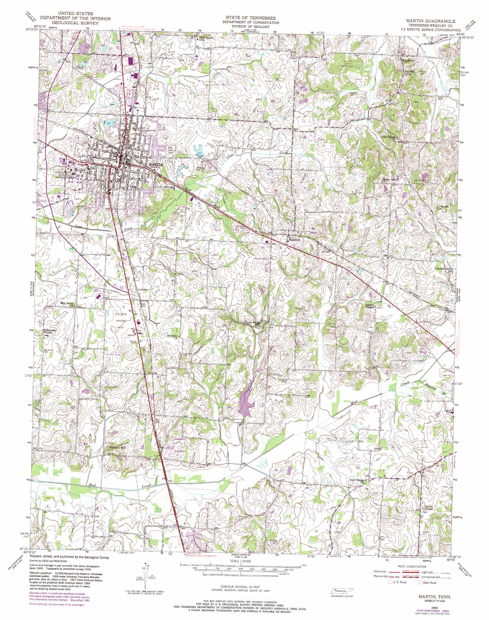
Martin Topo Map Tennessee
To zoom in, hover over the map of Martin
USGS Topo Quad 36088c7 - 1:24,000 scale
| Topo Map Name: | Martin |
| USGS Topo Quad ID: | 36088c7 |
| Print Size: | ca. 21 1/4" wide x 27" high |
| Southeast Coordinates: | 36.25° N latitude / 88.75° W longitude |
| Map Center Coordinates: | 36.3125° N latitude / 88.8125° W longitude |
| U.S. State: | TN |
| Filename: | o36088c7.jpg |
| Download Map JPG Image: | Martin topo map 1:24,000 scale |
| Map Type: | Topographic |
| Topo Series: | 7.5´ |
| Map Scale: | 1:24,000 |
| Source of Map Images: | United States Geological Survey (USGS) |
| Alternate Map Versions: |
Martin TN 1950, updated 1952 Download PDF Buy paper map Martin TN 1950, updated 1973 Download PDF Buy paper map Martin TN 1950, updated 1981 Download PDF Buy paper map Martin TN 1950, updated 1983 Download PDF Buy paper map Martin TN 2010 Download PDF Buy paper map Martin TN 2013 Download PDF Buy paper map Martin TN 2016 Download PDF Buy paper map |
1:24,000 Topo Quads surrounding Martin
Cayce |
Crutchfield |
Water Valley |
Cuba |
Lynnville |
Union City |
Harris |
Mcconnell |
Latham |
Palmersville |
Rives |
Gardner |
Martin |
Dresden |
Como |
Kenton |
Rutherford |
Greenfield |
Pillowville |
Mckenzie |
Yorkville |
Dyer |
Bradford |
Trezevant West |
Trezevant East |
> Back to 36088a1 at 1:100,000 scale
> Back to 36088a1 at 1:250,000 scale
> Back to U.S. Topo Maps home
Martin topo map: Gazetteer
Martin: Dams
Mud Creek Watershed Dam Fifteen elevation 110m 360′Mud Creek Watershed Dam Five elevation 113m 370′
Mud Creek Watershed Dam Number Seventeen elevation 107m 351′
Randolph Dam elevation 118m 387′
W F Baker Lake Dam elevation 123m 403′
Martin: Parks
Harmon Field elevation 128m 419′Pacer Stadium elevation 123m 403′
Rotary Field elevation 130m 426′
Virginia Weldon Park elevation 124m 406′
Martin: Populated Places
Hyndsver elevation 127m 416′Martin elevation 124m 406′
Ralston elevation 147m 482′
Martin: Post Offices
Hyndsver Post Office (historical) elevation 127m 416′Martin: Reservoirs
Mud Creek Watershed Lake Fifteen elevation 110m 360′Mud Creek Watershed Lake Five elevation 113m 370′
Mud Creek Watershed Lake Number Seventeen elevation 107m 351′
Randolph Lake elevation 118m 387′
W F Baker Lake elevation 123m 403′
Martin: Streams
Brassfield Branch elevation 110m 360′Chestnut Branch elevation 110m 360′
Martin digital topo map on disk
Buy this Martin topo map showing relief, roads, GPS coordinates and other geographical features, as a high-resolution digital map file on DVD: