Water Valley Topo Map Kentucky
To zoom in, hover over the map of Water Valley
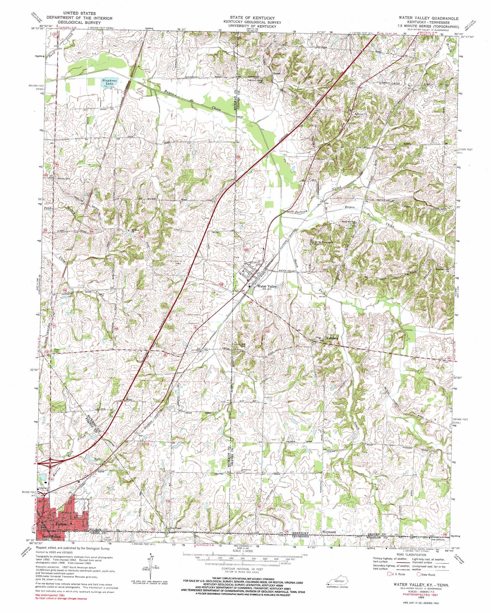
USGS Topo Quad 36088e7 - 1:24,000 scale
| Topo Map Name: | Water Valley |
| USGS Topo Quad ID: | 36088e7 |
| Print Size: | ca. 21 1/4" wide x 27" high |
| Southeast Coordinates: | 36.5° N latitude / 88.75° W longitude |
| Map Center Coordinates: | 36.5625° N latitude / 88.8125° W longitude |
| U.S. States: | KY, TN |
| Filename: | o36088e7.jpg |
| Download Map JPG Image: | Water Valley topo map 1:24,000 scale |
| Map Type: | Topographic |
| Topo Series: | 7.5´ |
| Map Scale: | 1:24,000 |
| Source of Map Images: | United States Geological Survey (USGS) |
| Alternate Map Versions: |
Water Valley KY 1952, updated 1953 Download PDF Buy paper map Water Valley KY 1969, updated 1971 Download PDF Buy paper map Water Valley KY 1969, updated 1983 Download PDF Buy paper map Water Valley KY 2010 Download PDF Buy paper map Water Valley KY 2013 Download PDF Buy paper map Water Valley KY 2016 Download PDF Buy paper map |
1:24,000 Topo Quads surrounding Water Valley
Arlington |
Milburn |
Fancy Farm |
Hickory |
Westplains |
Oakton |
Clinton |
Dublin |
Mayfield |
Farmington |
Cayce |
Crutchfield |
Water Valley |
Cuba |
Lynnville |
Union City |
Harris |
Mcconnell |
Latham |
Palmersville |
Rives |
Gardner |
Martin |
Dresden |
Como |
> Back to 36088e1 at 1:100,000 scale
> Back to 36088a1 at 1:250,000 scale
> Back to U.S. Topo Maps home
Water Valley topo map: Gazetteer
Water Valley: Lakes
Stephens Lake elevation 104m 341′Water Valley: Populated Places
Feliciana elevation 137m 449′Fulton elevation 110m 360′
Roper elevation 122m 400′
Water Valley elevation 119m 390′
Water Valley: Streams
Jackson Creek elevation 112m 367′South Fork Bayou de Chien elevation 112m 367′
Water Valley digital topo map on disk
Buy this Water Valley topo map showing relief, roads, GPS coordinates and other geographical features, as a high-resolution digital map file on DVD: