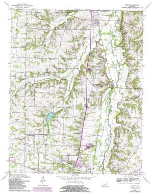
Dexter Topo Map Kentucky
To zoom in, hover over the map of Dexter
USGS Topo Quad 36088f3 - 1:24,000 scale
| Topo Map Name: | Dexter |
| USGS Topo Quad ID: | 36088f3 |
| Print Size: | ca. 21 1/4" wide x 27" high |
| Southeast Coordinates: | 36.625° N latitude / 88.25° W longitude |
| Map Center Coordinates: | 36.6875° N latitude / 88.3125° W longitude |
| U.S. State: | KY |
| Filename: | o36088f3.jpg |
| Download Map JPG Image: | Dexter topo map 1:24,000 scale |
| Map Type: | Topographic |
| Topo Series: | 7.5´ |
| Map Scale: | 1:24,000 |
| Source of Map Images: | United States Geological Survey (USGS) |
| Alternate Map Versions: |
Dexter KY 1936 Download PDF Buy paper map Dexter KY 1951, updated 1955 Download PDF Buy paper map Dexter KY 1951, updated 1967 Download PDF Buy paper map Dexter KY 1969, updated 1970 Download PDF Buy paper map Dexter KY 1969, updated 1987 Download PDF Buy paper map Dexter KY 2010 Download PDF Buy paper map Dexter KY 2013 Download PDF Buy paper map Dexter KY 2016 Download PDF Buy paper map |
1:24,000 Topo Quads surrounding Dexter
> Back to 36088e1 at 1:100,000 scale
> Back to 36088a1 at 1:250,000 scale
> Back to U.S. Topo Maps home
Dexter topo map: Gazetteer
Dexter: Airports
Kyle-Oakley Field elevation 172m 564′Dexter: Populated Places
Almo elevation 131m 429′Almo Heights elevation 158m 518′
Dexter elevation 135m 442′
Penny elevation 170m 557′
Pleasant Hill elevation 156m 511′
Wadesboro elevation 141m 462′
Dexter: Streams
Bee Creek elevation 137m 449′East Fork Rockhouse Creek elevation 133m 436′
Muck Branch elevation 134m 439′
Owen Branch elevation 136m 446′
Peterson Branch elevation 140m 459′
Rockhouse Creek elevation 122m 400′
Spring Creek elevation 145m 475′
West Fork Rockhouse Creek elevation 133m 436′
Dexter digital topo map on disk
Buy this Dexter topo map showing relief, roads, GPS coordinates and other geographical features, as a high-resolution digital map file on DVD:


