Milburn Topo Map Kentucky
To zoom in, hover over the map of Milburn
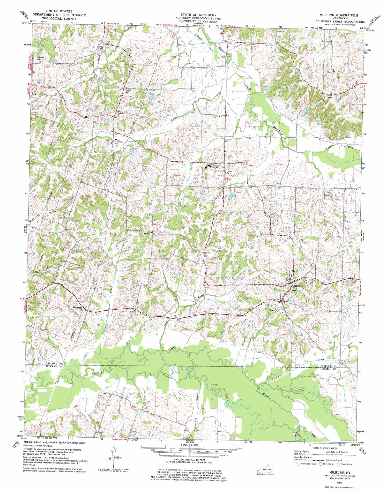
USGS Topo Quad 36088g8 - 1:24,000 scale
| Topo Map Name: | Milburn |
| USGS Topo Quad ID: | 36088g8 |
| Print Size: | ca. 21 1/4" wide x 27" high |
| Southeast Coordinates: | 36.75° N latitude / 88.875° W longitude |
| Map Center Coordinates: | 36.8125° N latitude / 88.9375° W longitude |
| U.S. State: | KY |
| Filename: | o36088g8.jpg |
| Download Map JPG Image: | Milburn topo map 1:24,000 scale |
| Map Type: | Topographic |
| Topo Series: | 7.5´ |
| Map Scale: | 1:24,000 |
| Source of Map Images: | United States Geological Survey (USGS) |
| Alternate Map Versions: |
Milburn KY 1951, updated 1953 Download PDF Buy paper map Milburn KY 1977, updated 1977 Download PDF Buy paper map Milburn KY 2010 Download PDF Buy paper map Milburn KY 2013 Download PDF Buy paper map Milburn KY 2016 Download PDF Buy paper map |
1:24,000 Topo Quads surrounding Milburn
Cairo |
Barlow |
La Center |
Heath |
Paducah West |
Wyatt |
Wickliffe |
Blandville |
Lovelaceville |
Melber |
Wickliffe Sw |
Arlington |
Milburn |
Fancy Farm |
Hickory |
Wolf Island |
Oakton |
Clinton |
Dublin |
Mayfield |
Hickman |
Cayce |
Crutchfield |
Water Valley |
Cuba |
> Back to 36088e1 at 1:100,000 scale
> Back to 36088a1 at 1:250,000 scale
> Back to U.S. Topo Maps home
Milburn topo map: Gazetteer
Milburn: Populated Places
Milburn elevation 147m 482′Milburn: Streams
Chalk Slough elevation 104m 341′Cypress Creek elevation 98m 321′
Guess Creek elevation 101m 331′
Hopewell Creek elevation 98m 321′
Horn Creek elevation 104m 341′
Little Creek elevation 101m 331′
Russells Creek elevation 101m 331′
Milburn digital topo map on disk
Buy this Milburn topo map showing relief, roads, GPS coordinates and other geographical features, as a high-resolution digital map file on DVD: