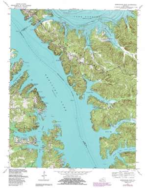
Birmingham Point Topo Map Kentucky
To zoom in, hover over the map of Birmingham Point
USGS Topo Quad 36088h2 - 1:24,000 scale
| Topo Map Name: | Birmingham Point |
| USGS Topo Quad ID: | 36088h2 |
| Print Size: | ca. 21 1/4" wide x 27" high |
| Southeast Coordinates: | 36.875° N latitude / 88.125° W longitude |
| Map Center Coordinates: | 36.9375° N latitude / 88.1875° W longitude |
| U.S. State: | KY |
| Filename: | o36088h2.jpg |
| Download Map JPG Image: | Birmingham Point topo map 1:24,000 scale |
| Map Type: | Topographic |
| Topo Series: | 7.5´ |
| Map Scale: | 1:24,000 |
| Source of Map Images: | United States Geological Survey (USGS) |
| Alternate Map Versions: |
Birmingham KY 1936 Download PDF Buy paper map Birmingham KY 1938 Download PDF Buy paper map Birmingham Point KY 1955, updated 1956 Download PDF Buy paper map Birmingham Point KY 1955, updated 1964 Download PDF Buy paper map Birmingham Point KY 1967, updated 1968 Download PDF Buy paper map Birmingham Point KY 1967, updated 1976 Download PDF Buy paper map Birmingham Point KY 1967, updated 1988 Download PDF Buy paper map Birmingham Point KY 2010 Download PDF Buy paper map Birmingham Point KY 2013 Download PDF Buy paper map Birmingham Point KY 2016 Download PDF Buy paper map |
| FStopo: | US Forest Service topo Birmingham Point is available: Download FStopo PDF Download FStopo TIF |
1:24,000 Topo Quads surrounding Birmingham Point
> Back to 36088e1 at 1:100,000 scale
> Back to 36088a1 at 1:250,000 scale
> Back to U.S. Topo Maps home
Birmingham Point topo map: Gazetteer
Birmingham Point: Bays
Crab Bay elevation 107m 351′Demumbers Bay elevation 107m 351′
Duncan Bay elevation 107m 351′
Pisgah Bay elevation 107m 351′
Smith Bay elevation 107m 351′
Willow Bay elevation 107m 351′
Birmingham Point: Canals
Barkley Canal elevation 107m 351′Birmingham Point: Capes
Birmingham Point elevation 117m 383′Birmingham Point: Parks
Birmingham Ferry Recreation Area elevation 112m 367′Canal Public Use Area elevation 125m 410′
Demumbers Point Recreation Area elevation 112m 367′
Nickell Point Recreation Area elevation 122m 400′
Pisgah Point Recreation Area elevation 114m 374′
Birmingham Point: Populated Places
Birmingham elevation 114m 374′Brien elevation 124m 406′
Buena Vista elevation 130m 426′
Cambridge Shores elevation 128m 419′
Little Bear Creek elevation 126m 413′
Marshall elevation 120m 393′
Sherwood Shores elevation 122m 400′
The Moors elevation 120m 393′
Twin Lakes elevation 134m 439′
Birmingham Point: Springs
Brown Spring elevation 120m 393′Birmingham Point: Streams
Bear Creek elevation 107m 351′Buckhorn Creek elevation 107m 351′
Cap Spring Creek elevation 108m 354′
Crab Creek elevation 110m 360′
Demumbers Creek elevation 108m 354′
Dodds Creek elevation 110m 360′
King Creek elevation 107m 351′
Little Bear Creek elevation 107m 351′
Malcolm Creek elevation 107m 351′
Moss Creek elevation 107m 351′
Nickell Branch elevation 107m 351′
O'Brien Branch elevation 107m 351′
Pisgah Creek elevation 107m 351′
Smith Creek elevation 108m 354′
Willow Creek elevation 109m 357′
Birmingham Point: Valleys
Nickell Cove elevation 107m 351′Birmingham Point digital topo map on disk
Buy this Birmingham Point topo map showing relief, roads, GPS coordinates and other geographical features, as a high-resolution digital map file on DVD:


