Yorkville Topo Map Tennessee
To zoom in, hover over the map of Yorkville
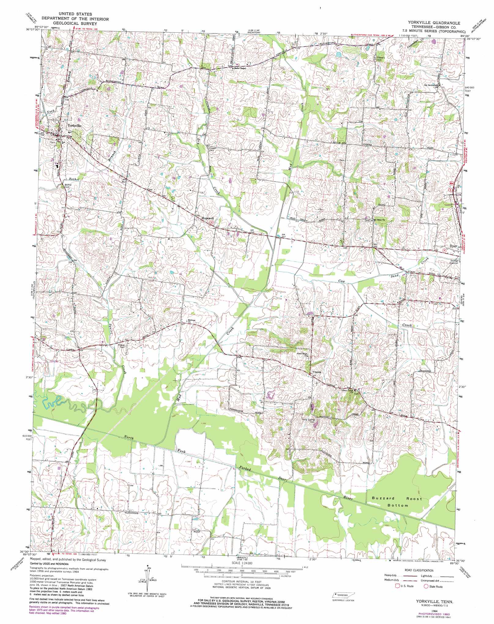
USGS Topo Quad 36089a1 - 1:24,000 scale
| Topo Map Name: | Yorkville |
| USGS Topo Quad ID: | 36089a1 |
| Print Size: | ca. 21 1/4" wide x 27" high |
| Southeast Coordinates: | 36° N latitude / 89° W longitude |
| Map Center Coordinates: | 36.0625° N latitude / 89.0625° W longitude |
| U.S. State: | TN |
| Filename: | o36089a1.jpg |
| Download Map JPG Image: | Yorkville topo map 1:24,000 scale |
| Map Type: | Topographic |
| Topo Series: | 7.5´ |
| Map Scale: | 1:24,000 |
| Source of Map Images: | United States Geological Survey (USGS) |
| Alternate Map Versions: |
Yorkville TN 1964, updated 1967 Download PDF Buy paper map Yorkville TN 1964, updated 1981 Download PDF Buy paper map Yorkville TN 2010 Download PDF Buy paper map Yorkville TN 2013 Download PDF Buy paper map Yorkville TN 2016 Download PDF Buy paper map |
1:24,000 Topo Quads surrounding Yorkville
Hornbeak |
Obion |
Rives |
Gardner |
Martin |
Lane |
Trimble |
Kenton |
Rutherford |
Greenfield |
Newbern |
Tatumville |
Yorkville |
Dyer |
Bradford |
Bonicord |
Friendship |
Brazil |
Trenton |
Milan |
Chestnut Bluff |
Maury City |
Alamo |
Humboldt |
Medina |
> Back to 36089a1 at 1:100,000 scale
> Back to 36088a1 at 1:250,000 scale
> Back to U.S. Topo Maps home
Yorkville topo map: Gazetteer
Yorkville: Basins
Buzzard Roost Bottom elevation 89m 291′Yorkville: Populated Places
Currie elevation 116m 380′Hooten (historical) elevation 93m 305′
Hopewell elevation 103m 337′
Newell elevation 122m 400′
Riverside (historical) elevation 88m 288′
Yorkville elevation 116m 380′
Yorkville: Streams
Cow Creek elevation 89m 291′Dry Creek elevation 90m 295′
Mud Creek elevation 84m 275′
Sand Creek elevation 93m 305′
Yorkville digital topo map on disk
Buy this Yorkville topo map showing relief, roads, GPS coordinates and other geographical features, as a high-resolution digital map file on DVD: