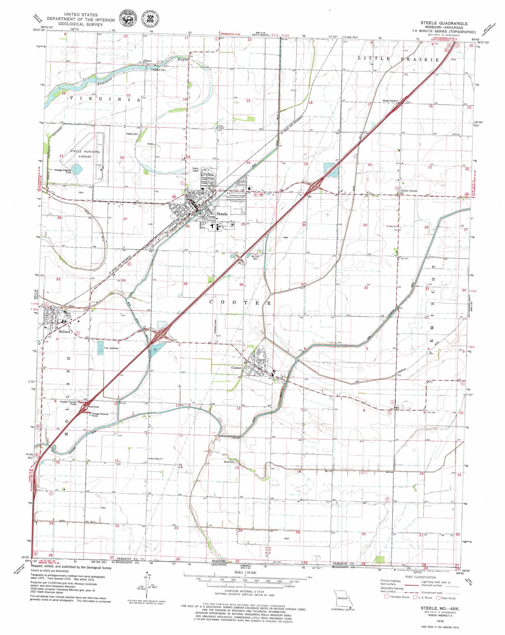
Steele Topo Map Missouri
To zoom in, hover over the map of Steele
USGS Topo Quad 36089a7 - 1:24,000 scale
| Topo Map Name: | Steele |
| USGS Topo Quad ID: | 36089a7 |
| Print Size: | ca. 21 1/4" wide x 27" high |
| Southeast Coordinates: | 36° N latitude / 89.75° W longitude |
| Map Center Coordinates: | 36.0625° N latitude / 89.8125° W longitude |
| U.S. States: | MO, AR |
| Filename: | o36089a7.jpg |
| Download Map JPG Image: | Steele topo map 1:24,000 scale |
| Map Type: | Topographic |
| Topo Series: | 7.5´ |
| Map Scale: | 1:24,000 |
| Source of Map Images: | United States Geological Survey (USGS) |
| Alternate Map Versions: |
Steele MO 1978, updated 1979 Download PDF Buy paper map Steele MO 2011 Download PDF Buy paper map Steele MO 2012 Download PDF Buy paper map Steele MO 2015 Download PDF Buy paper map |
1:24,000 Topo Quads surrounding Steele
Kennett North |
Bragg City |
Wardell |
Stanley |
Mooring |
Kennett South |
Deering |
Hayti Heights |
Caruthersville |
Tennemo |
Hornersville |
Denton |
Steele |
Cottonwood Point |
Caruthersville Se |
Half Moon |
Blytheville |
Armorel |
Chic |
Knob Creek |
Dell |
Luxora |
Rosa |
Open Lake |
Ripley North |
> Back to 36089a1 at 1:100,000 scale
> Back to 36088a1 at 1:250,000 scale
> Back to U.S. Topo Maps home
Steele topo map: Gazetteer
Steele: Airports
Steele Municipal Airport elevation 78m 255′Steele: Canals
Ditch Number 3 elevation 78m 255′Ditch Number 45 elevation 78m 255′
Ditch Number 5 elevation 77m 252′
New Franklin Ditch elevation 79m 259′
Old Franklin Ditch elevation 77m 252′
Steele: Dams
Pemiscot Bayou Dam elevation 78m 255′Steele: Guts
Pemiscot Bayou elevation 78m 255′Steele: Populated Places
Acorn Corner elevation 79m 259′Cooter elevation 80m 262′
Douglas elevation 78m 255′
Gibson elevation 80m 262′
Hall (historical) elevation 79m 259′
Holbert Corner elevation 78m 255′
Holland elevation 78m 255′
Oak Ridge elevation 78m 255′
Steele elevation 80m 262′
Steele: Reservoirs
Pemiscot Bayou Lake elevation 78m 255′Steele digital topo map on disk
Buy this Steele topo map showing relief, roads, GPS coordinates and other geographical features, as a high-resolution digital map file on DVD: