Denton Topo Map Missouri
To zoom in, hover over the map of Denton
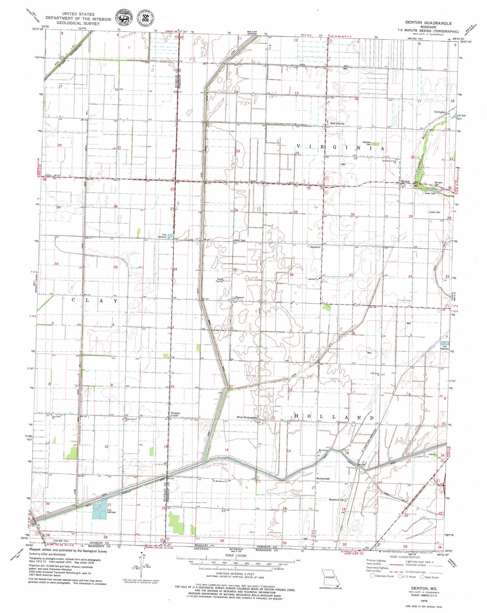
USGS Topo Quad 36089a8 - 1:24,000 scale
| Topo Map Name: | Denton |
| USGS Topo Quad ID: | 36089a8 |
| Print Size: | ca. 21 1/4" wide x 27" high |
| Southeast Coordinates: | 36° N latitude / 89.875° W longitude |
| Map Center Coordinates: | 36.0625° N latitude / 89.9375° W longitude |
| U.S. State: | MO |
| Filename: | o36089a8.jpg |
| Download Map JPG Image: | Denton topo map 1:24,000 scale |
| Map Type: | Topographic |
| Topo Series: | 7.5´ |
| Map Scale: | 1:24,000 |
| Source of Map Images: | United States Geological Survey (USGS) |
| Alternate Map Versions: |
Denton MO 1978, updated 1979 Download PDF Buy paper map Denton MO 2012 Download PDF Buy paper map Denton MO 2015 Download PDF Buy paper map |
1:24,000 Topo Quads surrounding Denton
Greenway |
Kennett North |
Bragg City |
Wardell |
Stanley |
Senath |
Kennett South |
Deering |
Hayti Heights |
Caruthersville |
Arbyrd |
Hornersville |
Denton |
Steele |
Cottonwood Point |
Manila North |
Half Moon |
Blytheville |
Armorel |
Chic |
Manila South |
Dell |
Luxora |
Rosa |
Open Lake |
> Back to 36089a1 at 1:100,000 scale
> Back to 36088a1 at 1:250,000 scale
> Back to U.S. Topo Maps home
Denton topo map: Gazetteer
Denton: Canals
Belle Fountain Ditch elevation 73m 239′Ditch Number 2 elevation 76m 249′
Ditch Number 4 elevation 76m 249′
Ditch Number 7 elevation 75m 246′
Ditch Number 8 elevation 75m 246′
Lateral Number 6 elevation 74m 242′
Main Ditch elevation 76m 249′
Main Ditch Number 1 elevation 74m 242′
Main Ditch Number 2 elevation 75m 246′
Denton: Populated Places
Channel elevation 76m 249′Covington elevation 78m 255′
Denton elevation 79m 259′
Hermondale elevation 77m 252′
New Survey elevation 78m 255′
Samford elevation 78m 255′
Temples Corner elevation 75m 246′
West Hermondale elevation 76m 249′
Westbrook (historical) elevation 78m 255′
Denton digital topo map on disk
Buy this Denton topo map showing relief, roads, GPS coordinates and other geographical features, as a high-resolution digital map file on DVD: