Kenton Topo Map Tennessee
To zoom in, hover over the map of Kenton
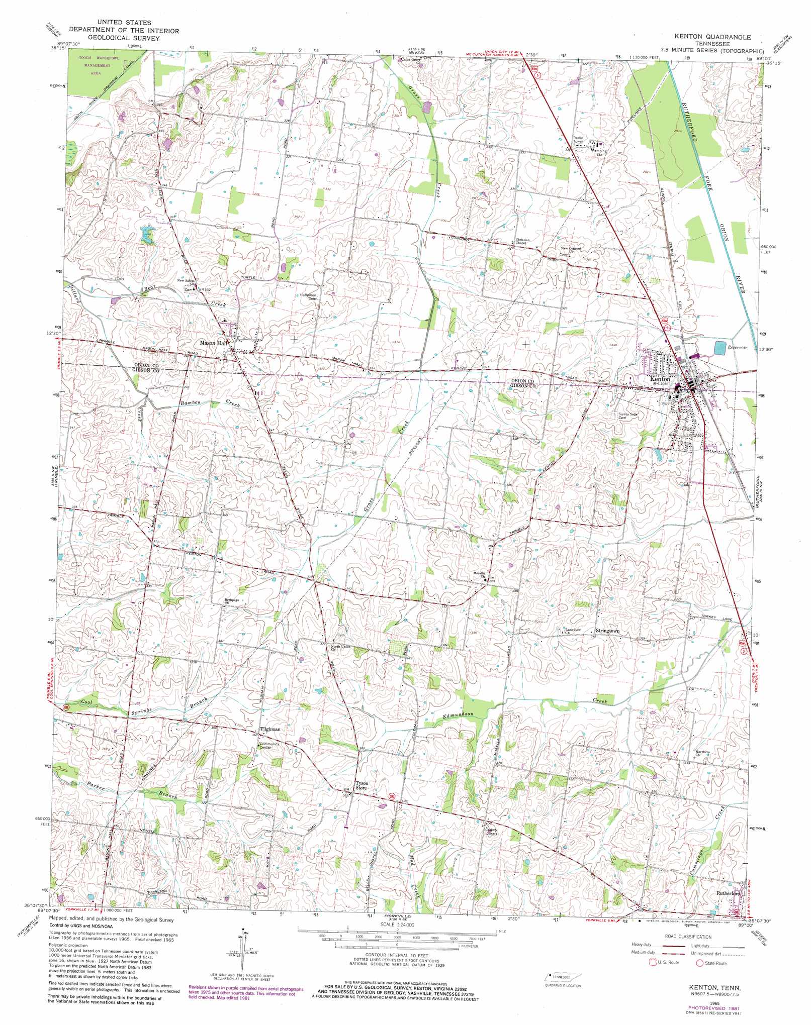
USGS Topo Quad 36089b1 - 1:24,000 scale
| Topo Map Name: | Kenton |
| USGS Topo Quad ID: | 36089b1 |
| Print Size: | ca. 21 1/4" wide x 27" high |
| Southeast Coordinates: | 36.125° N latitude / 89° W longitude |
| Map Center Coordinates: | 36.1875° N latitude / 89.0625° W longitude |
| U.S. State: | TN |
| Filename: | o36089b1.jpg |
| Download Map JPG Image: | Kenton topo map 1:24,000 scale |
| Map Type: | Topographic |
| Topo Series: | 7.5´ |
| Map Scale: | 1:24,000 |
| Source of Map Images: | United States Geological Survey (USGS) |
| Alternate Map Versions: |
Kenton TN 1965, updated 1966 Download PDF Buy paper map Kenton TN 1965, updated 1981 Download PDF Buy paper map Kenton TN 2010 Download PDF Buy paper map Kenton TN 2013 Download PDF Buy paper map Kenton TN 2016 Download PDF Buy paper map |
1:24,000 Topo Quads surrounding Kenton
Samburg |
Clayton |
Union City |
Harris |
Mcconnell |
Hornbeak |
Obion |
Rives |
Gardner |
Martin |
Lane |
Trimble |
Kenton |
Rutherford |
Greenfield |
Newbern |
Tatumville |
Yorkville |
Dyer |
Bradford |
Bonicord |
Friendship |
Brazil |
Trenton |
Milan |
> Back to 36089a1 at 1:100,000 scale
> Back to 36088a1 at 1:250,000 scale
> Back to U.S. Topo Maps home
Kenton topo map: Gazetteer
Kenton: Lakes
Possum Pond elevation 105m 344′Kenton: Parks
Kenton City Park elevation 96m 314′Kenton: Populated Places
Christian Chapel elevation 100m 328′Fairview elevation 103m 337′
Kenton elevation 95m 311′
Mason Hall elevation 108m 354′
Stringtown elevation 111m 364′
Tilghman elevation 113m 370′
Tyson Store elevation 109m 357′
Tysonville (historical) elevation 110m 360′
Kenton: Post Offices
Kenton Post Office elevation 94m 308′Kenton: Streams
Bamboo Creek elevation 92m 301′Bear Creek elevation 88m 288′
Kenton digital topo map on disk
Buy this Kenton topo map showing relief, roads, GPS coordinates and other geographical features, as a high-resolution digital map file on DVD: