Trimble Topo Map Tennessee
To zoom in, hover over the map of Trimble
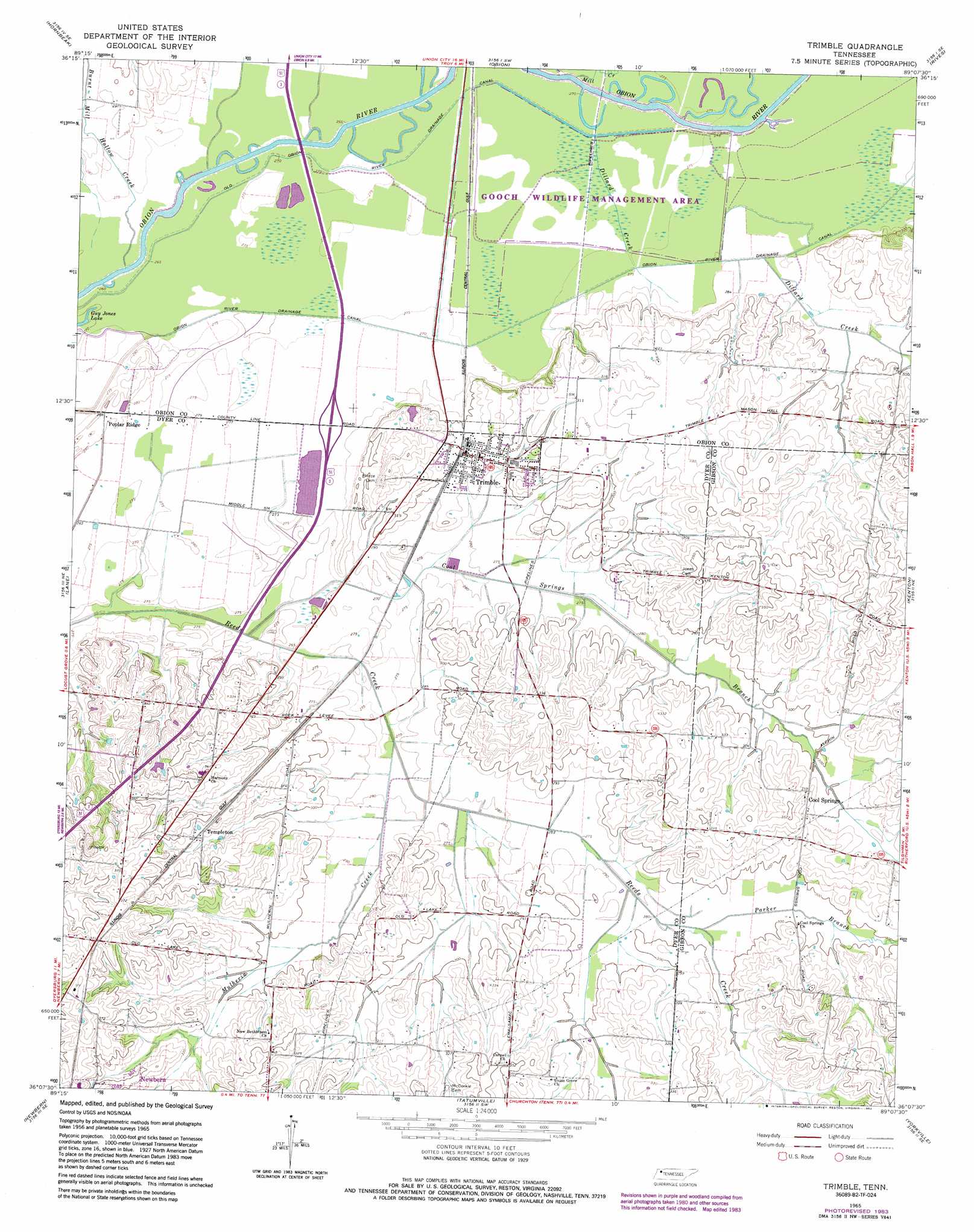
USGS Topo Quad 36089b2 - 1:24,000 scale
| Topo Map Name: | Trimble |
| USGS Topo Quad ID: | 36089b2 |
| Print Size: | ca. 21 1/4" wide x 27" high |
| Southeast Coordinates: | 36.125° N latitude / 89.125° W longitude |
| Map Center Coordinates: | 36.1875° N latitude / 89.1875° W longitude |
| U.S. State: | TN |
| Filename: | o36089b2.jpg |
| Download Map JPG Image: | Trimble topo map 1:24,000 scale |
| Map Type: | Topographic |
| Topo Series: | 7.5´ |
| Map Scale: | 1:24,000 |
| Source of Map Images: | United States Geological Survey (USGS) |
| Alternate Map Versions: |
Trimble TN 1965, updated 1967 Download PDF Buy paper map Trimble TN 1965, updated 1983 Download PDF Buy paper map Trimble TN 2010 Download PDF Buy paper map Trimble TN 2013 Download PDF Buy paper map Trimble TN 2016 Download PDF Buy paper map |
1:24,000 Topo Quads surrounding Trimble
Tiptonville |
Samburg |
Clayton |
Union City |
Harris |
Ridgely |
Hornbeak |
Obion |
Rives |
Gardner |
Miston |
Lane |
Trimble |
Kenton |
Rutherford |
Dyersburg |
Newbern |
Tatumville |
Yorkville |
Dyer |
Fowlkes |
Bonicord |
Friendship |
Brazil |
Trenton |
> Back to 36089a1 at 1:100,000 scale
> Back to 36088a1 at 1:250,000 scale
> Back to U.S. Topo Maps home
Trimble topo map: Gazetteer
Trimble: Canals
Obion River Drainage Canal elevation 84m 275′Old Obion River Drainage Canal elevation 83m 272′
Trimble: Lakes
Guy Jones Lake elevation 80m 262′Trimble: Populated Places
Cool Springs elevation 98m 321′Poplar Ridge elevation 88m 288′
Templeton elevation 101m 331′
Trimble elevation 91m 298′
Trimble: Streams
Burnt Mill Hollow Creek elevation 82m 269′Cool Springs Branch elevation 82m 269′
Dillard Creek elevation 85m 278′
Dillard Creek elevation 83m 272′
Mill Creek elevation 82m 269′
Mulherin Creek elevation 84m 275′
Parker Branch elevation 87m 285′
Trimble digital topo map on disk
Buy this Trimble topo map showing relief, roads, GPS coordinates and other geographical features, as a high-resolution digital map file on DVD: