Bragg City Topo Map Missouri
To zoom in, hover over the map of Bragg City
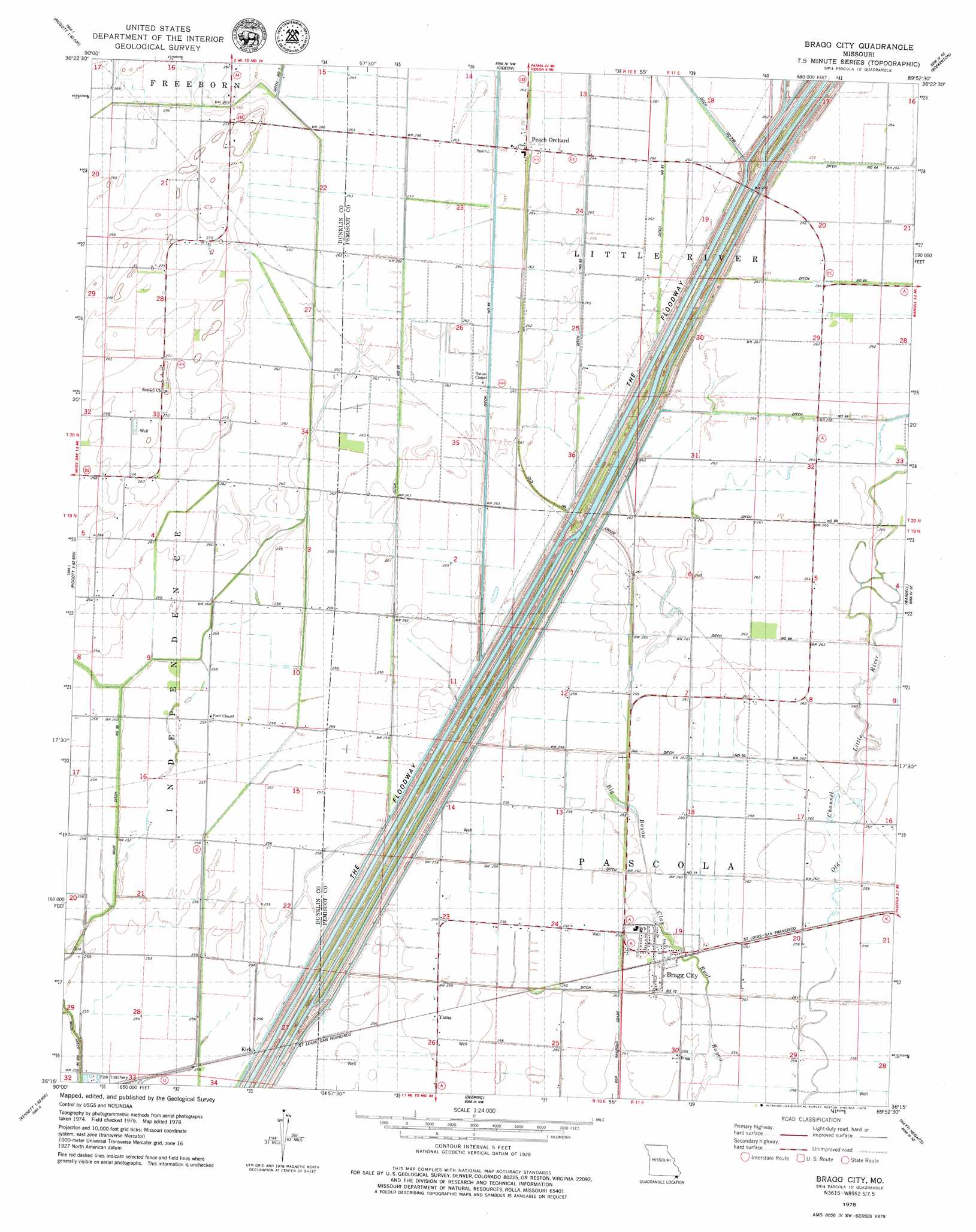
USGS Topo Quad 36089c8 - 1:24,000 scale
| Topo Map Name: | Bragg City |
| USGS Topo Quad ID: | 36089c8 |
| Print Size: | ca. 21 1/4" wide x 27" high |
| Southeast Coordinates: | 36.25° N latitude / 89.875° W longitude |
| Map Center Coordinates: | 36.3125° N latitude / 89.9375° W longitude |
| U.S. State: | MO |
| Filename: | o36089c8.jpg |
| Download Map JPG Image: | Bragg City topo map 1:24,000 scale |
| Map Type: | Topographic |
| Topo Series: | 7.5´ |
| Map Scale: | 1:24,000 |
| Source of Map Images: | United States Geological Survey (USGS) |
| Alternate Map Versions: |
Bragg City MO 1978, updated 1979 Download PDF Buy paper map Bragg City MO 2012 Download PDF Buy paper map Bragg City MO 2015 Download PDF Buy paper map |
1:24,000 Topo Quads surrounding Bragg City
Glennonville |
Valley Ridge |
Malden |
Parma |
Catron |
Peggott |
Campbell |
Gideon |
Boekerton |
Portageville |
Greenway |
Kennett North |
Bragg City |
Wardell |
Stanley |
Senath |
Kennett South |
Deering |
Hayti Heights |
Caruthersville |
Arbyrd |
Hornersville |
Denton |
Steele |
Cottonwood Point |
> Back to 36089a1 at 1:100,000 scale
> Back to 36088a1 at 1:250,000 scale
> Back to U.S. Topo Maps home
Bragg City topo map: Gazetteer
Bragg City: Canals
Ditch Number 251 elevation 84m 275′Ditch Number 65 elevation 79m 259′
Ditch Number 71 elevation 77m 252′
Ditch Number 72 elevation 80m 262′
Ditch Number 82 elevation 78m 255′
Ditch Number 83 elevation 80m 262′
Ditch Number 84 elevation 81m 265′
Ditch Number 85 elevation 79m 259′
Main Ditch Number 36 elevation 77m 252′
The Floodway elevation 81m 265′
Bragg City: Flats
Grey Horse Lake (historical) elevation 82m 269′Bragg City: Guts
Big Bayou elevation 78m 255′Bragg City: Populated Places
Bragg City elevation 79m 259′Gidson elevation 81m 265′
Kirk elevation 76m 249′
Peach Orchard elevation 81m 265′
Sumach elevation 82m 269′
Yama elevation 78m 255′
Bragg City digital topo map on disk
Buy this Bragg City topo map showing relief, roads, GPS coordinates and other geographical features, as a high-resolution digital map file on DVD: