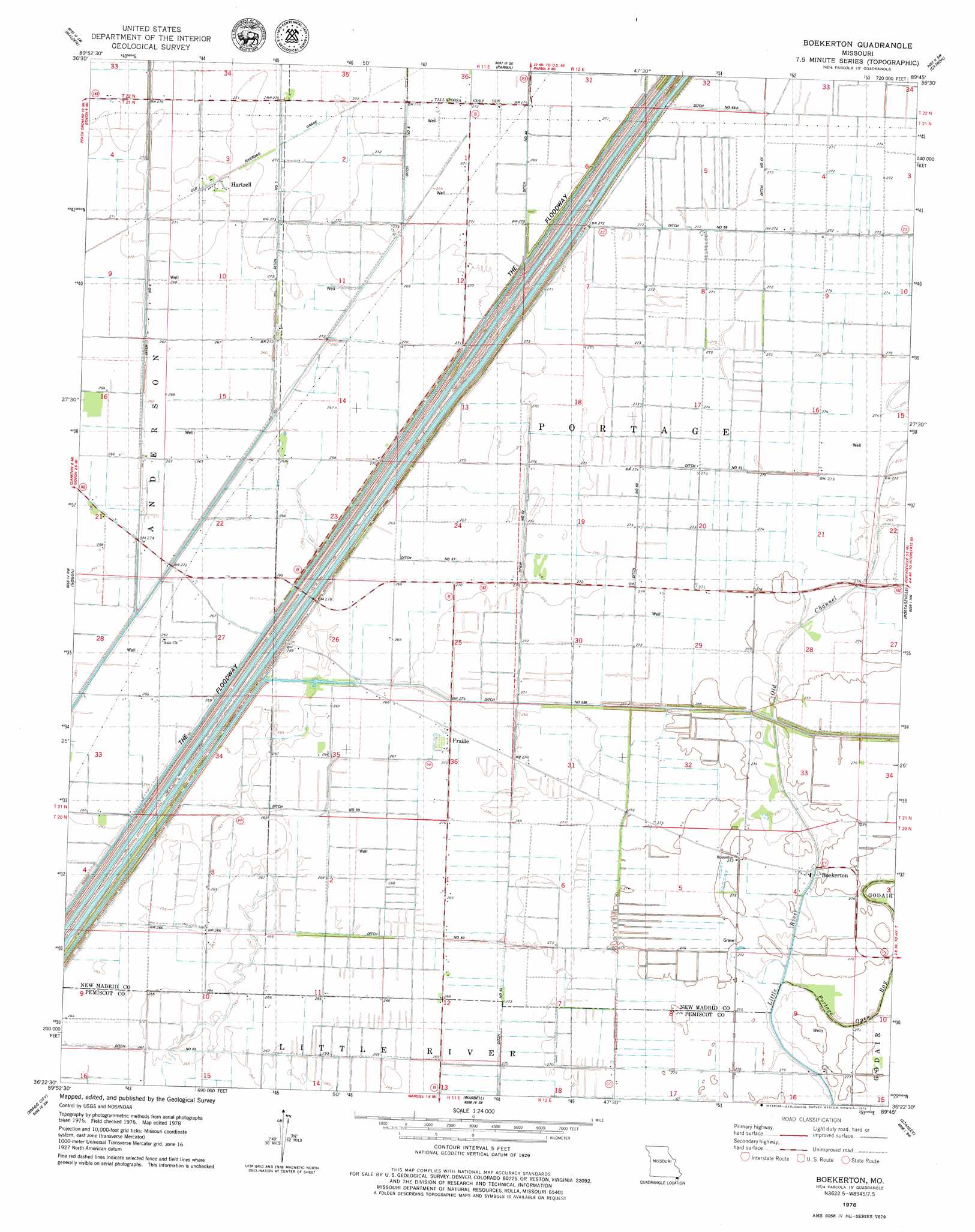
Boekerton Topo Map Missouri
To zoom in, hover over the map of Boekerton
USGS Topo Quad 36089d7 - 1:24,000 scale
| Topo Map Name: | Boekerton |
| USGS Topo Quad ID: | 36089d7 |
| Print Size: | ca. 21 1/4" wide x 27" high |
| Southeast Coordinates: | 36.375° N latitude / 89.75° W longitude |
| Map Center Coordinates: | 36.4375° N latitude / 89.8125° W longitude |
| U.S. State: | MO |
| Filename: | o36089d7.jpg |
| Download Map JPG Image: | Boekerton topo map 1:24,000 scale |
| Map Type: | Topographic |
| Topo Series: | 7.5´ |
| Map Scale: | 1:24,000 |
| Source of Map Images: | United States Geological Survey (USGS) |
| Alternate Map Versions: |
Boekerton MO 1978, updated 1979 Download PDF Buy paper map Boekerton MO 2012 Download PDF Buy paper map Boekerton MO 2015 Download PDF Buy paper map |
1:24,000 Topo Quads surrounding Boekerton
Powe |
Bernie |
Hills Store |
Charter Oak |
Kewanee |
Valley Ridge |
Malden |
Parma |
Catron |
New Madrid |
Campbell |
Gideon |
Boekerton |
Portageville |
Point Pleasant |
Kennett North |
Bragg City |
Wardell |
Stanley |
Mooring |
Kennett South |
Deering |
Hayti Heights |
Caruthersville |
Tennemo |
> Back to 36089a1 at 1:100,000 scale
> Back to 36088a1 at 1:250,000 scale
> Back to U.S. Topo Maps home
Boekerton topo map: Gazetteer
Boekerton: Canals
Ditch Number 1 elevation 86m 282′Ditch Number 256 elevation 83m 272′
Ditch Number 290 elevation 85m 278′
Ditch Number 55 elevation 83m 272′
Ditch Number 55-A elevation 82m 269′
Ditch Number 56 elevation 83m 272′
Ditch Number 57 elevation 80m 262′
Ditch Number 59 elevation 80m 262′
Ditch Number 60 elevation 82m 269′
Ditch Number 61 elevation 82m 269′
Ditch Number 62 elevation 82m 269′
Ditch Number 63 elevation 80m 262′
Ditch Number 8 elevation 81m 265′
Ditch Number 9 elevation 82m 269′
Boekerton: Populated Places
Boekerton elevation 81m 265′Frailie elevation 82m 269′
Garver elevation 82m 269′
Hartzell elevation 82m 269′
New Garver elevation 82m 269′
Boekerton: Streams
Portage Open Bay elevation 81m 265′Boekerton digital topo map on disk
Buy this Boekerton topo map showing relief, roads, GPS coordinates and other geographical features, as a high-resolution digital map file on DVD: