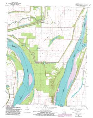
Hubbard Lake Topo Map Missouri
To zoom in, hover over the map of Hubbard Lake
USGS Topo Quad 36089e4 - 1:24,000 scale
| Topo Map Name: | Hubbard Lake |
| USGS Topo Quad ID: | 36089e4 |
| Print Size: | ca. 21 1/4" wide x 27" high |
| Southeast Coordinates: | 36.5° N latitude / 89.375° W longitude |
| Map Center Coordinates: | 36.5625° N latitude / 89.4375° W longitude |
| U.S. States: | MO, TN, KY |
| Filename: | o36089e4.jpg |
| Download Map JPG Image: | Hubbard Lake topo map 1:24,000 scale |
| Map Type: | Topographic |
| Topo Series: | 7.5´ |
| Map Scale: | 1:24,000 |
| Source of Map Images: | United States Geological Survey (USGS) |
| Alternate Map Versions: |
Hubbard Lake MO 1951, updated 1953 Download PDF Buy paper map Hubbard Lake MO 1951, updated 1964 Download PDF Buy paper map Hubbard Lake MO 1969, updated 1972 Download PDF Buy paper map Hubbard Lake MO 1969, updated 1983 Download PDF Buy paper map Hubbard Lake MO 2010 Download PDF Buy paper map Hubbard Lake MO 2012 Download PDF Buy paper map Hubbard Lake MO 2015 Download PDF Buy paper map |
1:24,000 Topo Quads surrounding Hubbard Lake
> Back to 36089e1 at 1:100,000 scale
> Back to 36088a1 at 1:250,000 scale
> Back to U.S. Topo Maps home
Hubbard Lake topo map: Gazetteer
Hubbard Lake: Bridges
Knotts Bridge elevation 84m 275′Hubbard Lake: Canals
Mud Ditch elevation 85m 278′Hubbard Lake: Capes
Kentucky Point elevation 89m 291′Hubbard Lake: Channels
Hotchkiss Bend elevation 83m 272′Hubbard Lake: Guts
Cutoff Slough elevation 88m 288′Elbow Slough elevation 90m 295′
Hubbard Lake: Islands
Island Number 9 elevation 89m 291′Hubbard Lake: Lakes
Bowman Hole elevation 89m 291′Conran Dike Hole elevation 90m 295′
Dawson Hole elevation 87m 285′
Fish Lake elevation 89m 291′
Hancock Hole elevation 88m 288′
Hancock Hole (historical) elevation 88m 288′
Hubbard Lake elevation 86m 282′
Lake Number 9 elevation 86m 282′
Morrison Hole elevation 88m 288′
Ransburgh Hole elevation 87m 285′
Riley Lake elevation 85m 278′
Round Hole elevation 89m 291′
Stonewall Lake elevation 86m 282′
Stump Hole elevation 90m 295′
Stump Hole (historical) elevation 87m 285′
Tressle Hole elevation 90m 295′
Washpan Lake elevation 84m 275′
Hubbard Lake: Levees
Conran Dike elevation 90m 295′La Forge Revetment (historical) elevation 84m 275′
New Madrid Farrenburg Levee elevation 89m 291′
Hubbard Lake: Streams
Chute of Island Number 8 elevation 86m 282′T Louis Bayou elevation 88m 288′
Wilson Bayou elevation 85m 278′
Hubbard Lake digital topo map on disk
Buy this Hubbard Lake topo map showing relief, roads, GPS coordinates and other geographical features, as a high-resolution digital map file on DVD:


