Oakton Topo Map Kentucky
To zoom in, hover over the map of Oakton
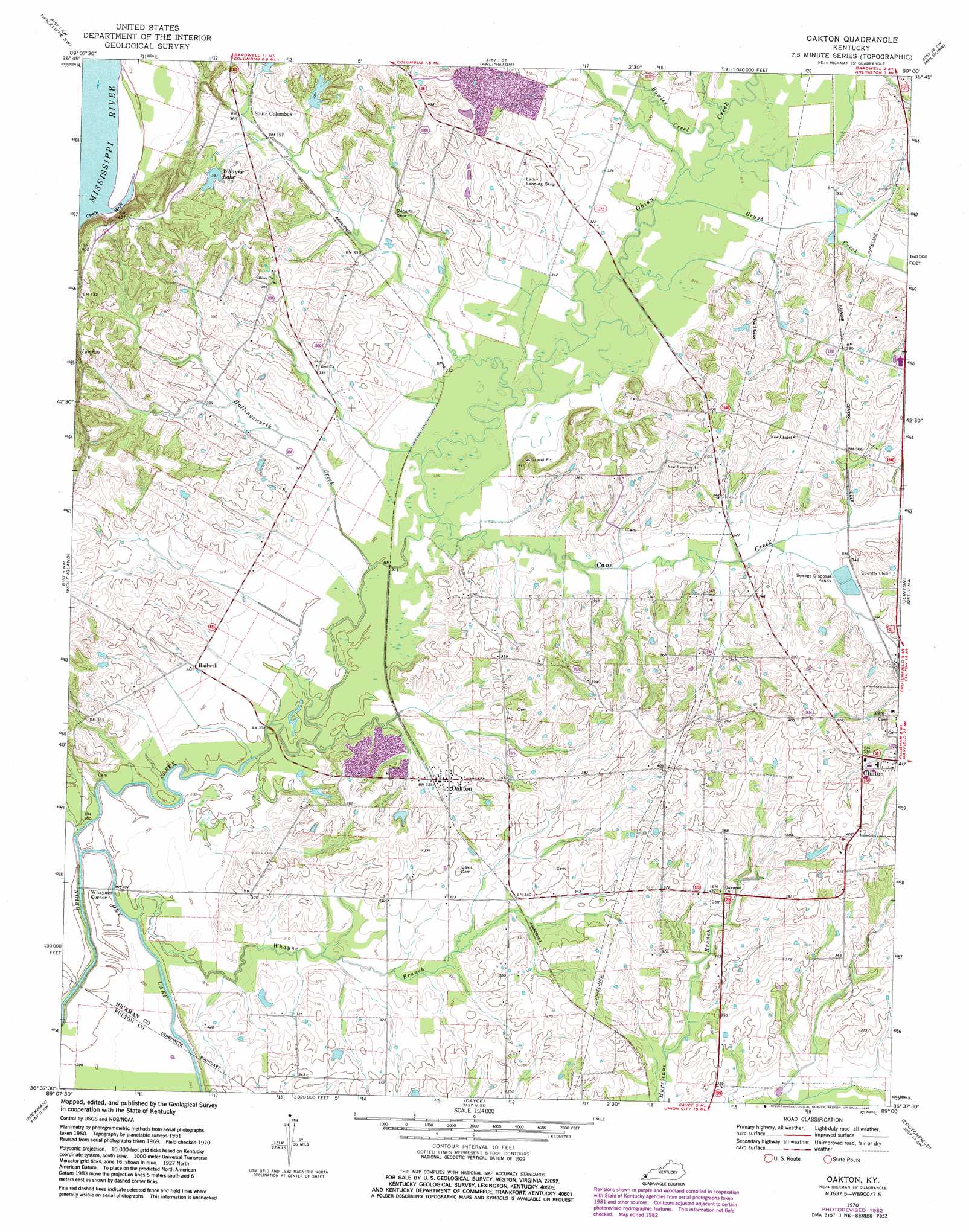
USGS Topo Quad 36089f1 - 1:24,000 scale
| Topo Map Name: | Oakton |
| USGS Topo Quad ID: | 36089f1 |
| Print Size: | ca. 21 1/4" wide x 27" high |
| Southeast Coordinates: | 36.625° N latitude / 89° W longitude |
| Map Center Coordinates: | 36.6875° N latitude / 89.0625° W longitude |
| U.S. State: | KY |
| Filename: | o36089f1.jpg |
| Download Map JPG Image: | Oakton topo map 1:24,000 scale |
| Map Type: | Topographic |
| Topo Series: | 7.5´ |
| Map Scale: | 1:24,000 |
| Source of Map Images: | United States Geological Survey (USGS) |
| Alternate Map Versions: |
Oakton KY 1951, updated 1952 Download PDF Buy paper map Oakton KY 1951, updated 1967 Download PDF Buy paper map Oakton KY 1970, updated 1972 Download PDF Buy paper map Oakton KY 1970, updated 1983 Download PDF Buy paper map Oakton KY 2010 Download PDF Buy paper map Oakton KY 2013 Download PDF Buy paper map Oakton KY 2016 Download PDF Buy paper map |
1:24,000 Topo Quads surrounding Oakton
Charleston |
Wyatt |
Wickliffe |
Blandville |
Lovelaceville |
Anniston |
Wickliffe Sw |
Arlington |
Milburn |
Fancy Farm |
Bayouville |
Wolf Island |
Oakton |
Clinton |
Dublin |
Bondurant |
Hickman |
Cayce |
Crutchfield |
Water Valley |
Samburg |
Clayton |
Union City |
Harris |
Mcconnell |
> Back to 36089e1 at 1:100,000 scale
> Back to 36088a1 at 1:250,000 scale
> Back to U.S. Topo Maps home
Oakton topo map: Gazetteer
Oakton: Lakes
Dry Lake elevation 89m 291′Oakton: Populated Places
Hailwell elevation 95m 311′Oakton elevation 104m 341′
South Columbus elevation 110m 360′
Whaynes Corner elevation 90m 295′
Oakton: Reservoirs
Whayne Lake elevation 116m 380′Oakton: Streams
Bowles Creek elevation 95m 311′Brush Creek elevation 95m 311′
Cane Creek elevation 91m 298′
Hollingsworth Creek elevation 90m 295′
Whayne Branch elevation 89m 291′
Oakton digital topo map on disk
Buy this Oakton topo map showing relief, roads, GPS coordinates and other geographical features, as a high-resolution digital map file on DVD: