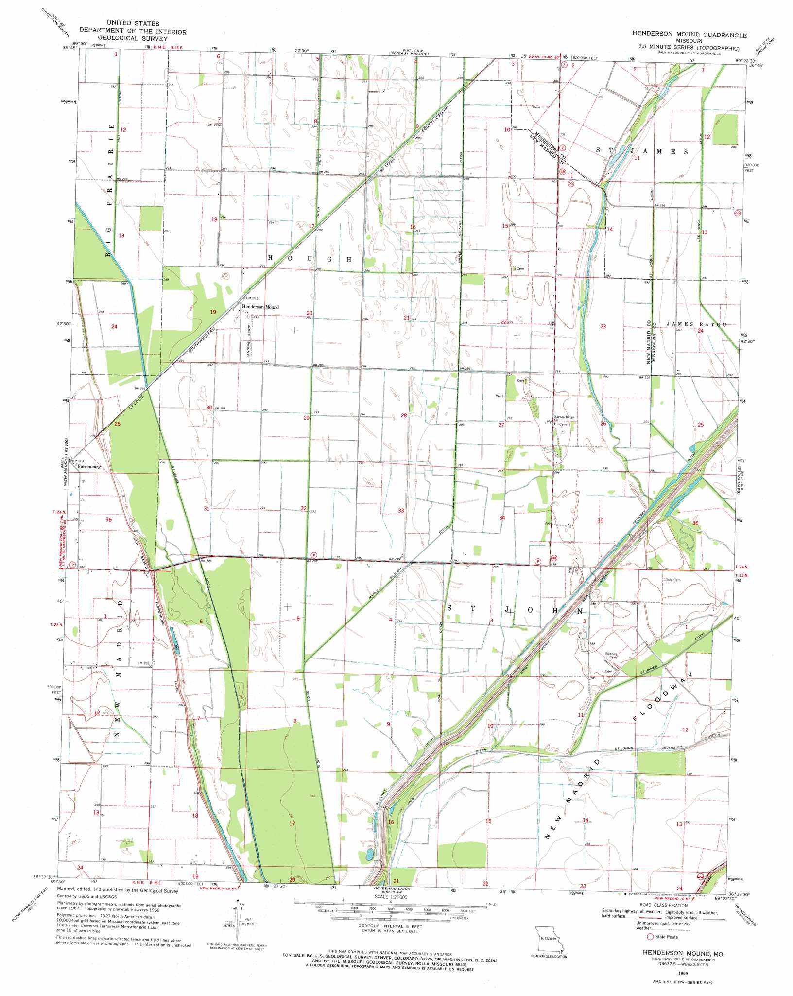
Henderson Mound Topo Map Missouri
To zoom in, hover over the map of Henderson Mound
USGS Topo Quad 36089f4 - 1:24,000 scale
| Topo Map Name: | Henderson Mound |
| USGS Topo Quad ID: | 36089f4 |
| Print Size: | ca. 21 1/4" wide x 27" high |
| Southeast Coordinates: | 36.625° N latitude / 89.375° W longitude |
| Map Center Coordinates: | 36.6875° N latitude / 89.4375° W longitude |
| U.S. State: | MO |
| Filename: | o36089f4.jpg |
| Download Map JPG Image: | Henderson Mound topo map 1:24,000 scale |
| Map Type: | Topographic |
| Topo Series: | 7.5´ |
| Map Scale: | 1:24,000 |
| Source of Map Images: | United States Geological Survey (USGS) |
| Alternate Map Versions: |
Henderson Mound MO 1969, updated 1971 Download PDF Buy paper map Henderson Mound MO 2012 Download PDF Buy paper map Henderson Mound MO 2015 Download PDF Buy paper map |
1:24,000 Topo Quads surrounding Henderson Mound
Vanduser |
Sikeston North |
Bertrand |
Charleston |
Wyatt |
Morehouse |
Sikeston South |
East Prairie |
Anniston |
Wickliffe Sw |
Charter Oak |
Kewanee |
Henderson Mound |
Bayouville |
Wolf Island |
Catron |
New Madrid |
Hubbard Lake |
Bondurant |
Hickman |
Portageville |
Point Pleasant |
Tiptonville |
Samburg |
Clayton |
> Back to 36089e1 at 1:100,000 scale
> Back to 36088a1 at 1:250,000 scale
> Back to U.S. Topo Maps home
Henderson Mound topo map: Gazetteer
Henderson Mound: Airports
Henderson Mounds E B G Airport elevation 89m 291′Henderson Mound: Canals
Coal Oil Ditch elevation 89m 291′Ditch Number 10 elevation 90m 295′
Henderson Mound: Populated Places
Selkirk elevation 90m 295′Henderson Mound: Ridges
Barnes Ridge elevation 91m 298′Henderson Mound: Streams
Black Bayou elevation 88m 288′Henderson Mound digital topo map on disk
Buy this Henderson Mound topo map showing relief, roads, GPS coordinates and other geographical features, as a high-resolution digital map file on DVD: