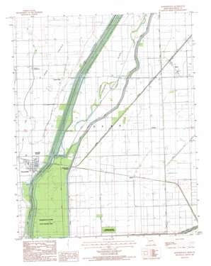
Hornersville Topo Map Missouri
To zoom in, hover over the map of Hornersville
USGS Topo Quad 36090a1 - 1:24,000 scale
| Topo Map Name: | Hornersville |
| USGS Topo Quad ID: | 36090a1 |
| Print Size: | ca. 21 1/4" wide x 27" high |
| Southeast Coordinates: | 36° N latitude / 90° W longitude |
| Map Center Coordinates: | 36.0625° N latitude / 90.0625° W longitude |
| U.S. State: | MO |
| Filename: | o36090a1.jpg |
| Download Map JPG Image: | Hornersville topo map 1:24,000 scale |
| Map Type: | Topographic |
| Topo Series: | 7.5´ |
| Map Scale: | 1:24,000 |
| Source of Map Images: | United States Geological Survey (USGS) |
| Alternate Map Versions: |
Hornersville MO 1983, updated 1984 Download PDF Buy paper map Hornersville MO 2012 Download PDF Buy paper map Hornersville MO 2015 Download PDF Buy paper map |
1:24,000 Topo Quads surrounding Hornersville
> Back to 36090a1 at 1:100,000 scale
> Back to 36090a1 at 1:250,000 scale
> Back to U.S. Topo Maps home
Hornersville topo map: Gazetteer
Hornersville: Airports
Reynolds Landing Strip elevation 77m 252′Hornersville: Areas
Grand Prairie elevation 78m 255′Hornersville: Canals
Ditch Number 2 elevation 73m 239′Ditch Number 3 elevation 73m 239′
Ditch Number 35 elevation 76m 249′
Ditch Number 5 elevation 72m 236′
Ditch Number 6 elevation 73m 239′
Ditch Number 79 elevation 72m 236′
Ditch Number 8 elevation 73m 239′
Ditch Number 80 elevation 74m 242′
Elk Chute Ditch elevation 75m 246′
Elk Chute Ditch Number 8 elevation 73m 239′
Lateral Number 10 elevation 75m 246′
Lateral Number 18 elevation 74m 242′
Lateral Number 19 elevation 74m 242′
Lateral Number 27 elevation 73m 239′
Lateral Number 4 elevation 75m 246′
Sand Slough Ditch elevation 71m 232′
Surface Ditch elevation 72m 236′
Hornersville: Islands
Treasure Island elevation 74m 242′Hornersville: Levees
Elk Chute Levee elevation 75m 246′Hornersville: Parks
Hornersville Swamp State Wildlife Area elevation 73m 239′Warbler Woods State Natural Area elevation 73m 239′
Hornersville: Populated Places
Branums Point elevation 72m 236′Cotton Plant elevation 77m 252′
Gilbert elevation 75m 246′
Hornersville elevation 75m 246′
Hornersville Junction elevation 73m 239′
Leachville Junction elevation 75m 246′
Rives elevation 75m 246′
Sunrise elevation 74m 242′
Hornersville: Streams
Old Channel Little River elevation 74m 242′Hornersville digital topo map on disk
Buy this Hornersville topo map showing relief, roads, GPS coordinates and other geographical features, as a high-resolution digital map file on DVD:


