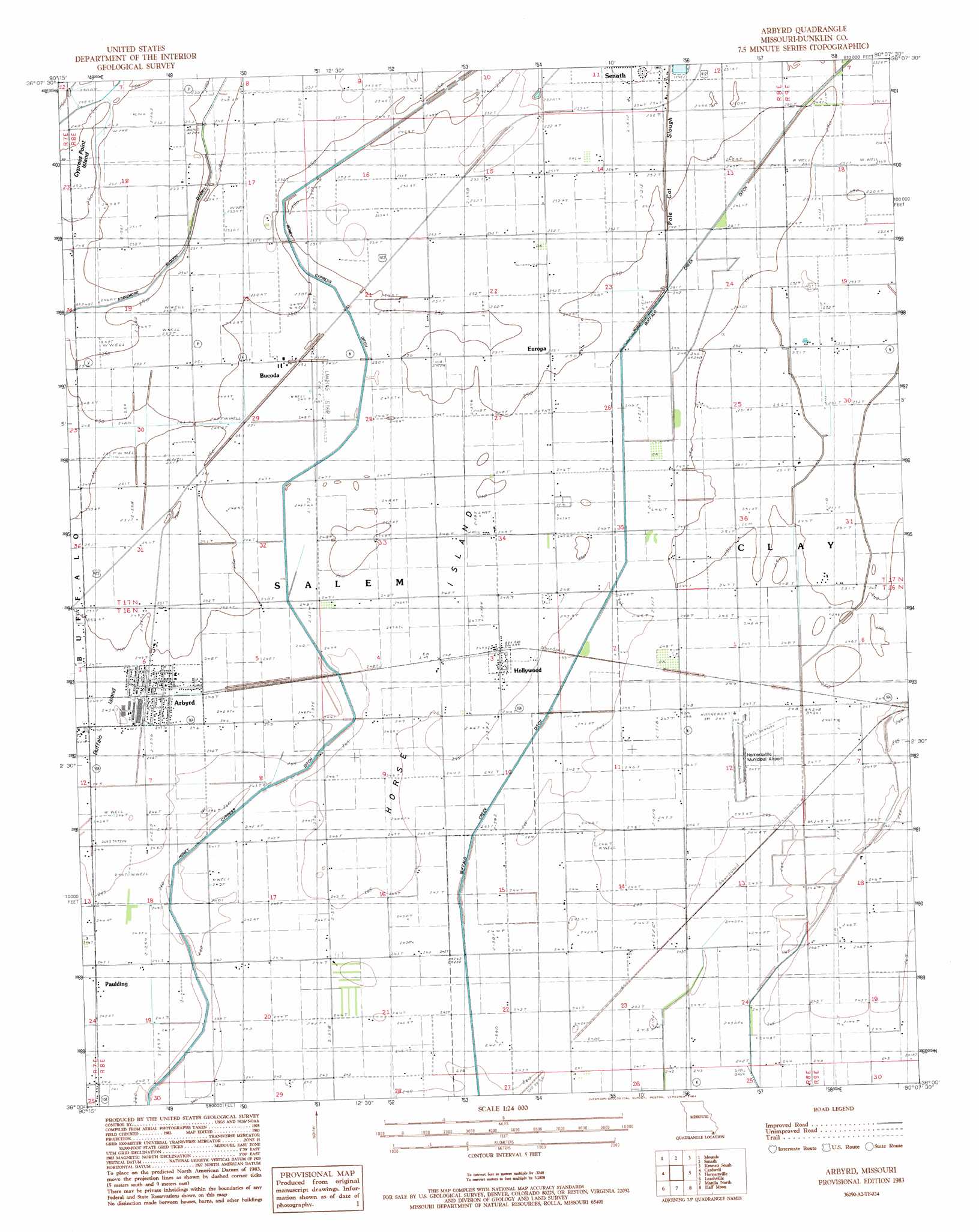
Arbyrd Topo Map Missouri
To zoom in, hover over the map of Arbyrd
USGS Topo Quad 36090a2 - 1:24,000 scale
| Topo Map Name: | Arbyrd |
| USGS Topo Quad ID: | 36090a2 |
| Print Size: | ca. 21 1/4" wide x 27" high |
| Southeast Coordinates: | 36° N latitude / 90.125° W longitude |
| Map Center Coordinates: | 36.0625° N latitude / 90.1875° W longitude |
| U.S. State: | MO |
| Filename: | o36090a2.jpg |
| Download Map JPG Image: | Arbyrd topo map 1:24,000 scale |
| Map Type: | Topographic |
| Topo Series: | 7.5´ |
| Map Scale: | 1:24,000 |
| Source of Map Images: | United States Geological Survey (USGS) |
| Alternate Map Versions: |
Arbyrd MO 1983, updated 1984 Download PDF Buy paper map Arbyrd MO 2011 Download PDF Buy paper map Arbyrd MO 2015 Download PDF Buy paper map |
1:24,000 Topo Quads surrounding Arbyrd
Boydsville |
Rector |
Greenway |
Kennett North |
Bragg City |
Marmaduke |
Mounds |
Senath |
Kennett South |
Deering |
Paragould East |
Cardwell |
Arbyrd |
Hornersville |
Denton |
Dixie |
Leachville |
Manila North |
Half Moon |
Blytheville |
Lake City |
Caraway |
Manila South |
Dell |
Luxora |
> Back to 36090a1 at 1:100,000 scale
> Back to 36090a1 at 1:250,000 scale
> Back to U.S. Topo Maps home
Arbyrd topo map: Gazetteer
Arbyrd: Airports
Hornersville Memorial Airport elevation 75m 246′Arbyrd: Areas
Buffalo Island elevation 76m 249′Cypress Point Island elevation 76m 249′
Horse Island elevation 76m 249′
Arbyrd: Canals
Cole Ditch elevation 75m 246′Honey Cypress Ditch Number 34 elevation 75m 246′
Lateral Number 2 elevation 76m 249′
Arbyrd: Populated Places
Arbyrd elevation 76m 249′Bucoda elevation 76m 249′
Caneer elevation 74m 242′
Europa elevation 76m 249′
Evorge elevation 75m 246′
Hollywood elevation 75m 246′
Nesbit elevation 77m 252′
Paulding elevation 73m 239′
Arbyrd: Streams
Pole Cat Slough elevation 75m 246′Arbyrd digital topo map on disk
Buy this Arbyrd topo map showing relief, roads, GPS coordinates and other geographical features, as a high-resolution digital map file on DVD: