Manson Topo Map Arkansas
To zoom in, hover over the map of Manson
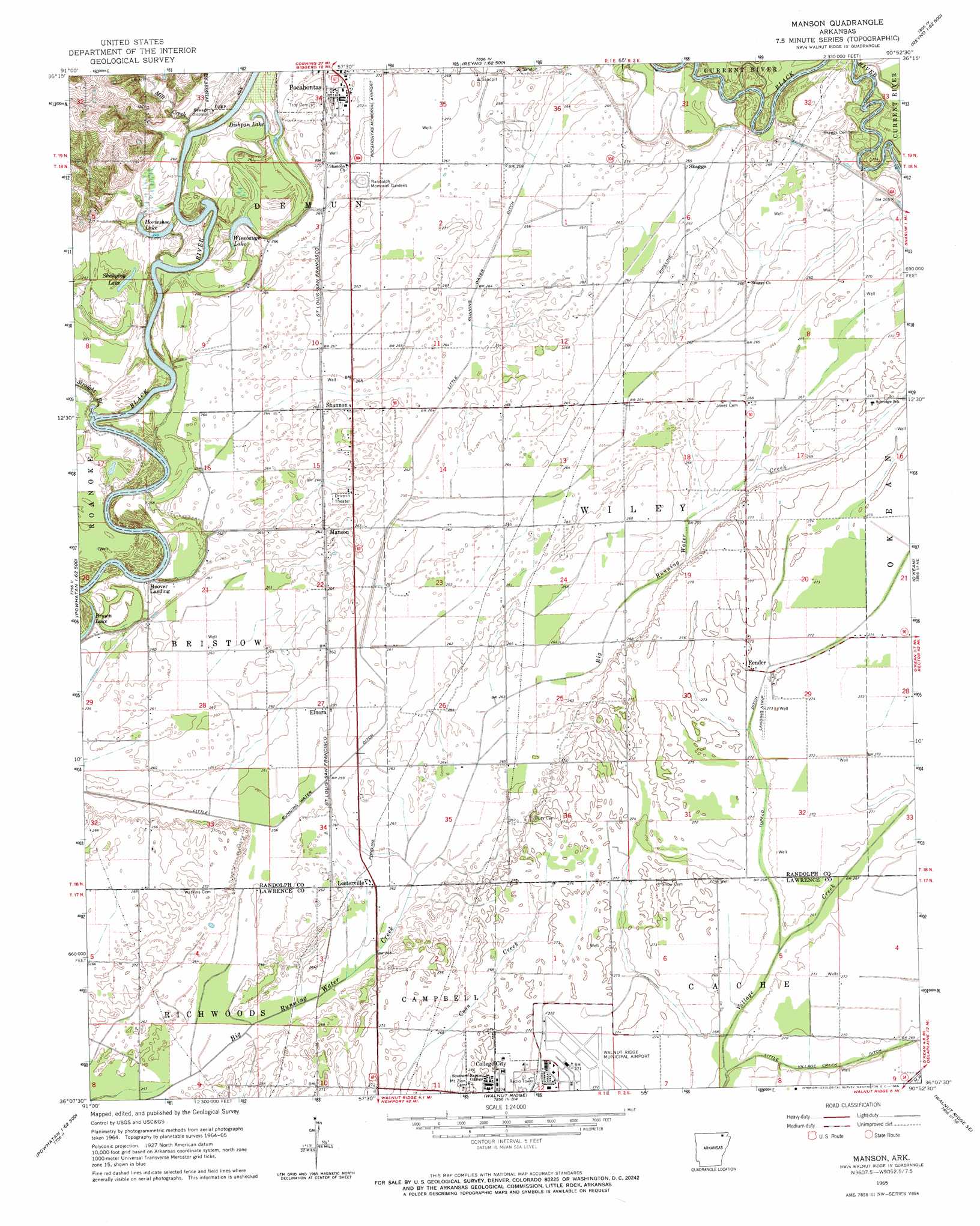
USGS Topo Quad 36090b8 - 1:24,000 scale
| Topo Map Name: | Manson |
| USGS Topo Quad ID: | 36090b8 |
| Print Size: | ca. 21 1/4" wide x 27" high |
| Southeast Coordinates: | 36.125° N latitude / 90.875° W longitude |
| Map Center Coordinates: | 36.1875° N latitude / 90.9375° W longitude |
| U.S. State: | AR |
| Filename: | o36090b8.jpg |
| Download Map JPG Image: | Manson topo map 1:24,000 scale |
| Map Type: | Topographic |
| Topo Series: | 7.5´ |
| Map Scale: | 1:24,000 |
| Source of Map Images: | United States Geological Survey (USGS) |
| Alternate Map Versions: |
Manson AR 1965, updated 1966 Download PDF Buy paper map Manson AR 2011 Download PDF Buy paper map Manson AR 2014 Download PDF Buy paper map |
1:24,000 Topo Quads surrounding Manson
Dalton |
Warm Springs |
Maynard |
Supply |
Datto |
Ravenden Springs |
Ravenden Springs Se |
Pocahontas |
Reyno |
Peach Orchard |
Imboden |
Noland |
Manson |
O'Kean |
Delaplaine |
Eaton |
Black Rock |
Walnut Ridge |
Walnut Ridge Se |
Walcott |
Strangers Home |
Alicia |
Podo Creek |
Bono |
Lorado |
> Back to 36090a1 at 1:100,000 scale
> Back to 36090a1 at 1:250,000 scale
> Back to U.S. Topo Maps home
Manson topo map: Gazetteer
Manson: Airports
Nick Wilson Field elevation 81m 265′Walnut Ridge Regional Airport elevation 82m 269′
Manson: Bends
Buttermilk Bend elevation 75m 246′Chesser Bend elevation 75m 246′
Gumthicket Bend elevation 78m 255′
Hoover Bend elevation 77m 252′
Inman Bend elevation 74m 242′
Luteman Bend elevation 78m 255′
Stacy Bend elevation 73m 239′
Manson: Canals
Cypress Lateral elevation 79m 259′Cypress Overcup Lateral elevation 76m 249′
Little Running Water Ditch elevation 76m 249′
Overcup Lateral elevation 78m 255′
Tupelo Ditch elevation 80m 262′
Manson: Crossings
Skaggs Ferry (historical) elevation 73m 239′Manson: Lakes
Dishpan Lake elevation 78m 255′Horseshoe Lake elevation 76m 249′
Shakybog Lake elevation 77m 252′
Winebaugh Lake elevation 79m 259′
Manson: Populated Places
College City elevation 83m 272′Elnora elevation 77m 252′
Fender elevation 83m 272′
Hoover Landing elevation 78m 255′
Lesterville elevation 80m 262′
Manson elevation 80m 262′
Shannon elevation 79m 259′
Skaggs elevation 78m 255′
Manson: Streams
Mill Creek elevation 79m 259′Straight Branch elevation 74m 242′
Manson digital topo map on disk
Buy this Manson topo map showing relief, roads, GPS coordinates and other geographical features, as a high-resolution digital map file on DVD: