Mcdougal Topo Map Arkansas
To zoom in, hover over the map of Mcdougal
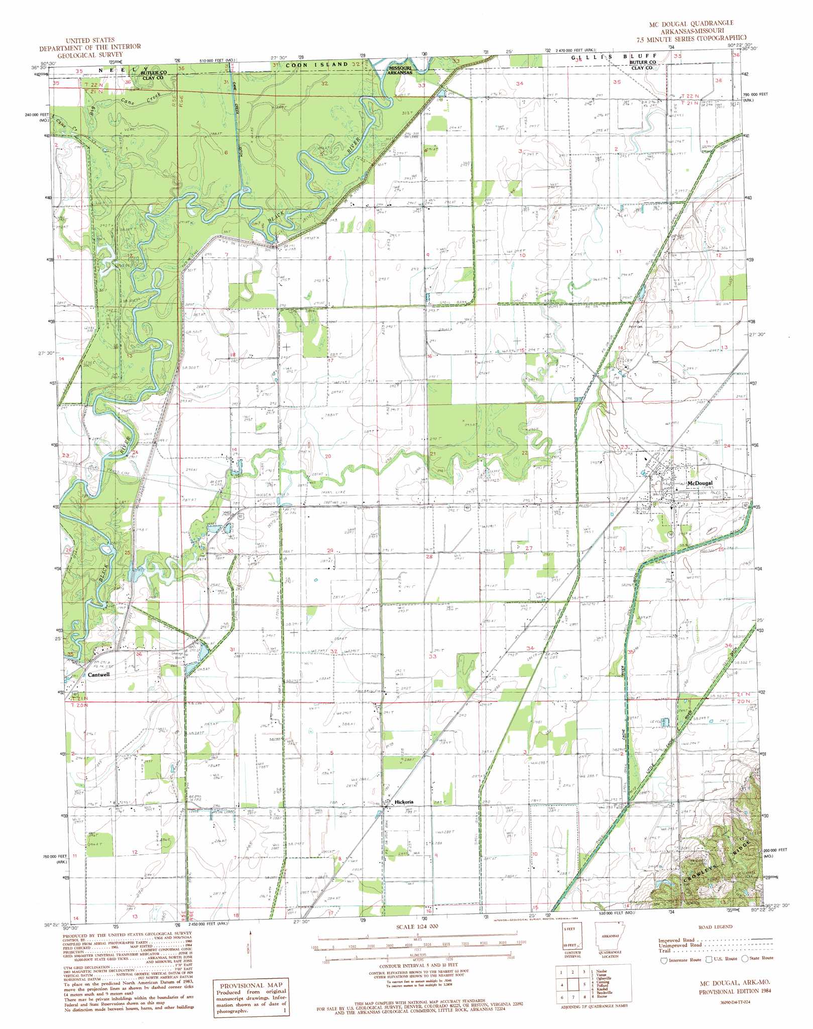
USGS Topo Quad 36090d4 - 1:24,000 scale
| Topo Map Name: | Mcdougal |
| USGS Topo Quad ID: | 36090d4 |
| Print Size: | ca. 21 1/4" wide x 27" high |
| Southeast Coordinates: | 36.375° N latitude / 90.375° W longitude |
| Map Center Coordinates: | 36.4375° N latitude / 90.4375° W longitude |
| U.S. States: | AR, MO |
| Filename: | o36090d4.jpg |
| Download Map JPG Image: | Mcdougal topo map 1:24,000 scale |
| Map Type: | Topographic |
| Topo Series: | 7.5´ |
| Map Scale: | 1:24,000 |
| Source of Map Images: | United States Geological Survey (USGS) |
| Alternate Map Versions: |
Mc Dougal AR 1984, updated 1984 Download PDF Buy paper map McDougal AR 2011 Download PDF Buy paper map McDougal AR 2014 Download PDF Buy paper map |
1:24,000 Topo Quads surrounding Mcdougal
Flatwoods |
Fairdealing |
Harviell |
Hanleyville |
Broseley |
Oxly |
Naylor |
Vastus |
Oglesville |
Glennonville |
Datto |
Corning |
Mcdougal |
Pollard |
Peggott |
Peach Orchard |
Knobel |
Boydsville |
Rector |
Greenway |
Delaplaine |
Lafe |
Marmaduke |
Mounds |
Senath |
> Back to 36090a1 at 1:100,000 scale
> Back to 36090a1 at 1:250,000 scale
> Back to U.S. Topo Maps home
Mcdougal topo map: Gazetteer
Mcdougal: Canals
Ditch Number 13 elevation 86m 282′Ditch Number 16 elevation 89m 291′
Ditch Number 17 elevation 86m 282′
Ditch Number 18 elevation 92m 301′
Ditch Number 19 elevation 85m 278′
Little Cache River Ditch elevation 93m 305′
Mcdougal: Crossings
Hineman Ferry (historical) elevation 88m 288′Mcdougal: Populated Places
Hickoria elevation 86m 282′McDougal elevation 91m 298′
Mcdougal: Streams
Big Cane Creek elevation 87m 285′Black River elevation 85m 278′
Burton Creek elevation 89m 291′
Mcdougal digital topo map on disk
Buy this Mcdougal topo map showing relief, roads, GPS coordinates and other geographical features, as a high-resolution digital map file on DVD: