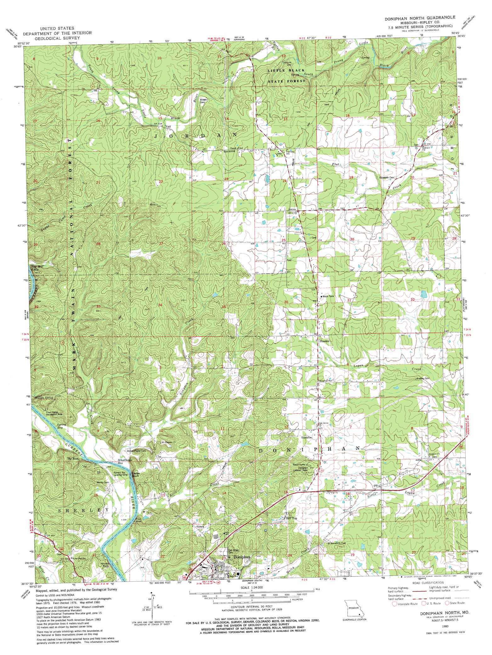
Doniphan North Topo Map Missouri
To zoom in, hover over the map of Doniphan North
USGS Topo Quad 36090f7 - 1:24,000 scale
| Topo Map Name: | Doniphan North |
| USGS Topo Quad ID: | 36090f7 |
| Print Size: | ca. 21 1/4" wide x 27" high |
| Southeast Coordinates: | 36.625° N latitude / 90.75° W longitude |
| Map Center Coordinates: | 36.6875° N latitude / 90.8125° W longitude |
| U.S. State: | MO |
| Filename: | o36090f7.jpg |
| Download Map JPG Image: | Doniphan North topo map 1:24,000 scale |
| Map Type: | Topographic |
| Topo Series: | 7.5´ |
| Map Scale: | 1:24,000 |
| Source of Map Images: | United States Geological Survey (USGS) |
| Alternate Map Versions: |
Doniphan North MO 1980, updated 1980 Download PDF Buy paper map Doniphan North MO 1997, updated 1999 Download PDF Buy paper map Doniphan North MO 2011 Download PDF Buy paper map Doniphan North MO 2015 Download PDF Buy paper map |
| FStopo: | US Forest Service topo Doniphan North is available: Download FStopo PDF Download FStopo TIF |
1:24,000 Topo Quads surrounding Doniphan North
Van Buren South |
Big Spring |
Hunter |
Ellsinore |
Williamsville |
Handy |
Grandin Sw |
Grandin |
Hogan Hollow |
Stringtown |
Bardley |
Briar |
Doniphan North |
Flatwoods |
Fairdealing |
Gatewood |
Poynor |
Doniphan South |
Oxly |
Naylor |
Warm Springs |
Maynard |
Supply |
Datto |
Corning |
> Back to 36090e1 at 1:100,000 scale
> Back to 36090a1 at 1:250,000 scale
> Back to U.S. Topo Maps home
Doniphan North topo map: Gazetteer
Doniphan North: Airports
Rancho Rio Landing Strip elevation 104m 341′Doniphan North: Bays
Bay Mill Eddy elevation 105m 344′Schoolhouse Bay elevation 104m 341′
Spring Bay elevation 104m 341′
Doniphan North: Cliffs
Cedar Bluff elevation 152m 498′Pine Bluff elevation 140m 459′
Doniphan North: Dams
Emerald Lake Dam elevation 138m 452′Kirby Dam elevation 151m 495′
Doniphan North: Forests
Little Black State Forest elevation 182m 597′Doniphan North: Parks
Float Camp Recreation Area elevation 104m 341′Doniphan North: Populated Places
Hill Top elevation 179m 587′Pleasant Grove elevation 183m 600′
Steeles elevation 170m 557′
Doniphan North: Post Offices
Fernook Post Office elevation 156m 511′Pleasant Grove Post Office elevation 183m 600′
Doniphan North: Reservoirs
Emerald Lake elevation 138m 452′Doniphan North: Springs
Malden Spring elevation 108m 354′Doniphan North: Streams
Barton Branch elevation 144m 472′Bills Creek elevation 105m 344′
Isaacs Creek elevation 104m 341′
Simpson Creek elevation 104m 341′
Doniphan North digital topo map on disk
Buy this Doniphan North topo map showing relief, roads, GPS coordinates and other geographical features, as a high-resolution digital map file on DVD: