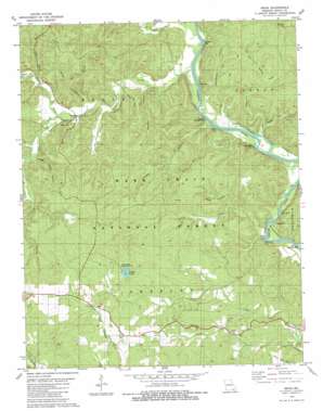
Briar Topo Map Missouri
To zoom in, hover over the map of Briar
USGS Topo Quad 36090f8 - 1:24,000 scale
| Topo Map Name: | Briar |
| USGS Topo Quad ID: | 36090f8 |
| Print Size: | ca. 21 1/4" wide x 27" high |
| Southeast Coordinates: | 36.625° N latitude / 90.875° W longitude |
| Map Center Coordinates: | 36.6875° N latitude / 90.9375° W longitude |
| U.S. State: | MO |
| Filename: | o36090f8.jpg |
| Download Map JPG Image: | Briar topo map 1:24,000 scale |
| Map Type: | Topographic |
| Topo Series: | 7.5´ |
| Map Scale: | 1:24,000 |
| Source of Map Images: | United States Geological Survey (USGS) |
| Alternate Map Versions: |
Briar MO 1979, updated 1980 Download PDF Buy paper map Briar MO 1997, updated 1999 Download PDF Buy paper map Briar MO 2011 Download PDF Buy paper map Briar MO 2015 Download PDF Buy paper map |
| FStopo: | US Forest Service topo Briar is available: Download FStopo PDF Download FStopo TIF |
1:24,000 Topo Quads surrounding Briar
> Back to 36090e1 at 1:100,000 scale
> Back to 36090a1 at 1:250,000 scale
> Back to U.S. Topo Maps home
Briar topo map: Gazetteer
Briar: Bays
Bugger Boo Bay elevation 104m 341′Dark Bay elevation 119m 390′
Peter Bay elevation 133m 436′
Pigs Ankle elevation 107m 351′
Round Bay elevation 109m 357′
Briar: Cliffs
Deer Leap elevation 115m 377′Briar: Dams
Ripley County Lake Dam elevation 201m 659′Briar: Parks
Compton Recreation Area elevation 111m 364′Deer Leap Recreation Area elevation 104m 341′
Float Camp Recreation Area elevation 104m 341′
Ripley Lake Recreation Area elevation 206m 675′
Briar: Populated Places
Briar elevation 202m 662′Carie elevation 192m 629′
Briar: Post Offices
Carie Post Office elevation 192m 629′Briar: Rapids
Hargus Eddy elevation 104m 341′Briar: Reservoirs
Ripley Lake elevation 201m 659′Briar: Streams
Buffalo Creek elevation 110m 360′Capps Creek elevation 109m 357′
Compton Creek elevation 111m 364′
Little Barren Creek elevation 110m 360′
North Fork Buffalo Creek elevation 120m 393′
Possum Creek elevation 116m 380′
South Fork Buffalo Creek elevation 120m 393′
Sugar Camp Creek elevation 109m 357′
Tattle Creek elevation 133m 436′
Terrible Creek elevation 130m 426′
Wells Creek elevation 107m 351′
Briar: Summits
Bee Hill elevation 215m 705′Fuse Hill elevation 227m 744′
Briar: Valleys
Hodo Hollow elevation 116m 380′Horse Hollow elevation 126m 413′
Jinks Hollow elevation 129m 423′
Mansco Hollow elevation 112m 367′
Mill Hollow elevation 154m 505′
Possum Hollow elevation 119m 390′
Sugar Camp Hollow elevation 131m 429′
Tar Kiln Hollow elevation 137m 449′
Voto Hollow elevation 120m 393′
Whetstone Hollow elevation 112m 367′
Briar digital topo map on disk
Buy this Briar topo map showing relief, roads, GPS coordinates and other geographical features, as a high-resolution digital map file on DVD:


