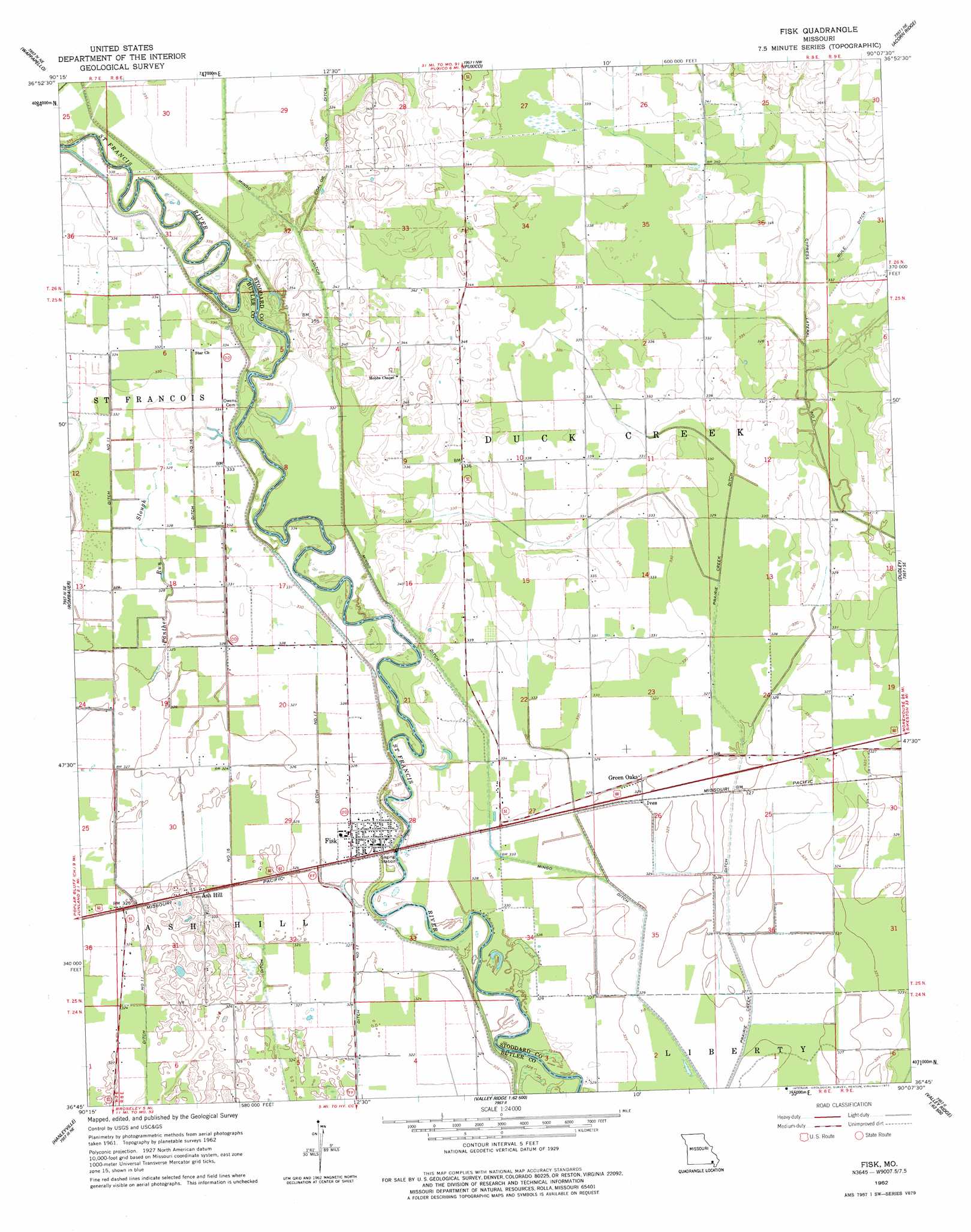
Fisk Topo Map Missouri
To zoom in, hover over the map of Fisk
USGS Topo Quad 36090g2 - 1:24,000 scale
| Topo Map Name: | Fisk |
| USGS Topo Quad ID: | 36090g2 |
| Print Size: | ca. 21 1/4" wide x 27" high |
| Southeast Coordinates: | 36.75° N latitude / 90.125° W longitude |
| Map Center Coordinates: | 36.8125° N latitude / 90.1875° W longitude |
| U.S. State: | MO |
| Filename: | o36090g2.jpg |
| Download Map JPG Image: | Fisk topo map 1:24,000 scale |
| Map Type: | Topographic |
| Topo Series: | 7.5´ |
| Map Scale: | 1:24,000 |
| Source of Map Images: | United States Geological Survey (USGS) |
| Alternate Map Versions: |
Fisk MO 1962, updated 1963 Download PDF Buy paper map Fisk MO 1962, updated 1977 Download PDF Buy paper map Fisk MO 2011 Download PDF Buy paper map Fisk MO 2015 Download PDF Buy paper map |
1:24,000 Topo Quads surrounding Fisk
Greenville Sw |
Shook |
Mcgee |
Sturdivant |
Advance |
Hendrickson |
Wappapello |
Puxico |
Acorn Ridge |
Bloomfield |
Poplar Bluff |
Rombauer |
Fisk |
Dudley |
Dexter |
Harviell |
Hanleyville |
Broseley |
Powe |
Bernie |
Vastus |
Oglesville |
Glennonville |
Valley Ridge |
Malden |
> Back to 36090e1 at 1:100,000 scale
> Back to 36090a1 at 1:250,000 scale
> Back to U.S. Topo Maps home
Fisk topo map: Gazetteer
Fisk: Canals
Ditch Number 11 elevation 99m 324′Ditch Number 16 elevation 98m 321′
Ditch Number 17 elevation 99m 324′
Mingo Ditch elevation 101m 331′
Prairie Creek Ditch elevation 98m 321′
Fisk: Guts
Panther Run Slough elevation 99m 324′Fisk: Lakes
Right Lake (historical) elevation 100m 328′Fisk: Populated Places
Ash Hill elevation 101m 331′Fisk elevation 101m 331′
Green Oaks elevation 99m 324′
Ives elevation 99m 324′
Randol elevation 101m 331′
Fisk digital topo map on disk
Buy this Fisk topo map showing relief, roads, GPS coordinates and other geographical features, as a high-resolution digital map file on DVD: