Hunter Topo Map Missouri
To zoom in, hover over the map of Hunter
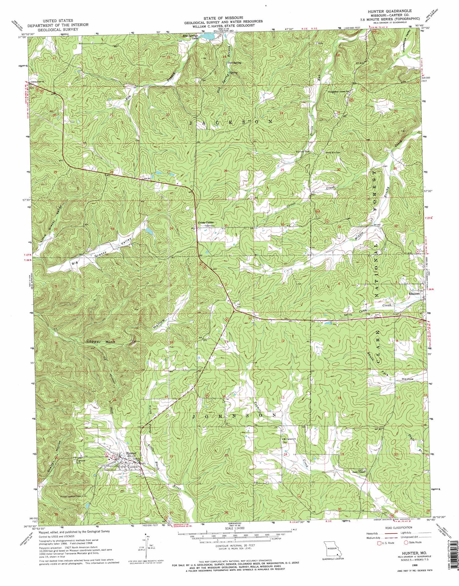
USGS Topo Quad 36090h7 - 1:24,000 scale
| Topo Map Name: | Hunter |
| USGS Topo Quad ID: | 36090h7 |
| Print Size: | ca. 21 1/4" wide x 27" high |
| Southeast Coordinates: | 36.875° N latitude / 90.75° W longitude |
| Map Center Coordinates: | 36.9375° N latitude / 90.8125° W longitude |
| U.S. State: | MO |
| Filename: | o36090h7.jpg |
| Download Map JPG Image: | Hunter topo map 1:24,000 scale |
| Map Type: | Topographic |
| Topo Series: | 7.5´ |
| Map Scale: | 1:24,000 |
| Source of Map Images: | United States Geological Survey (USGS) |
| Alternate Map Versions: |
Hunter MO 1968, updated 1969 Download PDF Buy paper map Hunter MO 1968, updated 1969 Download PDF Buy paper map Hunter MO 2011 Download PDF Buy paper map Hunter MO 2015 Download PDF Buy paper map |
| FStopo: | US Forest Service topo Hunter is available: Download FStopo PDF Download FStopo TIF |
1:24,000 Topo Quads surrounding Hunter
Exchange |
Ellington |
Clearwater Dam |
Piedmont |
Patterson |
Van Buren North |
Garwood |
Ellington Se |
Mill Spring |
Piedmont Se |
Van Buren South |
Big Spring |
Hunter |
Ellsinore |
Williamsville |
Handy |
Grandin Sw |
Grandin |
Hogan Hollow |
Stringtown |
Bardley |
Briar |
Doniphan North |
Flatwoods |
Fairdealing |
> Back to 36090e1 at 1:100,000 scale
> Back to 36090a1 at 1:250,000 scale
> Back to U.S. Topo Maps home
Hunter topo map: Gazetteer
Hunter: Dams
Carnahan Lake Dam elevation 253m 830′Elm Springs Lake Dam elevation 196m 643′
Number 445 Dam elevation 244m 800′
Pine Woods Dam elevation 233m 764′
Wallace Lake Dam elevation 237m 777′
Hunter: Lakes
Pinewoods Lake elevation 238m 780′Hunter: Populated Places
Crites Corner elevation 269m 882′Hunter elevation 219m 718′
Hunter: Reservoirs
Elm Springs Lake elevation 196m 643′Rozark Incorporated Reservoir elevation 253m 830′
Wallace Lake elevation 237m 777′
Hunter: Springs
Oak Spring elevation 206m 675′Hunter: Streams
Crites Creek elevation 189m 620′Hunter: Valleys
Little Grassy Valley elevation 190m 623′Hunter digital topo map on disk
Buy this Hunter topo map showing relief, roads, GPS coordinates and other geographical features, as a high-resolution digital map file on DVD: