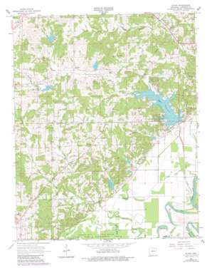
Eaton Topo Map Arkansas
To zoom in, hover over the map of Eaton
USGS Topo Quad 36091a2 - 1:24,000 scale
| Topo Map Name: | Eaton |
| USGS Topo Quad ID: | 36091a2 |
| Print Size: | ca. 21 1/4" wide x 27" high |
| Southeast Coordinates: | 36° N latitude / 91.125° W longitude |
| Map Center Coordinates: | 36.0625° N latitude / 91.1875° W longitude |
| U.S. State: | AR |
| Filename: | o36091a2.jpg |
| Download Map JPG Image: | Eaton topo map 1:24,000 scale |
| Map Type: | Topographic |
| Topo Series: | 7.5´ |
| Map Scale: | 1:24,000 |
| Source of Map Images: | United States Geological Survey (USGS) |
| Alternate Map Versions: |
Eaton AR 1966, updated 1967 Download PDF Buy paper map Eaton AR 1966, updated 1982 Download PDF Buy paper map Eaton AR 2011 Download PDF Buy paper map Eaton AR 2014 Download PDF Buy paper map |
1:24,000 Topo Quads surrounding Eaton
> Back to 36091a1 at 1:100,000 scale
> Back to 36090a1 at 1:250,000 scale
> Back to U.S. Topo Maps home
Eaton topo map: Gazetteer
Eaton: Dams
Flat Creek Site Five Dam elevation 79m 259′Flat Creek Site Four Dam elevation 82m 269′
Flat Creek Site One Dam elevation 125m 410′
Flat Creek Site Six Dam elevation 76m 249′
Flat Creek Site Three Dam elevation 78m 255′
Flat Creek Site Two Dam elevation 117m 383′
Ralph McDonald Lake Dam elevation 100m 328′
Eaton: Guts
Sawlog Slough elevation 73m 239′Eaton: Lakes
Brushy Pond elevation 73m 239′Fish Pond elevation 71m 232′
Long Pond elevation 72m 236′
Robinson Bay elevation 68m 223′
White Pond elevation 68m 223′
Eaton: Parks
Lake Charles State Park elevation 85m 278′Shirey Bay-Rainey Brake State Game Manag elevation 73m 239′
Eaton: Populated Places
Denton elevation 99m 324′Eaton elevation 89m 291′
Eaton: Reservoirs
Flat Creek Site Five Reservoir elevation 79m 259′Flat Creek Site Four Reservoir elevation 82m 269′
Flat Creek Site Six Reservoir elevation 76m 249′
Flat Creek Site Two Reservoir elevation 117m 383′
Lake Charles elevation 78m 255′
Phillips Lake elevation 120m 393′
Ralph McDonald Lake elevation 100m 328′
Eaton: Streams
Bench Creek elevation 99m 324′Big Cypress Creek elevation 72m 236′
Crow Creek elevation 71m 232′
Flat Creek elevation 68m 223′
Little Cypress Creek elevation 75m 246′
Eaton digital topo map on disk
Buy this Eaton topo map showing relief, roads, GPS coordinates and other geographical features, as a high-resolution digital map file on DVD:


