Evening Shade Topo Map Arkansas
To zoom in, hover over the map of Evening Shade
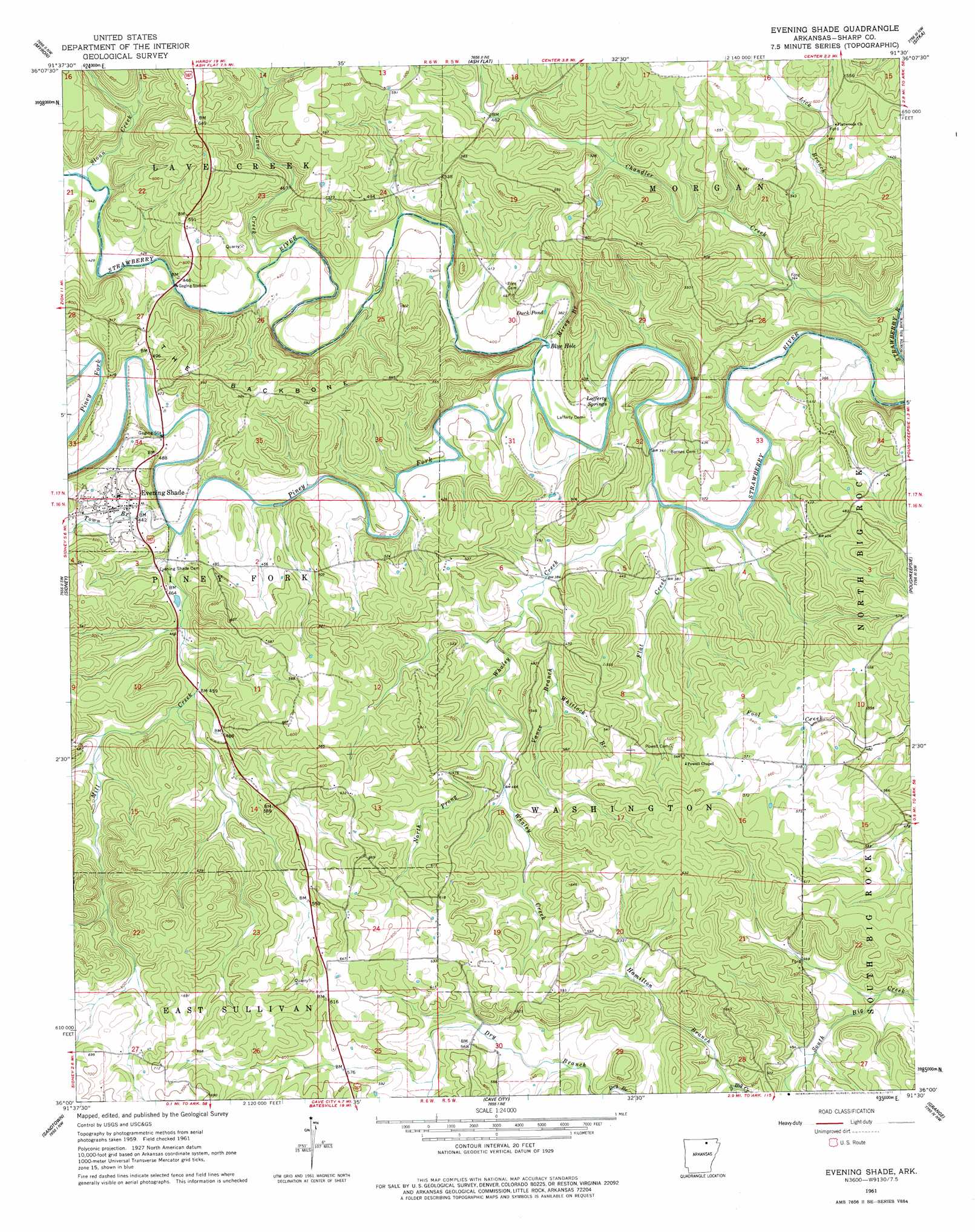
USGS Topo Quad 36091a5 - 1:24,000 scale
| Topo Map Name: | Evening Shade |
| USGS Topo Quad ID: | 36091a5 |
| Print Size: | ca. 21 1/4" wide x 27" high |
| Southeast Coordinates: | 36° N latitude / 91.5° W longitude |
| Map Center Coordinates: | 36.0625° N latitude / 91.5625° W longitude |
| U.S. State: | AR |
| Filename: | o36091a5.jpg |
| Download Map JPG Image: | Evening Shade topo map 1:24,000 scale |
| Map Type: | Topographic |
| Topo Series: | 7.5´ |
| Map Scale: | 1:24,000 |
| Source of Map Images: | United States Geological Survey (USGS) |
| Alternate Map Versions: |
Evening Shade AR 1961, updated 1963 Download PDF Buy paper map Evening Shade AR 1961, updated 1977 Download PDF Buy paper map Evening Shade AR 2011 Download PDF Buy paper map Evening Shade AR 2014 Download PDF Buy paper map |
1:24,000 Topo Quads surrounding Evening Shade
Salem |
Agnos |
Stuart |
Hardy |
Williford |
Franklin |
Myron |
Ash Flat |
Sitka |
Ravenden |
Zion |
Sidney |
Evening Shade |
Poughkeepsie |
Smithville |
Mount Pleasant |
Sandtown |
Cave City |
Grange |
Strawberry |
Bethesda |
Batesville |
Sulphur Rock |
Charlotte |
Cord |
> Back to 36091a1 at 1:100,000 scale
> Back to 36090a1 at 1:250,000 scale
> Back to U.S. Topo Maps home
Evening Shade topo map: Gazetteer
Evening Shade: Bays
Blue Hole elevation 113m 370′Evening Shade: Lakes
Duck Pond elevation 116m 380′Evening Shade: Populated Places
Amateur (historical) elevation 168m 551′Balboa (historical) elevation 145m 475′
Evening Shade elevation 140m 459′
Evening Shade: Ridges
The Backbone elevation 177m 580′Evening Shade: Springs
Lofferty Springs elevation 114m 374′Evening Shade: Streams
Dry Branch elevation 151m 495′Flat Creek elevation 107m 351′
Hamilton Branch elevation 142m 465′
Lave Creek elevation 125m 410′
Mill Creek elevation 128m 419′
Mirey Branch elevation 112m 367′
North Prong Whaley Creek elevation 137m 449′
Piney Fork elevation 114m 374′
Sloan Creek elevation 131m 429′
Town Branch elevation 128m 419′
Vance Branch elevation 156m 511′
Vance Branch elevation 114m 374′
Whaley Creek elevation 110m 360′
Whitlock Branch elevation 137m 449′
Evening Shade digital topo map on disk
Buy this Evening Shade topo map showing relief, roads, GPS coordinates and other geographical features, as a high-resolution digital map file on DVD: