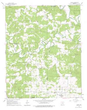
Sidney Topo Map Arkansas
To zoom in, hover over the map of Sidney
USGS Topo Quad 36091a6 - 1:24,000 scale
| Topo Map Name: | Sidney |
| USGS Topo Quad ID: | 36091a6 |
| Print Size: | ca. 21 1/4" wide x 27" high |
| Southeast Coordinates: | 36° N latitude / 91.625° W longitude |
| Map Center Coordinates: | 36.0625° N latitude / 91.6875° W longitude |
| U.S. State: | AR |
| Filename: | o36091a6.jpg |
| Download Map JPG Image: | Sidney topo map 1:24,000 scale |
| Map Type: | Topographic |
| Topo Series: | 7.5´ |
| Map Scale: | 1:24,000 |
| Source of Map Images: | United States Geological Survey (USGS) |
| Alternate Map Versions: |
Sidney AR 1962, updated 1963 Download PDF Buy paper map Sidney AR 1962, updated 1979 Download PDF Buy paper map Sidney AR 2011 Download PDF Buy paper map Sidney AR 2014 Download PDF Buy paper map |
1:24,000 Topo Quads surrounding Sidney
> Back to 36091a1 at 1:100,000 scale
> Back to 36090a1 at 1:250,000 scale
> Back to U.S. Topo Maps home
Sidney topo map: Gazetteer
Sidney: Dams
Catfish Lake Dam elevation 152m 498′Sidney: Populated Places
Needmore elevation 179m 587′Sidney elevation 184m 603′
Sidney: Post Offices
Sidney Post Office elevation 184m 603′Sidney: Reservoirs
Catfish Lake elevation 152m 498′Sidney: Streams
Bear Creek elevation 146m 479′Bird Creek elevation 157m 515′
Caney Creek elevation 165m 541′
Finley Creek elevation 162m 531′
Hamms Schoolhouse Branch elevation 159m 521′
Little Creek elevation 138m 452′
Mays Branch elevation 149m 488′
Mudtown Branch elevation 158m 518′
Tom Moore Branch elevation 166m 544′
Wildcat Branch elevation 134m 439′
Sidney: Summits
Gravel Hill elevation 192m 629′Sidney digital topo map on disk
Buy this Sidney topo map showing relief, roads, GPS coordinates and other geographical features, as a high-resolution digital map file on DVD:


