Ash Flat Topo Map Arkansas
To zoom in, hover over the map of Ash Flat
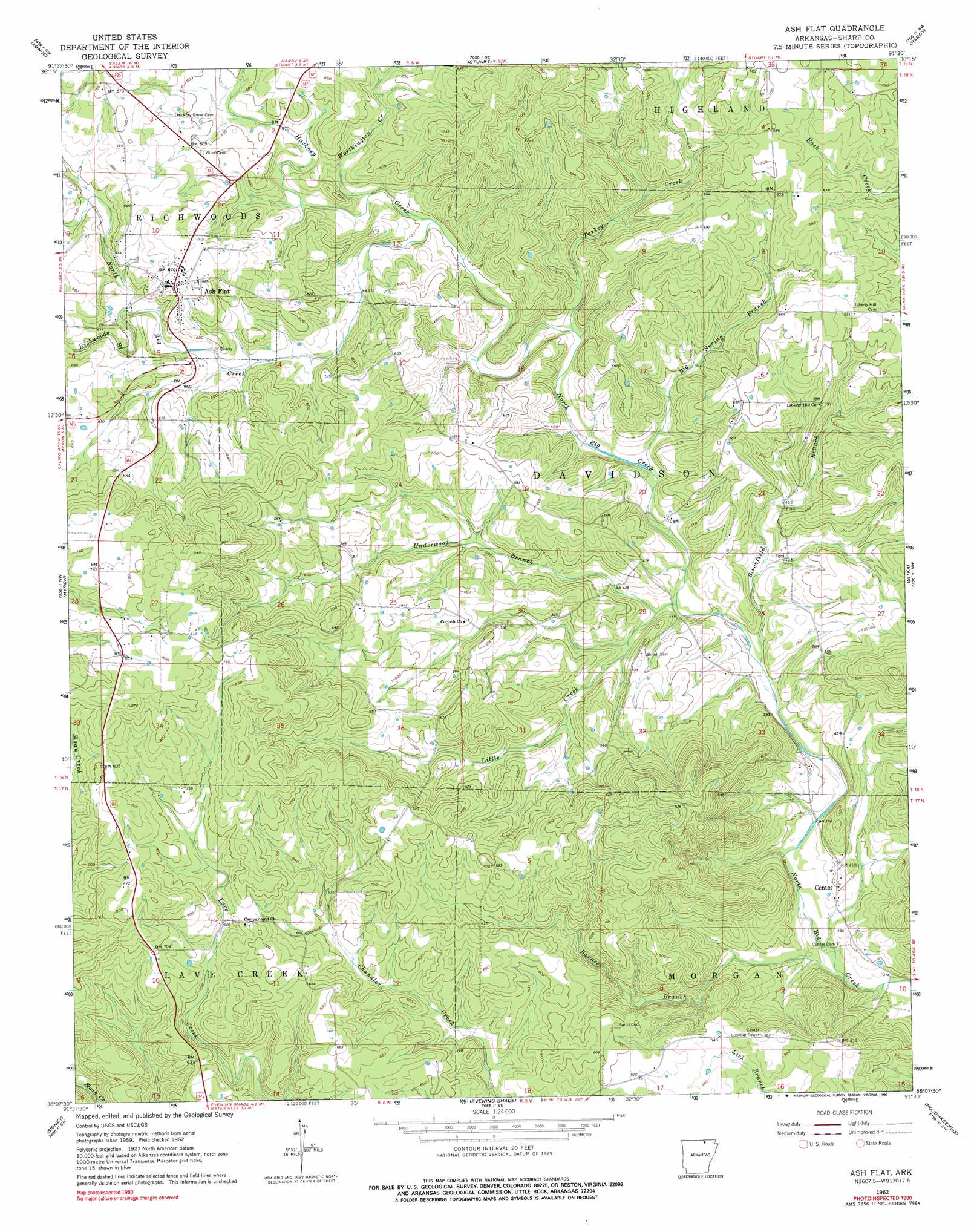
USGS Topo Quad 36091b5 - 1:24,000 scale
| Topo Map Name: | Ash Flat |
| USGS Topo Quad ID: | 36091b5 |
| Print Size: | ca. 21 1/4" wide x 27" high |
| Southeast Coordinates: | 36.125° N latitude / 91.5° W longitude |
| Map Center Coordinates: | 36.1875° N latitude / 91.5625° W longitude |
| U.S. State: | AR |
| Filename: | o36091b5.jpg |
| Download Map JPG Image: | Ash Flat topo map 1:24,000 scale |
| Map Type: | Topographic |
| Topo Series: | 7.5´ |
| Map Scale: | 1:24,000 |
| Source of Map Images: | United States Geological Survey (USGS) |
| Alternate Map Versions: |
Ash Flat AR 1962, updated 1963 Download PDF Buy paper map Ash Flat AR 1962, updated 1976 Download PDF Buy paper map Ash Flat AR 1962, updated 1990 Download PDF Buy paper map Ash Flat AR 2011 Download PDF Buy paper map Ash Flat AR 2014 Download PDF Buy paper map |
1:24,000 Topo Quads surrounding Ash Flat
Salem Knob |
Camp |
Mammoth Spring |
Wirth |
Hardy Ne |
Salem |
Agnos |
Stuart |
Hardy |
Williford |
Franklin |
Myron |
Ash Flat |
Sitka |
Ravenden |
Zion |
Sidney |
Evening Shade |
Poughkeepsie |
Smithville |
Mount Pleasant |
Sandtown |
Cave City |
Grange |
Strawberry |
> Back to 36091a1 at 1:100,000 scale
> Back to 36090a1 at 1:250,000 scale
> Back to U.S. Topo Maps home
Ash Flat topo map: Gazetteer
Ash Flat: Populated Places
Ash Flat elevation 203m 666′Center elevation 121m 396′
Kings Mills (historical) elevation 176m 577′
Ash Flat: Streams
Barnes Branch elevation 105m 344′Big Spring Branch elevation 131m 429′
Birchfield Branch elevation 116m 380′
Hackney Creek elevation 151m 495′
Little Creek elevation 120m 393′
Richwoods Branch elevation 171m 561′
Schales Branch elevation 107m 351′
Turkey Creek elevation 139m 456′
Underwood Branch elevation 124m 406′
Worthington Creek elevation 157m 515′
Ash Flat digital topo map on disk
Buy this Ash Flat topo map showing relief, roads, GPS coordinates and other geographical features, as a high-resolution digital map file on DVD: