Bardley Topo Map Missouri
To zoom in, hover over the map of Bardley
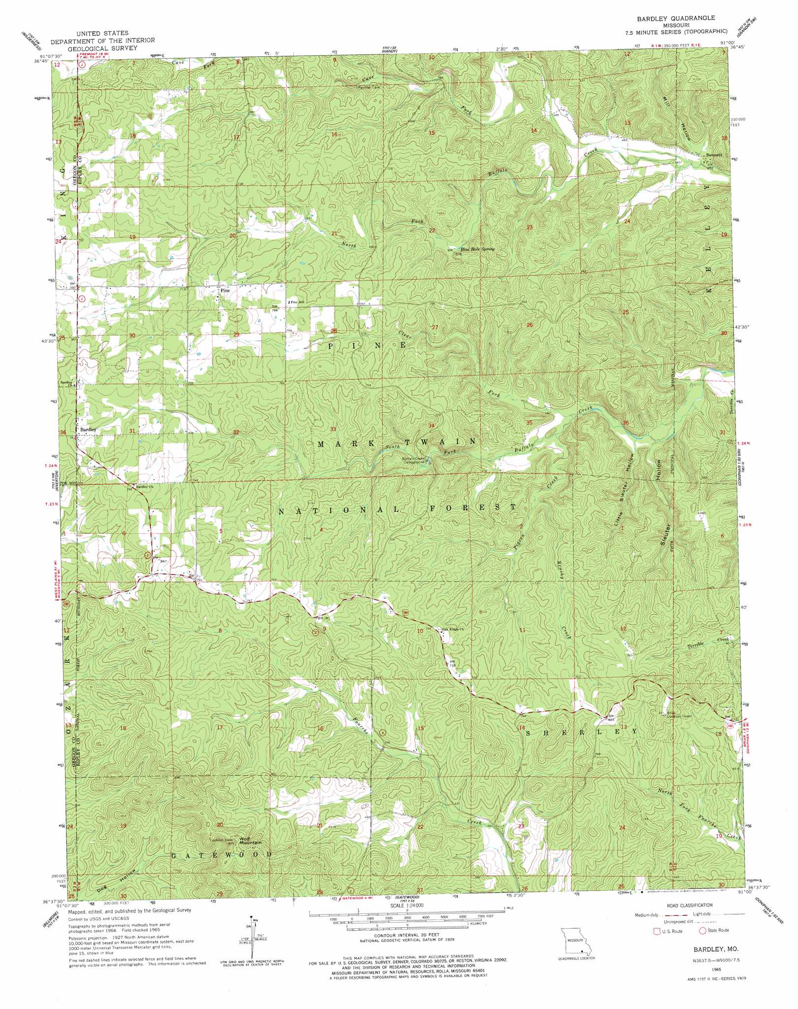
USGS Topo Quad 36091f1 - 1:24,000 scale
| Topo Map Name: | Bardley |
| USGS Topo Quad ID: | 36091f1 |
| Print Size: | ca. 21 1/4" wide x 27" high |
| Southeast Coordinates: | 36.625° N latitude / 91° W longitude |
| Map Center Coordinates: | 36.6875° N latitude / 91.0625° W longitude |
| U.S. State: | MO |
| Filename: | o36091f1.jpg |
| Download Map JPG Image: | Bardley topo map 1:24,000 scale |
| Map Type: | Topographic |
| Topo Series: | 7.5´ |
| Map Scale: | 1:24,000 |
| Source of Map Images: | United States Geological Survey (USGS) |
| Alternate Map Versions: |
Bardley MO 1965, updated 1967 Download PDF Buy paper map Bardley MO 1965, updated 1977 Download PDF Buy paper map Bardley MO 1997, updated 2000 Download PDF Buy paper map Bardley MO 2012 Download PDF Buy paper map Bardley MO 2015 Download PDF Buy paper map |
| FStopo: | US Forest Service topo Bardley is available: Download FStopo PDF Download FStopo TIF |
1:24,000 Topo Quads surrounding Bardley
Low Wassie |
Fremont |
Van Buren South |
Big Spring |
Hunter |
Greer |
Wilderness |
Handy |
Grandin Sw |
Grandin |
Many Springs |
Riverton |
Bardley |
Briar |
Doniphan North |
Myrtle |
Billmore |
Gatewood |
Poynor |
Doniphan South |
Hardy Ne |
Dalton |
Warm Springs |
Maynard |
Supply |
> Back to 36091e1 at 1:100,000 scale
> Back to 36090a1 at 1:250,000 scale
> Back to U.S. Topo Maps home
Bardley topo map: Gazetteer
Bardley: Dams
Fourche Creek Dam elevation 179m 587′Bardley: Lakes
Fourche Lake elevation 177m 580′Bardley: Populated Places
Bardley elevation 238m 780′Bennett elevation 140m 459′
Bardley: Springs
Blue Hole Spring elevation 177m 580′Bardley: Streams
Brushy Creek elevation 163m 534′Cave Fork elevation 142m 465′
Clear Fork elevation 146m 479′
Pigeon Creek elevation 148m 485′
Bardley: Summits
Wolf Mountain elevation 281m 921′Bardley: Valleys
Little Sleuter Hollow elevation 143m 469′Mill Hollow elevation 143m 469′
Sleuter Hollow elevation 141m 462′
Bardley digital topo map on disk
Buy this Bardley topo map showing relief, roads, GPS coordinates and other geographical features, as a high-resolution digital map file on DVD: