Thomasville Topo Map Missouri
To zoom in, hover over the map of Thomasville
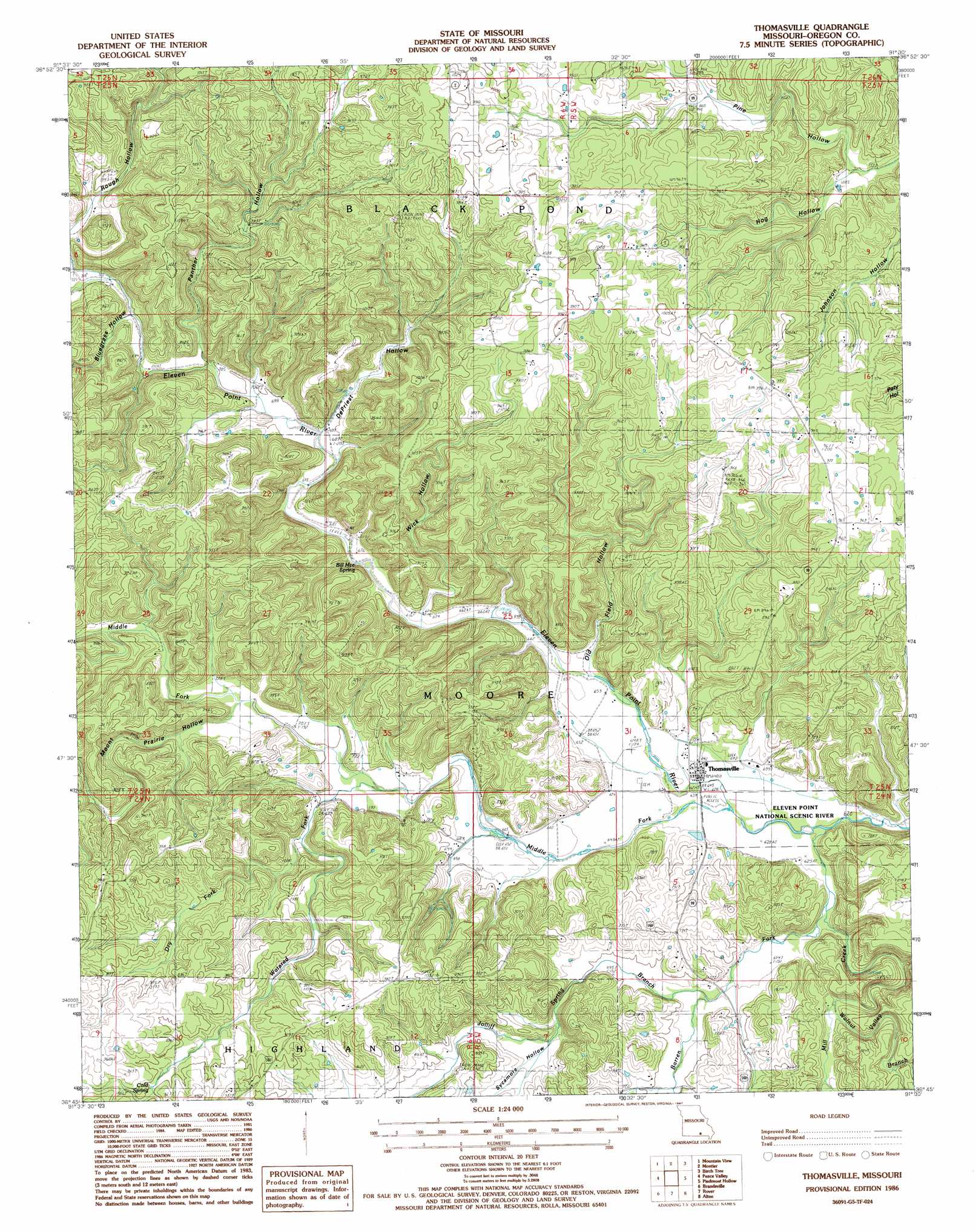
USGS Topo Quad 36091g5 - 1:24,000 scale
| Topo Map Name: | Thomasville |
| USGS Topo Quad ID: | 36091g5 |
| Print Size: | ca. 21 1/4" wide x 27" high |
| Southeast Coordinates: | 36.75° N latitude / 91.5° W longitude |
| Map Center Coordinates: | 36.8125° N latitude / 91.5625° W longitude |
| U.S. State: | MO |
| Filename: | o36091g5.jpg |
| Download Map JPG Image: | Thomasville topo map 1:24,000 scale |
| Map Type: | Topographic |
| Topo Series: | 7.5´ |
| Map Scale: | 1:24,000 |
| Source of Map Images: | United States Geological Survey (USGS) |
| Alternate Map Versions: |
Thomasville MO 1986, updated 1987 Download PDF Buy paper map Thomasville MO 1997, updated 2000 Download PDF Buy paper map Thomasville MO 2011 Download PDF Buy paper map Thomasville MO 2015 Download PDF Buy paper map |
| FStopo: | US Forest Service topo Thomasville is available: Download FStopo PDF Download FStopo TIF |
1:24,000 Topo Quads surrounding Thomasville
Clear Springs |
Pine Crest |
Jam Up Cave |
Bartlett |
Winona |
Trask |
Mountain View |
Montier |
Birch Tree |
Low Wassie |
White Church |
Peace Valley |
Thomasville |
Peidmont Hollow |
Greer |
West Plains |
Brandsville |
Rover |
Alton |
Many Springs |
Lanton |
Koshkonong |
Thayer |
Conch |
Myrtle |
> Back to 36091e1 at 1:100,000 scale
> Back to 36090a1 at 1:250,000 scale
> Back to U.S. Topo Maps home
Thomasville topo map: Gazetteer
Thomasville: Areas
Seven Points Hills elevation 223m 731′Thomasville: Populated Places
Thomasville elevation 195m 639′Thomasville: Springs
Bill Mac Spring elevation 229m 751′Cold Spring elevation 272m 892′
Thomasville: Streams
Barren Fork elevation 189m 620′Dry Fork elevation 216m 708′
Jolliff Spring Branch elevation 201m 659′
Middle Fork Eleven Point River elevation 190m 623′
Mill Creek elevation 200m 656′
Mount Prairie Branch elevation 219m 718′
Walnut Valley Branch elevation 219m 718′
Watered Fork elevation 207m 679′
Thomasville: Valleys
Bluegrass Hollow elevation 217m 711′De Priest Hollow elevation 210m 688′
Mount Prairie Hollow elevation 214m 702′
Old Field Hollow elevation 202m 662′
Panther Hollow elevation 216m 708′
Pine Hollow elevation 232m 761′
Rough Hollow elevation 222m 728′
Sycamore Hollow elevation 220m 721′
Wick Hollow elevation 203m 666′
Thomasville digital topo map on disk
Buy this Thomasville topo map showing relief, roads, GPS coordinates and other geographical features, as a high-resolution digital map file on DVD: