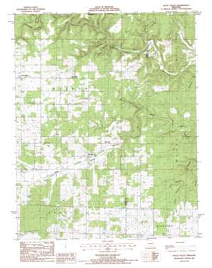
Peace Valley Topo Map Missouri
To zoom in, hover over the map of Peace Valley
USGS Topo Quad 36091g6 - 1:24,000 scale
| Topo Map Name: | Peace Valley |
| USGS Topo Quad ID: | 36091g6 |
| Print Size: | ca. 21 1/4" wide x 27" high |
| Southeast Coordinates: | 36.75° N latitude / 91.625° W longitude |
| Map Center Coordinates: | 36.8125° N latitude / 91.6875° W longitude |
| U.S. State: | MO |
| Filename: | o36091g6.jpg |
| Download Map JPG Image: | Peace Valley topo map 1:24,000 scale |
| Map Type: | Topographic |
| Topo Series: | 7.5´ |
| Map Scale: | 1:24,000 |
| Source of Map Images: | United States Geological Survey (USGS) |
| Alternate Map Versions: |
Peace Valley MO 1986, updated 1987 Download PDF Buy paper map Peace Valley MO 2011 Download PDF Buy paper map Peace Valley MO 2015 Download PDF Buy paper map |
1:24,000 Topo Quads surrounding Peace Valley
> Back to 36091e1 at 1:100,000 scale
> Back to 36090a1 at 1:250,000 scale
> Back to U.S. Topo Maps home
Peace Valley topo map: Gazetteer
Peace Valley: Areas
Courtois Hills elevation 305m 1000′Peace Valley: Lakes
Lost Pond elevation 315m 1033′Peace Valley: Populated Places
Fanchon elevation 281m 921′Peace Valley elevation 266m 872′
Peace Valley: Springs
Blowing Springs elevation 231m 757′Peace Valley: Streams
Little Creek elevation 232m 761′Walnut Sink Creek elevation 243m 797′
Peace Valley: Valleys
Cane Hollow elevation 227m 744′Chalk Hole Valley elevation 274m 898′
County Hollow elevation 234m 767′
Gunters Valley elevation 263m 862′
Lost Pond Hollow elevation 261m 856′
Snow Hollow elevation 231m 757′
Walnut Sink Hollow elevation 312m 1023′
Peace Valley digital topo map on disk
Buy this Peace Valley topo map showing relief, roads, GPS coordinates and other geographical features, as a high-resolution digital map file on DVD:


