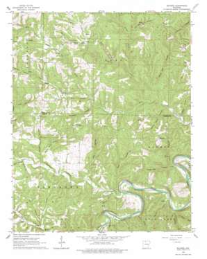
Maumee Topo Map Arkansas
To zoom in, hover over the map of Maumee
USGS Topo Quad 36092a6 - 1:24,000 scale
| Topo Map Name: | Maumee |
| USGS Topo Quad ID: | 36092a6 |
| Print Size: | ca. 21 1/4" wide x 27" high |
| Southeast Coordinates: | 36° N latitude / 92.625° W longitude |
| Map Center Coordinates: | 36.0625° N latitude / 92.6875° W longitude |
| U.S. State: | AR |
| Filename: | o36092a6.jpg |
| Download Map JPG Image: | Maumee topo map 1:24,000 scale |
| Map Type: | Topographic |
| Topo Series: | 7.5´ |
| Map Scale: | 1:24,000 |
| Source of Map Images: | United States Geological Survey (USGS) |
| Alternate Map Versions: |
Maumee AR 1966, updated 1967 Download PDF Buy paper map Maumee AR 1966, updated 1978 Download PDF Buy paper map Maumee AR 1966, updated 1978 Download PDF Buy paper map Maumee AR 2011 Download PDF Buy paper map Maumee AR 2014 Download PDF Buy paper map |
1:24,000 Topo Quads surrounding Maumee
> Back to 36092a1 at 1:100,000 scale
> Back to 36092a1 at 1:250,000 scale
> Back to U.S. Topo Maps home
Maumee topo map: Gazetteer
Maumee: Crossings
Maumee Crossing elevation 155m 508′Maumee: Falls
Lay Falls elevation 246m 807′Maumee: Populated Places
Caney elevation 338m 1108′Freck elevation 253m 830′
Maumee elevation 262m 859′
Tomahawk elevation 299m 980′
Maumee: Streams
Baker Spring Branch elevation 208m 682′Barren Fork elevation 191m 626′
Burns Creek elevation 250m 820′
Dry Branch elevation 185m 606′
Lay Creek elevation 223m 731′
Little Rocky Creek elevation 157m 515′
Rocky Creek elevation 158m 518′
Spring Creek elevation 202m 662′
Tomahawk Creek elevation 162m 531′
Maumee: Valleys
Big Hollow elevation 175m 574′Caney Hollow elevation 179m 587′
Copper Mine Hollow elevation 209m 685′
Cross Hollow elevation 203m 666′
Davis Hollow elevation 248m 813′
Elm Cave Hollow elevation 239m 784′
Elm Hollow elevation 187m 613′
Ezell Hollow elevation 169m 554′
Granny Price Hollow elevation 185m 606′
Green Haw Hollow elevation 160m 524′
Gulf Hollow elevation 224m 734′
Harris Hollow elevation 262m 859′
Marshall Hollow elevation 209m 685′
Maumee Hollow elevation 166m 544′
McKinney Hollow elevation 165m 541′
Mill Hollow elevation 217m 711′
Mud Hollow elevation 167m 547′
Osborne Hollow elevation 193m 633′
Pine Hollow elevation 232m 761′
Scott Hollow elevation 185m 606′
White Oak Hollow elevation 187m 613′
Wilson Hollow elevation 286m 938′
Maumee digital topo map on disk
Buy this Maumee topo map showing relief, roads, GPS coordinates and other geographical features, as a high-resolution digital map file on DVD:


