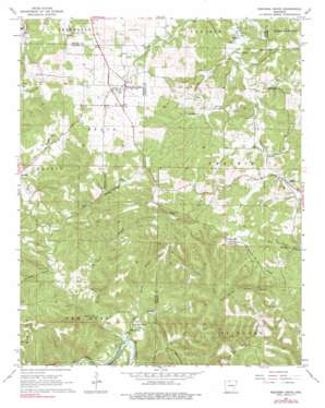
Western Grove Topo Map Arkansas
To zoom in, hover over the map of Western Grove
USGS Topo Quad 36092a8 - 1:24,000 scale
| Topo Map Name: | Western Grove |
| USGS Topo Quad ID: | 36092a8 |
| Print Size: | ca. 21 1/4" wide x 27" high |
| Southeast Coordinates: | 36° N latitude / 92.875° W longitude |
| Map Center Coordinates: | 36.0625° N latitude / 92.9375° W longitude |
| U.S. State: | AR |
| Filename: | o36092a8.jpg |
| Download Map JPG Image: | Western Grove topo map 1:24,000 scale |
| Map Type: | Topographic |
| Topo Series: | 7.5´ |
| Map Scale: | 1:24,000 |
| Source of Map Images: | United States Geological Survey (USGS) |
| Alternate Map Versions: |
Western Grove AR 1967, updated 1968 Download PDF Buy paper map Western Grove AR 1967, updated 1977 Download PDF Buy paper map Western Grove AR 2011 Download PDF Buy paper map Western Grove AR 2014 Download PDF Buy paper map |
1:24,000 Topo Quads surrounding Western Grove
> Back to 36092a1 at 1:100,000 scale
> Back to 36092a1 at 1:250,000 scale
> Back to U.S. Topo Maps home
Western Grove topo map: Gazetteer
Western Grove: Cliffs
Copper Bluff elevation 214m 702′Western Grove: Mines
Hurricane Mine elevation 327m 1072′Western Grove: Populated Places
Clutes (historical) elevation 334m 1095′Mount Hersey elevation 223m 731′
Pindall elevation 322m 1056′
Western Grove elevation 324m 1062′
Western Grove: Ranges
Cane Branch Hills elevation 342m 1122′Western Grove: Ridges
Chinquapin Spring Ridge elevation 384m 1259′Western Grove: Springs
Chinquapin Spring elevation 376m 1233′Dugger Spring elevation 275m 902′
Glencoe Spring elevation 298m 977′
Mitch Hill Spring elevation 219m 718′
Western Grove: Streams
Davis Creek elevation 206m 675′East Fork Clear Creek elevation 285m 935′
Hurricane Branch elevation 227m 744′
Mill Branch elevation 206m 675′
Plum Branch elevation 332m 1089′
Qualls Branch elevation 224m 734′
Shaddock Branch elevation 251m 823′
Spring Brook elevation 284m 931′
West Fork Clear Creek elevation 274m 898′
Western Grove: Summits
Lead Hill elevation 413m 1354′Western Grove: Valleys
Cave Spring Hollow elevation 249m 816′Pinhook Hollow elevation 237m 777′
Western Grove digital topo map on disk
Buy this Western Grove topo map showing relief, roads, GPS coordinates and other geographical features, as a high-resolution digital map file on DVD:


