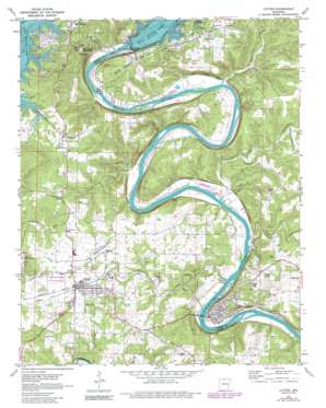
Cotter Topo Map Arkansas
To zoom in, hover over the map of Cotter
USGS Topo Quad 36092c5 - 1:24,000 scale
| Topo Map Name: | Cotter |
| USGS Topo Quad ID: | 36092c5 |
| Print Size: | ca. 21 1/4" wide x 27" high |
| Southeast Coordinates: | 36.25° N latitude / 92.5° W longitude |
| Map Center Coordinates: | 36.3125° N latitude / 92.5625° W longitude |
| U.S. State: | AR |
| Filename: | o36092c5.jpg |
| Download Map JPG Image: | Cotter topo map 1:24,000 scale |
| Map Type: | Topographic |
| Topo Series: | 7.5´ |
| Map Scale: | 1:24,000 |
| Source of Map Images: | United States Geological Survey (USGS) |
| Alternate Map Versions: |
Cotter AR 1972, updated 1973 Download PDF Buy paper map Cotter AR 1972, updated 1982 Download PDF Buy paper map Cotter AR 1979, updated 1981 Download PDF Buy paper map Cotter AR 2011 Download PDF Buy paper map Cotter AR 2014 Download PDF Buy paper map |
1:24,000 Topo Quads surrounding Cotter
> Back to 36092a1 at 1:100,000 scale
> Back to 36092a1 at 1:250,000 scale
> Back to U.S. Topo Maps home
Cotter topo map: Gazetteer
Cotter: Airports
Gastons Airport elevation 144m 472′Marion County Regional Airport elevation 207m 679′
The Valley Airport elevation 133m 436′
Cotter: Bridges
Cotter Bridge elevation 121m 396′Cotter: Channels
Trammels Shute elevation 133m 436′Cotter: Crossings
Collis Ferry (historical) elevation 133m 436′Denton Ferry (historical) elevation 124m 406′
Dews Ford elevation 133m 436′
McBees Ferry (historical) elevation 124m 406′
Whites Ferry (historical) elevation 130m 426′
Cotter: Dams
Bull Shoals Dam elevation 213m 698′Cotter: Flats
Trimble Flat elevation 221m 725′Cotter: Islands
Bayless Island elevation 130m 426′Cane Island elevation 139m 456′
Cotter: Parks
Bull Shoals Natural Park elevation 225m 738′Bull Shoals State Park elevation 225m 738′
Cotter: Populated Places
Amos elevation 230m 754′Cotter elevation 189m 620′
Fairview elevation 237m 777′
Flippin elevation 194m 636′
Lakeview elevation 238m 780′
Cotter: Reservoirs
Bull Shoals Lake elevation 213m 698′Cotter: Springs
Dew Spring elevation 137m 449′Cotter: Streams
Bruce Creek elevation 133m 436′Crane Creek elevation 182m 597′
Fallen Ash Creek elevation 126m 413′
Hightower Creek elevation 126m 413′
Jenkins Branch elevation 129m 423′
Lithia Creek elevation 126m 413′
Cotter: Summits
Bull Shoals Mountain elevation 335m 1099′Cotter digital topo map on disk
Buy this Cotter topo map showing relief, roads, GPS coordinates and other geographical features, as a high-resolution digital map file on DVD:


