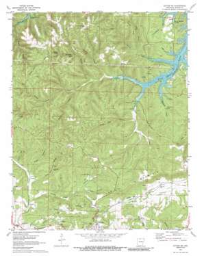
Cotter Sw Topo Map Arkansas
To zoom in, hover over the map of Cotter Sw
USGS Topo Quad 36092c6 - 1:24,000 scale
| Topo Map Name: | Cotter Sw |
| USGS Topo Quad ID: | 36092c6 |
| Print Size: | ca. 21 1/4" wide x 27" high |
| Southeast Coordinates: | 36.25° N latitude / 92.625° W longitude |
| Map Center Coordinates: | 36.3125° N latitude / 92.6875° W longitude |
| U.S. State: | AR |
| Filename: | o36092c6.jpg |
| Download Map JPG Image: | Cotter Sw topo map 1:24,000 scale |
| Map Type: | Topographic |
| Topo Series: | 7.5´ |
| Map Scale: | 1:24,000 |
| Source of Map Images: | United States Geological Survey (USGS) |
| Alternate Map Versions: |
Cotter SW AR 1972, updated 1973 Download PDF Buy paper map Cotter SW AR 1972, updated 1986 Download PDF Buy paper map Cotter SW AR 1979, updated 1981 Download PDF Buy paper map Cotter SW AR 2011 Download PDF Buy paper map Cotter SW AR 2014 Download PDF Buy paper map |
1:24,000 Topo Quads surrounding Cotter Sw
> Back to 36092a1 at 1:100,000 scale
> Back to 36092a1 at 1:250,000 scale
> Back to U.S. Topo Maps home
Cotter Sw topo map: Gazetteer
Cotter Sw: Mines
Erie Ozark Mine elevation 223m 731′Lead Drift Mine elevation 267m 875′
Lost Bell Mine elevation 250m 820′
Monkey Hill Mine elevation 226m 741′
Onwata Mine elevation 315m 1033′
Cotter Sw: Pillars
The Rock House elevation 294m 964′Cotter Sw: Populated Places
Kingdom Springs (historical) elevation 219m 718′Stone (historical) elevation 195m 639′
Summit elevation 266m 872′
Cotter Sw: Ridges
Sharpy Jim Ridge elevation 363m 1190′Sunset Ridge elevation 354m 1161′
Wolf Wallow Ridge elevation 346m 1135′
Cotter Sw: Springs
Elephant Spring elevation 296m 971′Cotter Sw: Streams
Brushy Fork elevation 235m 770′Cedar Creek elevation 195m 639′
Hampton Branch elevation 242m 793′
Jimmie Creek elevation 197m 646′
Johnnie Creek elevation 198m 649′
Little Georges Creek elevation 201m 659′
Mitchell Creek elevation 194m 636′
Moccasin Creek elevation 199m 652′
Wildcat Creek elevation 195m 639′
Wolfpen Branch elevation 214m 702′
Cotter Sw: Summits
Lee Mountain elevation 358m 1174′Cotter Sw: Valleys
Booker Hollow elevation 216m 708′Cove Hollow elevation 221m 725′
Dilday Hollow elevation 218m 715′
Fee Hollow elevation 266m 872′
Hawkins Hollow elevation 250m 820′
Lean Mine Hollow elevation 210m 688′
Moore Hollow elevation 232m 761′
North Star Hollow elevation 215m 705′
Onwata Hollow elevation 220m 721′
Cotter Sw digital topo map on disk
Buy this Cotter Sw topo map showing relief, roads, GPS coordinates and other geographical features, as a high-resolution digital map file on DVD:


