Gepp Topo Map Arkansas
To zoom in, hover over the map of Gepp
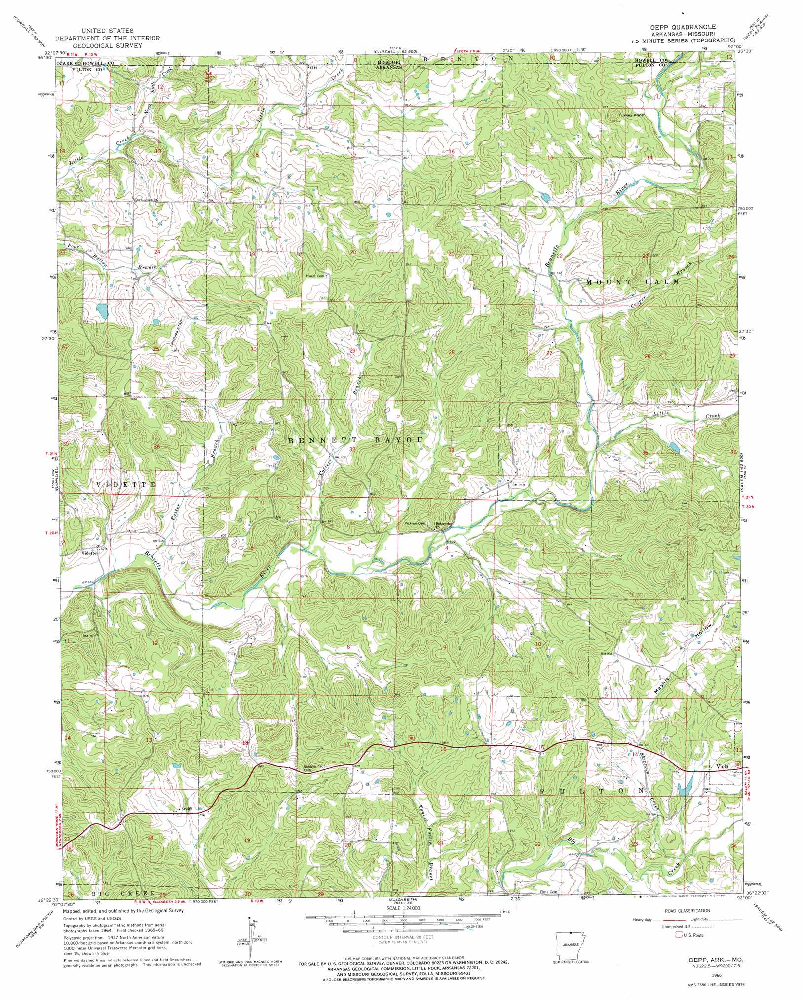
USGS Topo Quad 36092d1 - 1:24,000 scale
| Topo Map Name: | Gepp |
| USGS Topo Quad ID: | 36092d1 |
| Print Size: | ca. 21 1/4" wide x 27" high |
| Southeast Coordinates: | 36.375° N latitude / 92° W longitude |
| Map Center Coordinates: | 36.4375° N latitude / 92.0625° W longitude |
| U.S. States: | AR, MO |
| Filename: | o36092d1.jpg |
| Download Map JPG Image: | Gepp topo map 1:24,000 scale |
| Map Type: | Topographic |
| Topo Series: | 7.5´ |
| Map Scale: | 1:24,000 |
| Source of Map Images: | United States Geological Survey (USGS) |
| Alternate Map Versions: |
Gepp AR 1966, updated 1967 Download PDF Buy paper map Gepp AR 2011 Download PDF Buy paper map Gepp AR 2014 Download PDF Buy paper map |
1:24,000 Topo Quads surrounding Gepp
Sycamore |
Cureall Nw |
Pottersville |
South Fork |
West Plains |
Udall |
Bakersfield |
Caulfield |
Moody |
Lanton |
Clarkridge |
Gamaliel |
Gepp |
Viola |
Salem Knob |
Mountain Home East |
Norfork Dam North |
Elizabeth |
Byron |
Salem |
Norfork |
Norfork Dam South |
Pineville |
Oxford |
Franklin |
> Back to 36092a1 at 1:100,000 scale
> Back to 36092a1 at 1:250,000 scale
> Back to U.S. Topo Maps home
Gepp topo map: Gazetteer
Gepp: Dams
Heldebrend Lake Dam elevation 251m 823′Lake Bertie Dam elevation 245m 803′
Pine Trail Reservation Lake Dam elevation 232m 761′
Gepp: Populated Places
Argosy (historical) elevation 244m 800′Gepp elevation 233m 764′
Ott elevation 249m 816′
Pickren Hall elevation 209m 685′
Vidette elevation 204m 669′
Gepp: Reservoirs
East Arkansas Council Boy Scouts Lake elevation 232m 761′Heldebrend Lake elevation 251m 823′
Lake Bertie elevation 245m 803′
Gepp: Streams
Bailey Branch elevation 244m 800′Bennetts River elevation 189m 620′
Cooper Branch elevation 223m 731′
Cotter Branch elevation 204m 669′
Foster Branch elevation 193m 633′
Little Creek elevation 219m 718′
North Little Creek elevation 211m 692′
Shipman Creek elevation 232m 761′
Gepp: Summits
Turkey Knob elevation 293m 961′Gepp: Valleys
Mashie Hollow elevation 251m 823′Gepp digital topo map on disk
Buy this Gepp topo map showing relief, roads, GPS coordinates and other geographical features, as a high-resolution digital map file on DVD: