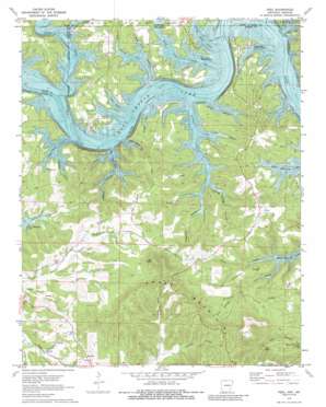
Peel Topo Map Arkansas
To zoom in, hover over the map of Peel
USGS Topo Quad 36092d7 - 1:24,000 scale
| Topo Map Name: | Peel |
| USGS Topo Quad ID: | 36092d7 |
| Print Size: | ca. 21 1/4" wide x 27" high |
| Southeast Coordinates: | 36.375° N latitude / 92.75° W longitude |
| Map Center Coordinates: | 36.4375° N latitude / 92.8125° W longitude |
| U.S. States: | AR, MO |
| Filename: | o36092d7.jpg |
| Download Map JPG Image: | Peel topo map 1:24,000 scale |
| Map Type: | Topographic |
| Topo Series: | 7.5´ |
| Map Scale: | 1:24,000 |
| Source of Map Images: | United States Geological Survey (USGS) |
| Alternate Map Versions: |
Peel AR 1972, updated 1973 Download PDF Buy paper map Peel AR 1972, updated 1988 Download PDF Buy paper map Peel AR 2011 Download PDF Buy paper map Peel AR 2014 Download PDF Buy paper map |
1:24,000 Topo Quads surrounding Peel
> Back to 36092a1 at 1:100,000 scale
> Back to 36092a1 at 1:250,000 scale
> Back to U.S. Topo Maps home
Peel topo map: Gazetteer
Peel: Bays
Cow Cove elevation 197m 646′Five Finger Cove elevation 195m 639′
Three Finger Cove elevation 194m 636′
Peel: Crossings
Buck Shoals Ford (historical) elevation 197m 646′Fishtrap Shoals Ford (historical) elevation 196m 643′
Holt Ferry (historical) elevation 196m 643′
Keesee Ferry (historical) elevation 199m 652′
Peel: Parks
Buck Creek Public Use Area elevation 198m 649′Highway 125 Public Use Area elevation 199m 652′
Peel: Populated Places
Monarch elevation 265m 869′Mount Perrian (historical) elevation 249m 816′
Peel elevation 282m 925′
Peel: Post Offices
Peel Post Office elevation 279m 915′Peel: Ridges
Campbell Ridge elevation 259m 849′Gay Ridge elevation 271m 889′
Linley Ridge elevation 271m 889′
Peel: Streams
Buck Creek elevation 199m 652′Buck Creek elevation 196m 643′
Horton Creek elevation 223m 731′
Little Buck Creek elevation 199m 652′
Little Buck Creek elevation 197m 646′
Shoal Creek elevation 199m 652′
Spicewood Creek elevation 190m 623′
Trimble Creek elevation 195m 639′
Peel: Summits
Japanese Knob elevation 394m 1292′Short Mountain elevation 385m 1263′
Tater Knob elevation 333m 1092′
Peel: Valleys
Ball Hollow elevation 194m 636′Beach Hollow elevation 194m 636′
Becky Hollow elevation 196m 643′
Black Bear Hollow elevation 226m 741′
Cave Hollow elevation 234m 767′
Clyde Hollow elevation 196m 643′
Grapevine Hollow elevation 197m 646′
Horse Hollow elevation 198m 649′
Little Beach Hollow elevation 195m 639′
Open Hollow elevation 197m 646′
Pine Hollow elevation 194m 636′
Pine Hollow elevation 199m 652′
Risley Hollow elevation 199m 652′
Seed Tick Hollow elevation 195m 639′
Sunrise Hollow elevation 263m 862′
Turnbull Hollow elevation 199m 652′
Upshaw Hollow elevation 195m 639′
Walker Hollow elevation 195m 639′
Willow Spring Hollow elevation 194m 636′
Peel digital topo map on disk
Buy this Peel topo map showing relief, roads, GPS coordinates and other geographical features, as a high-resolution digital map file on DVD:


