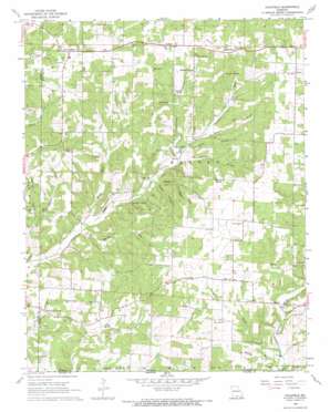
Caulfield Topo Map Missouri
To zoom in, hover over the map of Caulfield
USGS Topo Quad 36092e1 - 1:24,000 scale
| Topo Map Name: | Caulfield |
| USGS Topo Quad ID: | 36092e1 |
| Print Size: | ca. 21 1/4" wide x 27" high |
| Southeast Coordinates: | 36.5° N latitude / 92° W longitude |
| Map Center Coordinates: | 36.5625° N latitude / 92.0625° W longitude |
| U.S. State: | MO |
| Filename: | o36092e1.jpg |
| Download Map JPG Image: | Caulfield topo map 1:24,000 scale |
| Map Type: | Topographic |
| Topo Series: | 7.5´ |
| Map Scale: | 1:24,000 |
| Source of Map Images: | United States Geological Survey (USGS) |
| Alternate Map Versions: |
Caulfield MO 1968 Download PDF Buy paper map Caulfield MO 2012 Download PDF Buy paper map Caulfield MO 2015 Download PDF Buy paper map |
1:24,000 Topo Quads surrounding Caulfield
> Back to 36092e1 at 1:100,000 scale
> Back to 36092a1 at 1:250,000 scale
> Back to U.S. Topo Maps home
Caulfield topo map: Gazetteer
Caulfield: Airports
Campbell Ranch Airport elevation 321m 1053′Caulfield: Dams
Lair Lake Dam elevation 311m 1020′Caulfield: Lakes
Elm Pond elevation 310m 1017′Caulfield: Mines
Alice Mine elevation 298m 977′Caulfield: Populated Places
Amy elevation 361m 1184′Arditta elevation 331m 1085′
Caulfield elevation 313m 1026′
Egypt Grove elevation 347m 1138′
Hocomo elevation 345m 1131′
Leota elevation 301m 987′
Wetherhill (historical) elevation 325m 1066′
Caulfield: Post Offices
Bly Post Office elevation 258m 846′Caulfield: Reservoirs
Lair Lake elevation 311m 1020′Caulfield: Springs
Big Spring elevation 265m 869′Crumbly Spring elevation 292m 958′
Fair Spring elevation 318m 1043′
Fite Spring elevation 286m 938′
Limekiln Spring elevation 249m 816′
McDaniel Spring elevation 310m 1017′
Nicholas Spring elevation 292m 958′
Nichols Spring elevation 243m 797′
Rattlesnake Spring elevation 240m 787′
Smith Spring elevation 246m 807′
Spark Spring elevation 257m 843′
Vaughn Spring elevation 311m 1020′
Caulfield: Streams
Corn Creek elevation 287m 941′Easley Branch elevation 251m 823′
Halsey Branch elevation 230m 754′
Horn Creek elevation 248m 813′
Mirey Fork elevation 233m 764′
Ray Branch elevation 250m 820′
Caulfield: Valleys
Boswell Hollow elevation 277m 908′Crumbly Hollow elevation 262m 859′
Easley Hollow elevation 252m 826′
Hamilton Hollow elevation 236m 774′
Julius Hollow elevation 260m 853′
Mashey Hollow elevation 252m 826′
Smith Hollow elevation 223m 731′
Taylor Hollow elevation 264m 866′
Wildcat Hollow elevation 268m 879′
Caulfield digital topo map on disk
Buy this Caulfield topo map showing relief, roads, GPS coordinates and other geographical features, as a high-resolution digital map file on DVD:


