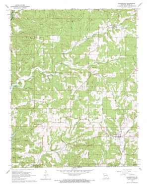
Bakersfield Topo Map Missouri
To zoom in, hover over the map of Bakersfield
USGS Topo Quad 36092e2 - 1:24,000 scale
| Topo Map Name: | Bakersfield |
| USGS Topo Quad ID: | 36092e2 |
| Print Size: | ca. 21 1/4" wide x 27" high |
| Southeast Coordinates: | 36.5° N latitude / 92.125° W longitude |
| Map Center Coordinates: | 36.5625° N latitude / 92.1875° W longitude |
| U.S. State: | MO |
| Filename: | o36092e2.jpg |
| Download Map JPG Image: | Bakersfield topo map 1:24,000 scale |
| Map Type: | Topographic |
| Topo Series: | 7.5´ |
| Map Scale: | 1:24,000 |
| Source of Map Images: | United States Geological Survey (USGS) |
| Alternate Map Versions: |
Bakersfield MO 1968, updated 1969 Download PDF Buy paper map Bakersfield MO 1968, updated 1969 Download PDF Buy paper map Bakersfield MO 2012 Download PDF Buy paper map Bakersfield MO 2015 Download PDF Buy paper map |
1:24,000 Topo Quads surrounding Bakersfield
> Back to 36092e1 at 1:100,000 scale
> Back to 36092a1 at 1:250,000 scale
> Back to U.S. Topo Maps home
Bakersfield topo map: Gazetteer
Bakersfield: Areas
Central Plateau elevation 319m 1046′Bakersfield: Cliffs
Cedar Bluff elevation 212m 695′Bakersfield: Populated Places
Bakersfield elevation 214m 702′Elijah elevation 272m 892′
Sharp elevation 291m 954′
Thuroy elevation 228m 748′
Bakersfield: Post Offices
Sharp Post Office (historical) elevation 291m 954′Vaughn Post Office (historical) elevation 259m 849′
Bakersfield: Ridges
Hawkins Ridge elevation 250m 820′Paint Ridge elevation 299m 980′
Bakersfield: Springs
Bluff Spring elevation 221m 725′Halford Spring elevation 227m 744′
Petty Spring elevation 195m 639′
Spoon Spring elevation 268m 879′
Taylor Spring elevation 273m 895′
Bakersfield: Streams
Needle Branch elevation 206m 675′North Bridges Creek elevation 216m 708′
Rattlesnake Branch elevation 197m 646′
Roberts Branch elevation 229m 751′
South Bridges Creek elevation 216m 708′
Bakersfield: Valleys
Blair Hollow elevation 183m 600′Brown Hollow elevation 233m 764′
Butram Hollow elevation 237m 777′
Gillette Hollow elevation 206m 675′
Hasty Pudding Hollow elevation 181m 593′
Hickory Stump Hollow elevation 184m 603′
Manes Hollow elevation 245m 803′
Petty Hollow elevation 183m 600′
Plumb Hollow elevation 216m 708′
Scofield Hollow elevation 267m 875′
Wolf Hollow elevation 216m 708′
Bakersfield digital topo map on disk
Buy this Bakersfield topo map showing relief, roads, GPS coordinates and other geographical features, as a high-resolution digital map file on DVD:


