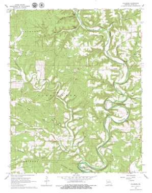
Sycamore Topo Map Missouri
To zoom in, hover over the map of Sycamore
USGS Topo Quad 36092f3 - 1:24,000 scale
| Topo Map Name: | Sycamore |
| USGS Topo Quad ID: | 36092f3 |
| Print Size: | ca. 21 1/4" wide x 27" high |
| Southeast Coordinates: | 36.625° N latitude / 92.25° W longitude |
| Map Center Coordinates: | 36.6875° N latitude / 92.3125° W longitude |
| U.S. State: | MO |
| Filename: | o36092f3.jpg |
| Download Map JPG Image: | Sycamore topo map 1:24,000 scale |
| Map Type: | Topographic |
| Topo Series: | 7.5´ |
| Map Scale: | 1:24,000 |
| Source of Map Images: | United States Geological Survey (USGS) |
| Alternate Map Versions: |
Sycamore MO 1968, updated 1969 Download PDF Buy paper map Sycamore MO 2012 Download PDF Buy paper map Sycamore MO 2015 Download PDF Buy paper map |
1:24,000 Topo Quads surrounding Sycamore
> Back to 36092e1 at 1:100,000 scale
> Back to 36092a1 at 1:250,000 scale
> Back to U.S. Topo Maps home
Sycamore topo map: Gazetteer
Sycamore: Bends
Horseshoe Bend elevation 239m 784′Muleshoe Bend elevation 206m 675′
Sycamore: Cliffs
Rattail Point elevation 264m 866′Sycamore: Crossings
Negro Ford elevation 204m 669′Osburn Ford elevation 190m 623′
Russel Ford elevation 190m 623′
Sanfield Ford elevation 182m 597′
Sycamore: Populated Places
Luna elevation 254m 833′Sycamore elevation 248m 813′
Zanoni elevation 213m 698′
Sycamore: Ridges
Brushy Ridge elevation 319m 1046′The Narrows elevation 230m 754′
Sycamore: Springs
Brixey Spring elevation 186m 610′Hodgson Mill Spring elevation 200m 656′
Sycamore: Streams
Bollinger Branch elevation 196m 643′Caney Creek elevation 183m 600′
Hurricane Creek elevation 201m 659′
Pine Creek elevation 177m 580′
Trail Creek elevation 203m 666′
Sycamore: Valleys
Bee Hollow elevation 197m 646′Birdtown Hollow elevation 220m 721′
Cave Spring Hollow elevation 202m 662′
Christy Hollow elevation 222m 728′
Holdman Hollow elevation 248m 813′
Job Hollow elevation 200m 656′
Lottie Hollow elevation 195m 639′
Shipley Hollow elevation 214m 702′
Weidensaul Hollow elevation 192m 629′
Sycamore digital topo map on disk
Buy this Sycamore topo map showing relief, roads, GPS coordinates and other geographical features, as a high-resolution digital map file on DVD:


