Protem Ne Topo Map Missouri
To zoom in, hover over the map of Protem Ne
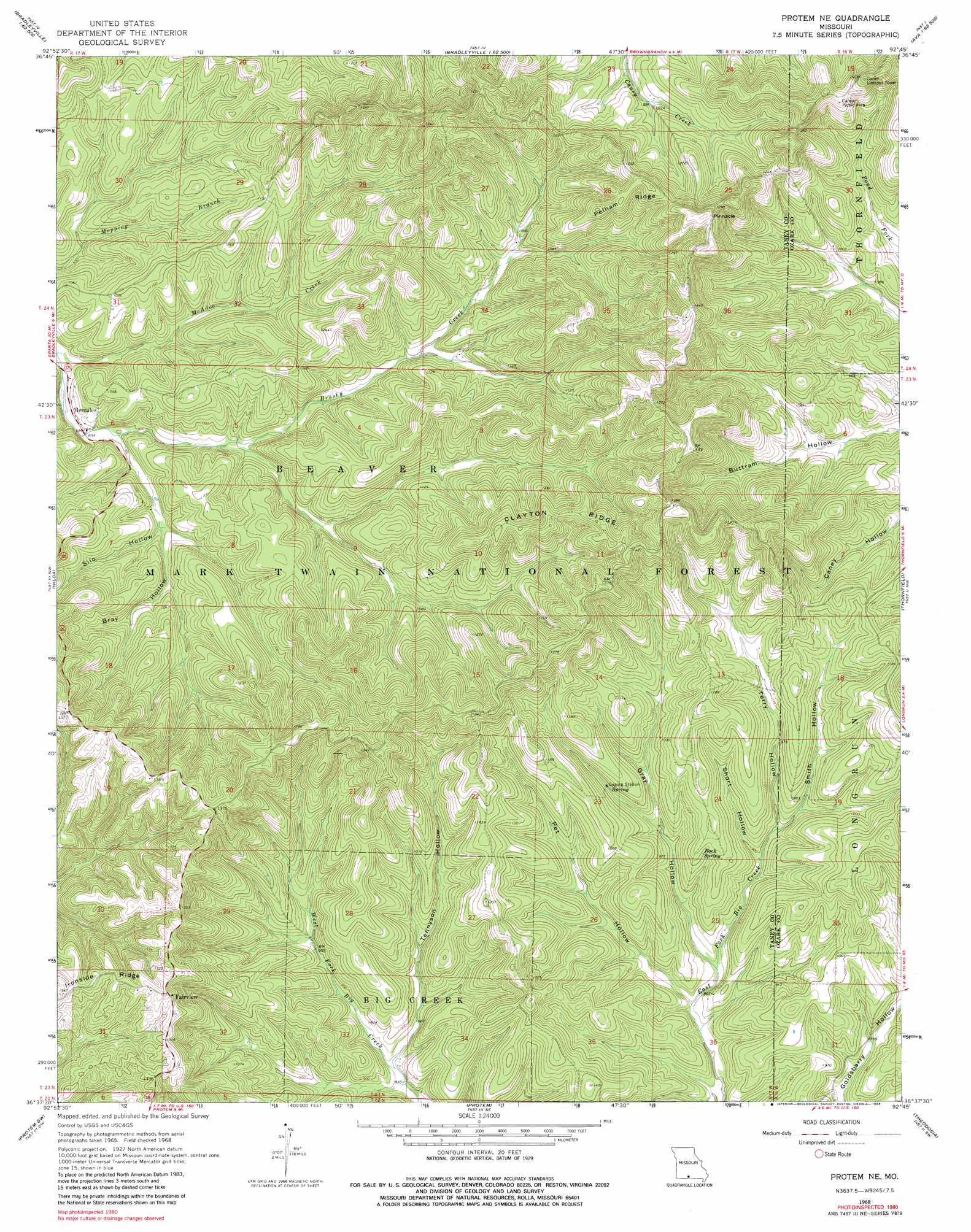
USGS Topo Quad 36092f7 - 1:24,000 scale
| Topo Map Name: | Protem Ne |
| USGS Topo Quad ID: | 36092f7 |
| Print Size: | ca. 21 1/4" wide x 27" high |
| Southeast Coordinates: | 36.625° N latitude / 92.75° W longitude |
| Map Center Coordinates: | 36.6875° N latitude / 92.8125° W longitude |
| U.S. State: | MO |
| Filename: | o36092f7.jpg |
| Download Map JPG Image: | Protem Ne topo map 1:24,000 scale |
| Map Type: | Topographic |
| Topo Series: | 7.5´ |
| Map Scale: | 1:24,000 |
| Source of Map Images: | United States Geological Survey (USGS) |
| Alternate Map Versions: |
Protem NE MO 1968, updated 1969 Download PDF Buy paper map Protem NE MO 1968, updated 1983 Download PDF Buy paper map Protem NE MO 2004, updated 2006 Download PDF Buy paper map Protem NE MO 2012 Download PDF Buy paper map Protem NE MO 2015 Download PDF Buy paper map |
| FStopo: | US Forest Service topo Protem NE is available: Download FStopo PDF Download FStopo TIF |
1:24,000 Topo Quads surrounding Protem Ne
Chadwick |
Keltner |
Goodhope |
Ava |
Sweden |
Garrison |
Bradleyville |
Brownbranch |
Smallett |
Wasola |
Forsyth |
Hilda |
Protem Ne |
Thornfield |
Willhoit |
Mincy |
Protem Sw |
Protem |
Theodosia |
Isabella |
Omaha Ne |
Diamond City |
Peel |
Cotter Nw |
Bull Shoals |
> Back to 36092e1 at 1:100,000 scale
> Back to 36092a1 at 1:250,000 scale
> Back to U.S. Topo Maps home
Protem Ne topo map: Gazetteer
Protem Ne: Populated Places
Eastview (historical) elevation 430m 1410′Fairview elevation 418m 1371′
Hercules elevation 273m 895′
Protem Ne: Post Offices
East View Post Office (historical) elevation 430m 1410′Protem Ne: Ridges
Clayton Ridge elevation 417m 1368′Pelham Ridge elevation 427m 1400′
Protem Ne: Springs
Rock Spring elevation 313m 1026′Protem Ne: Streams
McAdoo Creek elevation 266m 872′Protem Ne: Summits
Pinnacle elevation 446m 1463′Protem Ne: Valleys
Bray Hollow elevation 286m 938′Gray Hollow elevation 255m 836′
Montgomery Hollow elevation 296m 971′
Pet Hollow elevation 249m 816′
Short Hollow elevation 270m 885′
Silo Hollow elevation 284m 931′
Smith Hollow elevation 271m 889′
Tennyson Hollow elevation 255m 836′
Terry Hollow elevation 272m 892′
Protem Ne digital topo map on disk
Buy this Protem Ne topo map showing relief, roads, GPS coordinates and other geographical features, as a high-resolution digital map file on DVD: