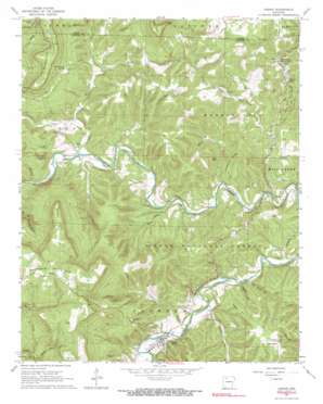
Jasper Topo Map Arkansas
To zoom in, hover over the map of Jasper
USGS Topo Quad 36093a2 - 1:24,000 scale
| Topo Map Name: | Jasper |
| USGS Topo Quad ID: | 36093a2 |
| Print Size: | ca. 21 1/4" wide x 27" high |
| Southeast Coordinates: | 36° N latitude / 93.125° W longitude |
| Map Center Coordinates: | 36.0625° N latitude / 93.1875° W longitude |
| U.S. State: | AR |
| Filename: | o36093a2.jpg |
| Download Map JPG Image: | Jasper topo map 1:24,000 scale |
| Map Type: | Topographic |
| Topo Series: | 7.5´ |
| Map Scale: | 1:24,000 |
| Source of Map Images: | United States Geological Survey (USGS) |
| Alternate Map Versions: |
Jasper AR 1967, updated 1968 Download PDF Buy paper map Jasper AR 1967, updated 1975 Download PDF Buy paper map Jasper AR 2011 Download PDF Buy paper map Jasper AR 2014 Download PDF Buy paper map |
| FStopo: | US Forest Service topo Jasper is available: Download FStopo PDF Download FStopo TIF |
1:24,000 Topo Quads surrounding Jasper
Green Forest |
Alpena |
Batavia |
Bergman |
Zinc |
Osage |
Osage Ne |
Gaither |
Harrison |
Everton |
Osage Sw |
Ponca |
Jasper |
Hasty |
Western Grove |
Boxley |
Murray |
Parthenon |
Mount Judea |
Eula |
Fallsville |
Swain |
Deer |
Lurton |
Moore |
> Back to 36093a1 at 1:100,000 scale
> Back to 36092a1 at 1:250,000 scale
> Back to U.S. Topo Maps home
Jasper topo map: Gazetteer
Jasper: Capes
Buck Point elevation 379m 1243′Newberry Point elevation 643m 2109′
Jasper: Cliffs
Briar Bluff elevation 237m 777′Goat Bluff elevation 257m 843′
Spring Bluff elevation 332m 1089′
Welch Bluff elevation 241m 790′
Jasper: Dams
Edwards Lake Dam elevation 327m 1072′Mill Creek Hollow Dam elevation 246m 807′
Weatherby Lake Dam elevation 637m 2089′
Jasper: Falls
Marble Falls elevation 299m 980′Jasper: Flats
Dogwood Flat elevation 325m 1066′Jasper: Forests
Henry Koen Experimental Forest elevation 350m 1148′Jasper: Mines
Conard Fissure elevation 318m 1043′Panther Creek Mine elevation 337m 1105′
Jasper: Parks
Henry Koen Experimental Forest elevation 455m 1492′Jasper: Pillars
Point Rock elevation 564m 1850′Jasper: Populated Places
Dogpatch elevation 299m 980′Erbie elevation 306m 1003′
Flatwoods elevation 367m 1204′
Jasper elevation 258m 846′
Little Buffalo (historical) elevation 293m 961′
Pruitt elevation 254m 833′
The Basin elevation 282m 925′
Jasper: Reservoirs
Edwards Lake elevation 327m 1072′Mill Creek Hollow Reservoir elevation 246m 807′
North Pond elevation 260m 853′
South Pond elevation 256m 839′
Weatherby Lake elevation 637m 2089′
Jasper: Ridges
Grapevine Ridge elevation 361m 1184′Jasper: Springs
Cave Spring elevation 275m 902′Cove Spring elevation 283m 928′
Tom Thumb Spring elevation 468m 1535′
Van Dyke Spring elevation 308m 1010′
Jasper: Streams
Boulder Creek elevation 316m 1036′Carlton Branch elevation 272m 892′
Cecil Creek elevation 264m 866′
Cove Creek elevation 254m 833′
Flatrock Creek elevation 243m 797′
Harp Creek elevation 246m 807′
Hoskin Creek elevation 239m 784′
Mill Creek elevation 257m 843′
Spider Creek elevation 244m 800′
Webb Branch elevation 254m 833′
Jasper: Summits
Mutton Point elevation 651m 2135′Sherman Mountain elevation 670m 2198′
Jasper: Valleys
Little Blade Hollow elevation 243m 797′Sawmill Hollow elevation 249m 816′
Stringtown Hollow elevation 237m 777′
Tadpole Hollow elevation 253m 830′
Wildcat Hollow elevation 338m 1108′
Jasper digital topo map on disk
Buy this Jasper topo map showing relief, roads, GPS coordinates and other geographical features, as a high-resolution digital map file on DVD:


