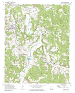
Huntsville Topo Map Arkansas
To zoom in, hover over the map of Huntsville
USGS Topo Quad 36093a6 - 1:24,000 scale
| Topo Map Name: | Huntsville |
| USGS Topo Quad ID: | 36093a6 |
| Print Size: | ca. 21 1/4" wide x 27" high |
| Southeast Coordinates: | 36° N latitude / 93.625° W longitude |
| Map Center Coordinates: | 36.0625° N latitude / 93.6875° W longitude |
| U.S. State: | AR |
| Filename: | o36093a6.jpg |
| Download Map JPG Image: | Huntsville topo map 1:24,000 scale |
| Map Type: | Topographic |
| Topo Series: | 7.5´ |
| Map Scale: | 1:24,000 |
| Source of Map Images: | United States Geological Survey (USGS) |
| Alternate Map Versions: |
Huntsville AR 1973, updated 1976 Download PDF Buy paper map Huntsville AR 1973, updated 1989 Download PDF Buy paper map Huntsville AR 2011 Download PDF Buy paper map Huntsville AR 2014 Download PDF Buy paper map |
1:24,000 Topo Quads surrounding Huntsville
> Back to 36093a1 at 1:100,000 scale
> Back to 36092a1 at 1:250,000 scale
> Back to U.S. Topo Maps home
Huntsville topo map: Gazetteer
Huntsville: Airports
Huntsville Memorial Hospital Heliport elevation 452m 1482′Huntsville: Dams
City of Huntsville Lake Dam elevation 383m 1256′Huntsville: Populated Places
Harmony elevation 433m 1420′Huntsville elevation 463m 1519′
Wharton elevation 424m 1391′
Huntsville: Reservoirs
City of Huntsville Lake elevation 383m 1256′Huntsville: Springs
Elm Spring elevation 392m 1286′Huntsville: Streams
Berry Branch elevation 376m 1233′Coon Branch elevation 394m 1292′
Jackson Creek elevation 400m 1312′
Mitchell Branch elevation 397m 1302′
Reed Creek elevation 386m 1266′
Town Branch elevation 380m 1246′
Wharton Creek elevation 387m 1269′
Huntsville: Summits
Carlock Mountain elevation 531m 1742′Diera Mountain elevation 580m 1902′
Huntsville: Valleys
Hanney Hollow elevation 406m 1332′Huntsville digital topo map on disk
Buy this Huntsville topo map showing relief, roads, GPS coordinates and other geographical features, as a high-resolution digital map file on DVD:


