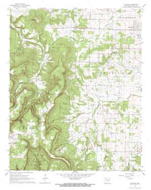
Gaither Topo Map Arkansas
To zoom in, hover over the map of Gaither
USGS Topo Quad 36093b2 - 1:24,000 scale
| Topo Map Name: | Gaither |
| USGS Topo Quad ID: | 36093b2 |
| Print Size: | ca. 21 1/4" wide x 27" high |
| Southeast Coordinates: | 36.125° N latitude / 93.125° W longitude |
| Map Center Coordinates: | 36.1875° N latitude / 93.1875° W longitude |
| U.S. State: | AR |
| Filename: | o36093b2.jpg |
| Download Map JPG Image: | Gaither topo map 1:24,000 scale |
| Map Type: | Topographic |
| Topo Series: | 7.5´ |
| Map Scale: | 1:24,000 |
| Source of Map Images: | United States Geological Survey (USGS) |
| Alternate Map Versions: |
Gaither AR 1967, updated 1968 Download PDF Buy paper map Gaither AR 1967, updated 1968 Download PDF Buy paper map Gaither AR 2011 Download PDF Buy paper map Gaither AR 2014 Download PDF Buy paper map |
1:24,000 Topo Quads surrounding Gaither
> Back to 36093a1 at 1:100,000 scale
> Back to 36092a1 at 1:250,000 scale
> Back to U.S. Topo Maps home
Gaither topo map: Gazetteer
Gaither: Areas
Gaither Prairie elevation 389m 1276′Gaither: Capes
Jones Point elevation 628m 2060′Stewart Point elevation 633m 2076′
Gaither: Dams
Beaver Lodge Lake Dam elevation 486m 1594′Gaither: Populated Places
Capps elevation 435m 1427′Gaither elevation 417m 1368′
Grubb Springs elevation 440m 1443′
Gaither: Reservoirs
Beaver Lodge Lake elevation 486m 1594′Gaither: Streams
Dowell Branch elevation 349m 1145′East Fork Terrapin Creek elevation 423m 1387′
West Fork Terrapin Creek elevation 422m 1384′
Gaither: Summits
Cone Point elevation 648m 2125′Gaither Mountain elevation 655m 2148′
Hambrick Knob elevation 484m 1587′
Kennedy Mountain elevation 604m 1981′
Piney Mountain elevation 652m 2139′
Gaither: Valleys
Dowell Cove elevation 382m 1253′Fernsides Cove elevation 474m 1555′
Gaither Cove elevation 393m 1289′
Johnson Cove elevation 526m 1725′
Sims Cove elevation 458m 1502′
Terrapin Cove elevation 450m 1476′
Gaither digital topo map on disk
Buy this Gaither topo map showing relief, roads, GPS coordinates and other geographical features, as a high-resolution digital map file on DVD:


