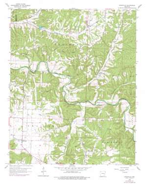
Hindsville Topo Map Arkansas
To zoom in, hover over the map of Hindsville
USGS Topo Quad 36093b7 - 1:24,000 scale
| Topo Map Name: | Hindsville |
| USGS Topo Quad ID: | 36093b7 |
| Print Size: | ca. 21 1/4" wide x 27" high |
| Southeast Coordinates: | 36.125° N latitude / 93.75° W longitude |
| Map Center Coordinates: | 36.1875° N latitude / 93.8125° W longitude |
| U.S. State: | AR |
| Filename: | o36093b7.jpg |
| Download Map JPG Image: | Hindsville topo map 1:24,000 scale |
| Map Type: | Topographic |
| Topo Series: | 7.5´ |
| Map Scale: | 1:24,000 |
| Source of Map Images: | United States Geological Survey (USGS) |
| Alternate Map Versions: |
Hindsville AR 1958, updated 1959 Download PDF Buy paper map Hindsville AR 1958, updated 1974 Download PDF Buy paper map Hindsville AR 1958, updated 1977 Download PDF Buy paper map Hindsville AR 2011 Download PDF Buy paper map Hindsville AR 2014 Download PDF Buy paper map |
1:24,000 Topo Quads surrounding Hindsville
> Back to 36093a1 at 1:100,000 scale
> Back to 36092a1 at 1:250,000 scale
> Back to U.S. Topo Maps home
Hindsville topo map: Gazetteer
Hindsville: Crossings
Parker Ford elevation 362m 1187′Rocky Ford elevation 366m 1200′
Hindsville: Populated Places
Clifty elevation 431m 1414′Hindsville elevation 416m 1364′
Hindsville: Streams
Clear Creek elevation 363m 1190′Glade Creek elevation 361m 1184′
Hartwell Creek elevation 371m 1217′
Houston Creek elevation 364m 1194′
Hindsville: Summits
Tater Hill elevation 464m 1522′Hindsville: Valleys
Hartwell Hollow elevation 377m 1236′Houston Hollow elevation 369m 1210′
Lynch Hollow elevation 375m 1230′
Poyner Hollow elevation 363m 1190′
Walnut Hollow elevation 379m 1243′
Ward Hollow elevation 379m 1243′
Hindsville digital topo map on disk
Buy this Hindsville topo map showing relief, roads, GPS coordinates and other geographical features, as a high-resolution digital map file on DVD:


