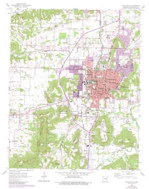
Fayettville Topo Map Arkansas
To zoom in, hover over the map of Fayettville
USGS Topo Quad 36094a2 - 1:24,000 scale
| Topo Map Name: | Fayettville |
| USGS Topo Quad ID: | 36094a2 |
| Print Size: | ca. 21 1/4" wide x 27" high |
| Southeast Coordinates: | 36° N latitude / 94.125° W longitude |
| Map Center Coordinates: | 36.0625° N latitude / 94.1875° W longitude |
| U.S. State: | AR |
| Filename: | o36094a2.jpg |
| Download Map JPG Image: | Fayettville topo map 1:24,000 scale |
| Map Type: | Topographic |
| Topo Series: | 7.5´ |
| Map Scale: | 1:24,000 |
| Source of Map Images: | United States Geological Survey (USGS) |
| Alternate Map Versions: |
Fayetteville AR 1958, updated 1959 Download PDF Buy paper map Fayetteville AR 1958, updated 1961 Download PDF Buy paper map Fayetteville AR 1958, updated 1977 Download PDF Buy paper map Fayetteville AR 1958, updated 1982 Download PDF Buy paper map Fayetteville AR 1995, updated 1998 Download PDF Buy paper map Fayetteville AR 2011 Download PDF Buy paper map Fayetteville AR 2014 Download PDF Buy paper map |
1:24,000 Topo Quads surrounding Fayettville
> Back to 36094a1 at 1:100,000 scale
> Back to 36094a1 at 1:250,000 scale
> Back to U.S. Topo Maps home
Fayettville topo map: Gazetteer
Fayettville: Airports
Drake Field elevation 377m 1236′Mount Comfort Airpark elevation 365m 1197′
Razorback Airport elevation 385m 1263′
Veterans Administration Heliport elevation 443m 1453′
Fayettville: Dams
Adams Lake Dam elevation 392m 1286′Arkansas Noname 350 Dam elevation 445m 1459′
Lake Lucille Dam elevation 451m 1479′
Wilson Lake Dam elevation 398m 1305′
Fayettville: Lakes
Lake Wilson elevation 398m 1305′Fayettville: Parks
Agricultural Park elevation 390m 1279′Asbell Park elevation 384m 1259′
Babe Ruth Ball Park elevation 362m 1187′
Butterfield Trail Park elevation 387m 1269′
Central Plaza elevation 440m 1443′
Combs Park elevation 362m 1187′
Finger Park elevation 400m 1312′
George Cole Field elevation 397m 1302′
Gregory Park elevation 431m 1414′
Happy Hollow Park elevation 380m 1246′
Harmon Playground elevation 395m 1295′
Hotz Park elevation 398m 1305′
Jefferson Park elevation 390m 1279′
Mount Nord Historic District elevation 444m 1456′
Oberman Park elevation 369m 1210′
Razorback Stadium elevation 406m 1332′
Root Park elevation 440m 1443′
Sycamore Park elevation 440m 1443′
Walker Park elevation 374m 1227′
Walker Park elevation 373m 1223′
Washington Park elevation 443m 1453′
Washington-Willow Historic District elevation 439m 1440′
Wilson Park elevation 411m 1348′
Fayettville: Populated Places
Appleby elevation 372m 1220′Barbara (historical) elevation 385m 1263′
Farmington elevation 362m 1187′
Fayette Junction elevation 378m 1240′
Fayetteville elevation 427m 1400′
McNair elevation 387m 1269′
Fayettville: Post Offices
Fayetteville Post Office elevation 426m 1397′Fayettville: Reservoirs
Adams Lake elevation 392m 1286′Arkansas Noname 350 Reservoir elevation 445m 1459′
Lake Lucille elevation 451m 1479′
Fayettville: Streams
Cato Springs Branch elevation 366m 1200′Little Wildcat Creek elevation 334m 1095′
Scull Creek elevation 358m 1174′
Town Branch elevation 359m 1177′
Ward Slough elevation 373m 1223′
Fayettville: Summits
Archias Mountain elevation 466m 1528′Goat Hill elevation 426m 1397′
Kessler Mountain elevation 565m 1853′
McCullom Mountain elevation 491m 1610′
Miller Mountain elevation 551m 1807′
Millsaps Mountain elevation 459m 1505′
Mount Sequoyah elevation 493m 1617′
Puddin Hill elevation 476m 1561′
Raid Mountain elevation 445m 1459′
Root Hill elevation 432m 1417′
Round Top Mountain elevation 500m 1640′
South Mountain elevation 465m 1525′
Washington Mountain elevation 462m 1515′
Fayettville digital topo map on disk
Buy this Fayettville topo map showing relief, roads, GPS coordinates and other geographical features, as a high-resolution digital map file on DVD:


