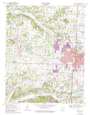
Springdale Topo Map Arkansas
To zoom in, hover over the map of Springdale
USGS Topo Quad 36094b2 - 1:24,000 scale
| Topo Map Name: | Springdale |
| USGS Topo Quad ID: | 36094b2 |
| Print Size: | ca. 21 1/4" wide x 27" high |
| Southeast Coordinates: | 36.125° N latitude / 94.125° W longitude |
| Map Center Coordinates: | 36.1875° N latitude / 94.1875° W longitude |
| U.S. State: | AR |
| Filename: | o36094b2.jpg |
| Download Map JPG Image: | Springdale topo map 1:24,000 scale |
| Map Type: | Topographic |
| Topo Series: | 7.5´ |
| Map Scale: | 1:24,000 |
| Source of Map Images: | United States Geological Survey (USGS) |
| Alternate Map Versions: |
Springdale AR 1970, updated 1972 Download PDF Buy paper map Springdale AR 1970, updated 1977 Download PDF Buy paper map Springdale AR 1970, updated 1982 Download PDF Buy paper map Springdale AR 1994, updated 1998 Download PDF Buy paper map Springdale AR 2011 Download PDF Buy paper map Springdale AR 2014 Download PDF Buy paper map |
1:24,000 Topo Quads surrounding Springdale
> Back to 36094a1 at 1:100,000 scale
> Back to 36094a1 at 1:250,000 scale
> Back to U.S. Topo Maps home
Springdale topo map: Gazetteer
Springdale: Airports
Springdale Memorial Hospital Heliport elevation 404m 1325′Springdale: Bridges
Spring Creek Bridge elevation 353m 1158′Springdale: Dams
Arbor Acres Lake Dam elevation 349m 1145′Lake Elmdale Dam elevation 377m 1236′
Lake Fayetteville Dam elevation 377m 1236′
Springdale: Parks
Murphy Park elevation 406m 1332′Shiloh Historic District elevation 400m 1312′
Shiloh Memorial Park elevation 401m 1315′
Springdale: Populated Places
Bethel Heights elevation 411m 1348′Cross Roads (historical) elevation 405m 1328′
Elm Springs elevation 361m 1184′
Gulley elevation 367m 1204′
Johnson elevation 365m 1197′
Liberty (historical) elevation 378m 1240′
Oak Grove elevation 401m 1315′
Shady Grove elevation 384m 1259′
Silent Grove elevation 395m 1295′
Spring Creek elevation 367m 1204′
Springdale elevation 403m 1322′
Steele elevation 363m 1190′
Tontitown elevation 393m 1289′
Vogel (historical) elevation 409m 1341′
Springdale: Post Offices
Johnson Post Office elevation 365m 1197′Springdale Post Office elevation 403m 1322′
Springdale: Reservoirs
Arbor Acres Lake elevation 349m 1145′Lake Elmdale elevation 377m 1236′
Lake Fayetteville elevation 377m 1236′
Springdale: Springs
Elm Springs elevation 359m 1177′Goad Springs elevation 390m 1279′
Greathouse Spring elevation 363m 1190′
Stultz Spring elevation 382m 1253′
Springdale: Streams
Cross Creek elevation 344m 1128′Mud Creek elevation 358m 1174′
Puppy Creek elevation 354m 1161′
Spring Creek elevation 333m 1092′
Springdale: Summits
Callahan Mountain elevation 463m 1519′Springdale digital topo map on disk
Buy this Springdale topo map showing relief, roads, GPS coordinates and other geographical features, as a high-resolution digital map file on DVD:


