Gallatin Topo Map Arkansas
To zoom in, hover over the map of Gallatin
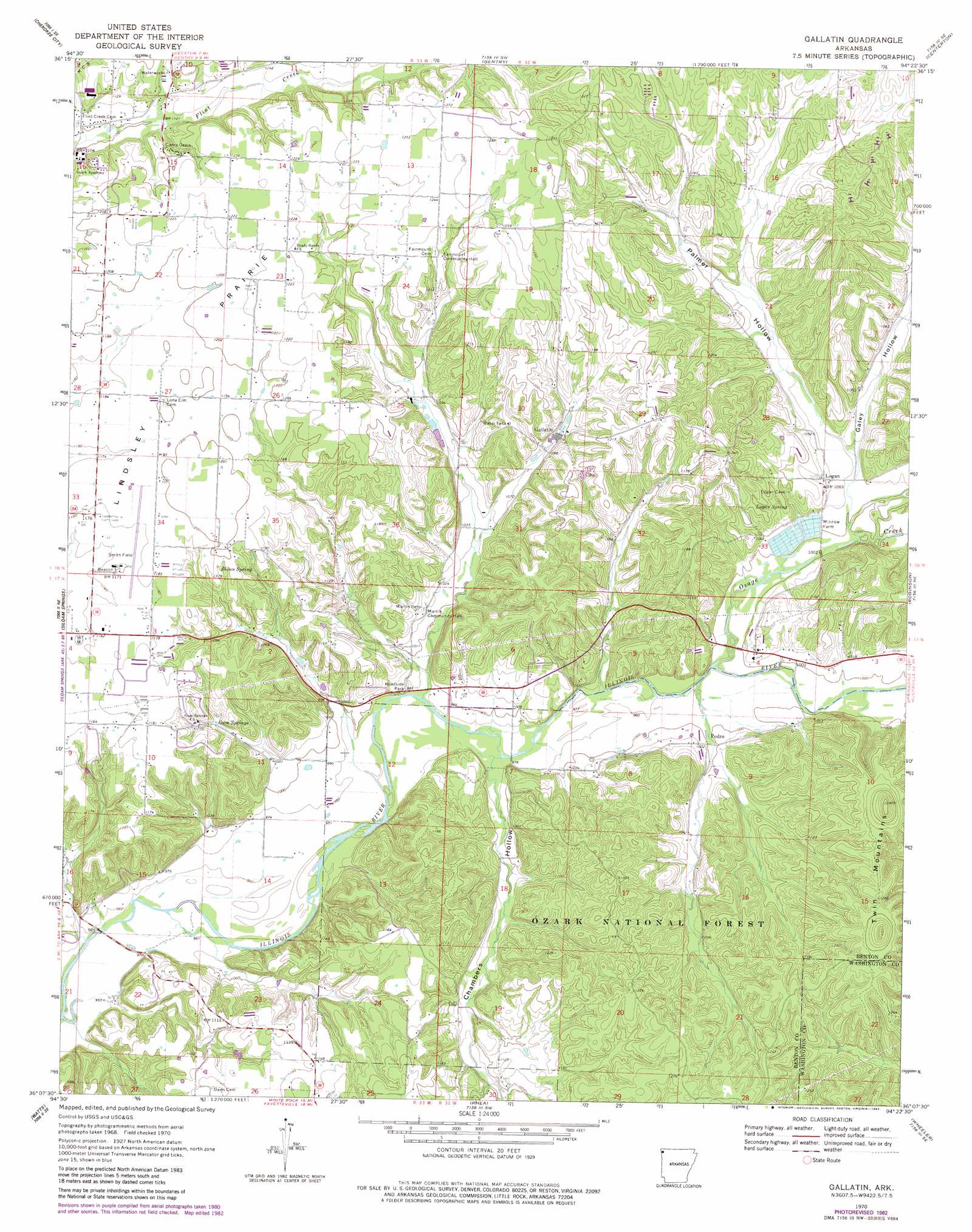
USGS Topo Quad 36094b4 - 1:24,000 scale
| Topo Map Name: | Gallatin |
| USGS Topo Quad ID: | 36094b4 |
| Print Size: | ca. 21 1/4" wide x 27" high |
| Southeast Coordinates: | 36.125° N latitude / 94.375° W longitude |
| Map Center Coordinates: | 36.1875° N latitude / 94.4375° W longitude |
| U.S. State: | AR |
| Filename: | o36094b4.jpg |
| Download Map JPG Image: | Gallatin topo map 1:24,000 scale |
| Map Type: | Topographic |
| Topo Series: | 7.5´ |
| Map Scale: | 1:24,000 |
| Source of Map Images: | United States Geological Survey (USGS) |
| Alternate Map Versions: |
Gallatin AR 1970, updated 1972 Download PDF Buy paper map Gallatin AR 1970, updated 1982 Download PDF Buy paper map Gallatin AR 2011 Download PDF Buy paper map Gallatin AR 2014 Download PDF Buy paper map |
| FStopo: | US Forest Service topo Gallatin is available: Download FStopo PDF Download FStopo TIF |
1:24,000 Topo Quads surrounding Gallatin
Sycamore |
Colcord Ne |
Gravette |
Hiwasse |
Bentonville North |
Colcord |
Cherokee City |
Gentry |
Centerton |
Bentonville South |
Siloam Springs Nw |
Siloam Springs |
Gallatin |
Robinson |
Springdale |
Chance |
Watts |
Rhea |
Wheeler |
Fayettville |
Christie |
Westville |
Lincoln |
Prairie Grove |
West Fork |
> Back to 36094a1 at 1:100,000 scale
> Back to 36094a1 at 1:250,000 scale
> Back to U.S. Topo Maps home
Gallatin topo map: Gazetteer
Gallatin: Airports
Smith Field elevation 358m 1174′Gallatin: Bridges
Fisher Ford Bridge elevation 289m 948′Gallatin: Crossings
Fisher Ford elevation 289m 948′Gallatin: Flats
Lindsley Prairie elevation 365m 1197′Gallatin: Populated Places
Fairmount elevation 376m 1233′Felker (historical) elevation 372m 1220′
Flint (historical) elevation 375m 1230′
Gallatin elevation 333m 1092′
Logan elevation 318m 1043′
Lone Elm (historical) elevation 365m 1197′
Martin elevation 313m 1026′
Pedro elevation 304m 997′
Gallatin: Springs
Gum Springs elevation 332m 1089′Logan Spring elevation 313m 1026′
Shinn Spring elevation 354m 1161′
Gallatin: Streams
Chambers Spring Branch elevation 297m 974′Osage Creek elevation 297m 974′
Gallatin: Summits
Lower Round Top elevation 425m 1394′Twin Mountains elevation 383m 1256′
Upper Round Top elevation 428m 1404′
Gallatin: Trails
Weddington Hiking Trail elevation 359m 1177′Gallatin: Valleys
Chambers Hollow elevation 297m 974′Galey Hollow elevation 312m 1023′
Gum Springs Hollow elevation 310m 1017′
Martin Valley elevation 298m 977′
Palmer Hollow elevation 312m 1023′
Gallatin digital topo map on disk
Buy this Gallatin topo map showing relief, roads, GPS coordinates and other geographical features, as a high-resolution digital map file on DVD: