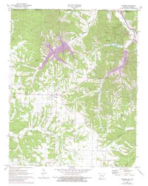
Hiwasse Topo Map Arkansas
To zoom in, hover over the map of Hiwasse
USGS Topo Quad 36094d3 - 1:24,000 scale
| Topo Map Name: | Hiwasse |
| USGS Topo Quad ID: | 36094d3 |
| Print Size: | ca. 21 1/4" wide x 27" high |
| Southeast Coordinates: | 36.375° N latitude / 94.25° W longitude |
| Map Center Coordinates: | 36.4375° N latitude / 94.3125° W longitude |
| U.S. States: | AR, MO |
| Filename: | o36094d3.jpg |
| Download Map JPG Image: | Hiwasse topo map 1:24,000 scale |
| Map Type: | Topographic |
| Topo Series: | 7.5´ |
| Map Scale: | 1:24,000 |
| Source of Map Images: | United States Geological Survey (USGS) |
| Alternate Map Versions: |
Hiwasse AR 1971, updated 1973 Download PDF Buy paper map Hiwasse AR 1971, updated 1982 Download PDF Buy paper map Hiwasse AR 1971, updated 1982 Download PDF Buy paper map Hiwasse AR 2011 Download PDF Buy paper map Hiwasse AR 2014 Download PDF Buy paper map |
1:24,000 Topo Quads surrounding Hiwasse
> Back to 36094a1 at 1:100,000 scale
> Back to 36094a1 at 1:250,000 scale
> Back to U.S. Topo Maps home
Hiwasse topo map: Gazetteer
Hiwasse: Dams
Lake Avalon Dam elevation 325m 1066′Lake Windsor Dam elevation 322m 1056′
Hiwasse: Populated Places
Bella Vista elevation 377m 1236′Calis (historical) elevation 396m 1299′
Caverna elevation 295m 967′
Caverna elevation 300m 984′
Hiwasse elevation 406m 1332′
Miller elevation 404m 1325′
Race (historical) elevation 421m 1381′
Rocky Comfort (historical) elevation 379m 1243′
Hiwasse: Post Offices
Hiwasse Post Office elevation 403m 1322′Hiwasse: Reservoirs
Lake Avalon elevation 325m 1066′Lake Windsor elevation 322m 1056′
Hiwasse: Streams
Browning Creek elevation 301m 987′Tanyard Creek elevation 295m 967′
Hiwasse: Summits
Gobblers Knob elevation 390m 1279′Hiwasse digital topo map on disk
Buy this Hiwasse topo map showing relief, roads, GPS coordinates and other geographical features, as a high-resolution digital map file on DVD:


